
A road in the Yorkshire moors; June 17, 2018
A road in the Yorkshire moors; June 17, 2018

The road between Ouarzazate and Tinghir, Morocco; February 7, 2017

Quebrada de Cafayate, Argentina; June 9, 2014

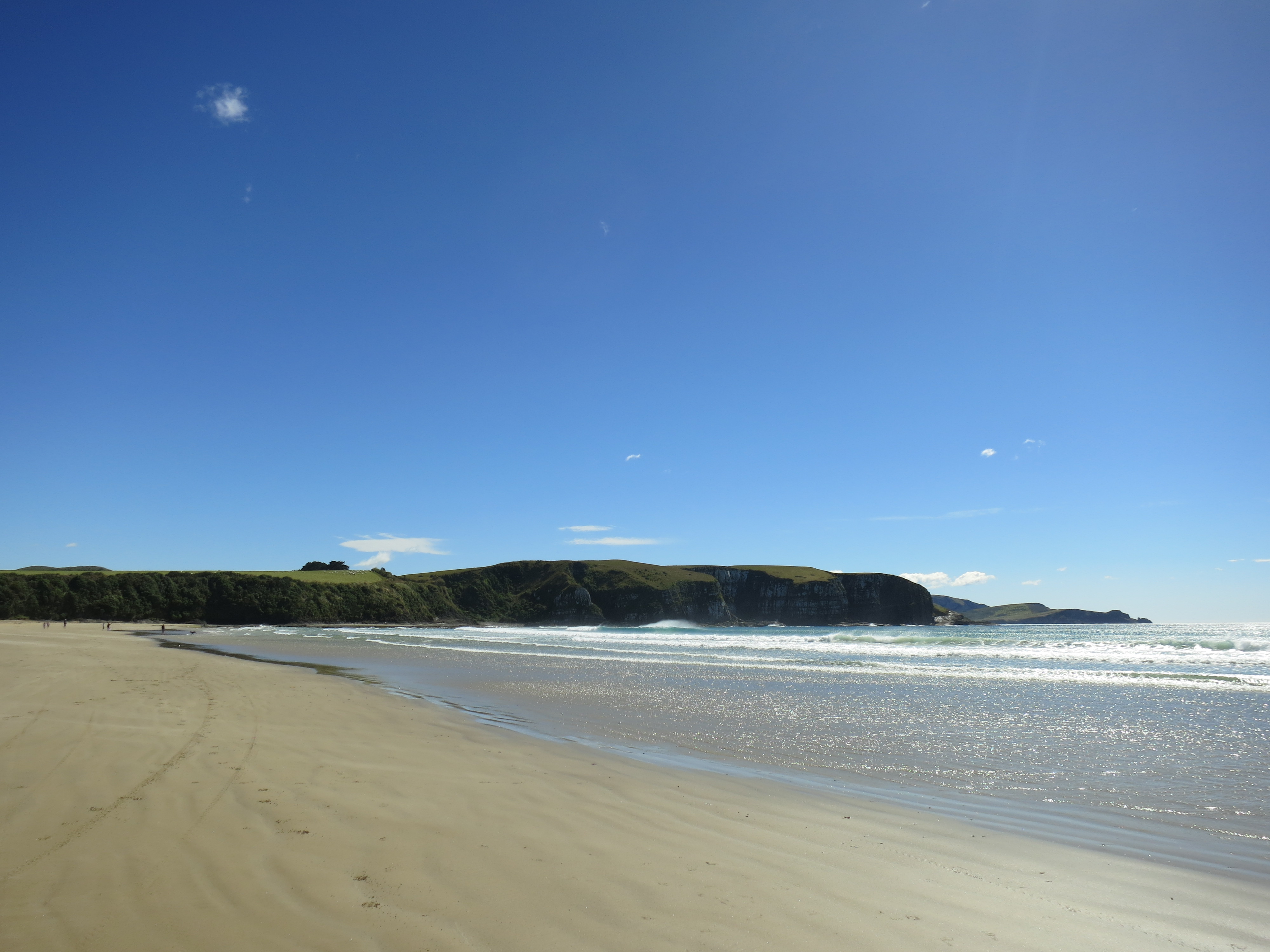
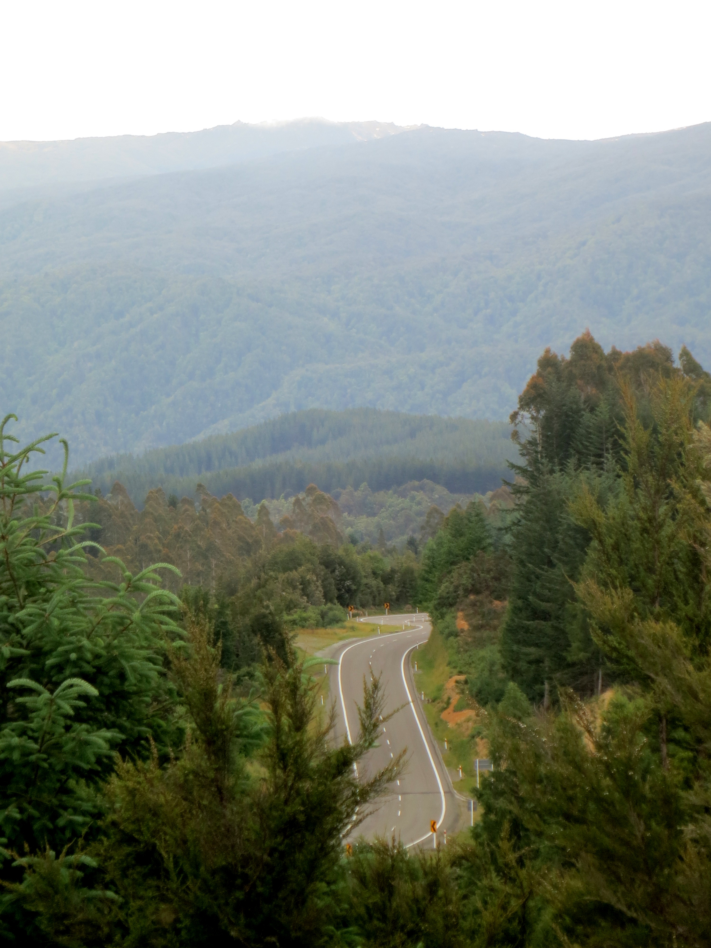
Southland, New Zealand; January 6, 2013
O sylvan Wye! thou wanderer thro’ the woods,How often has my spirit turned to thee!

Tintern Abbey
Wordsworth returns to a place he was fond of once, and he finds it lovely again, although he knows he’s changed and he sees it differently now. The poem he wrote about revisiting the Wye River near Tintern Abbey is one of my favorite Romantic poems, because he doesn’t just wade in the shallows of nature worship and nostalgia, but rather embraces his former self while appreciating who he has become. He values the memories, and wishes similarly fond memories for his sister, but he doesn’t want to turn back the clock.

Wordsworth’s sylvan Wye
Finding comfort in revisiting a place without being overwhelmed by nostalgia is difficult, I think, and I’m impressed that he could do it and then write a brilliant poem about it. I suppose that’s what makes Wordsworth a poet we return to again and again.

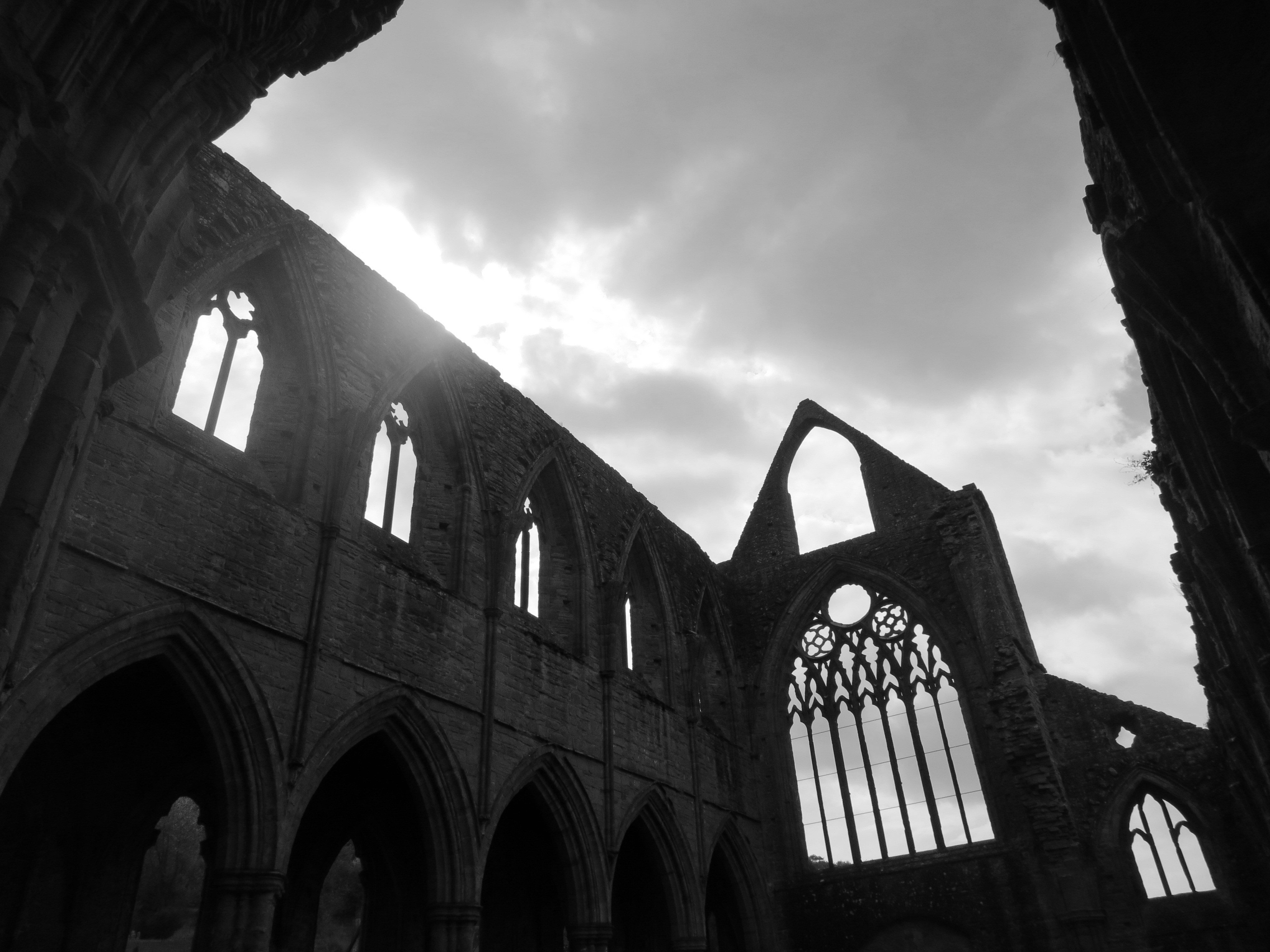
Nature creeping up on the abbey
I first visited the ruins of Tintern Abbey with my family when I was in high school, around the time we studied “Lines Composed a Few Miles Above Tintern Abbey” in English class. I saw them again last May, when my friend Liz and I drove from London to Wales for a couple days. I remembered it as a lovely spot in the ’90s and unsurprisingly, it still was in 2013. I didn’t quite have the revelations Wordsworth did, but finding old and new pleasures in revisited sites is something I’ve long valued.

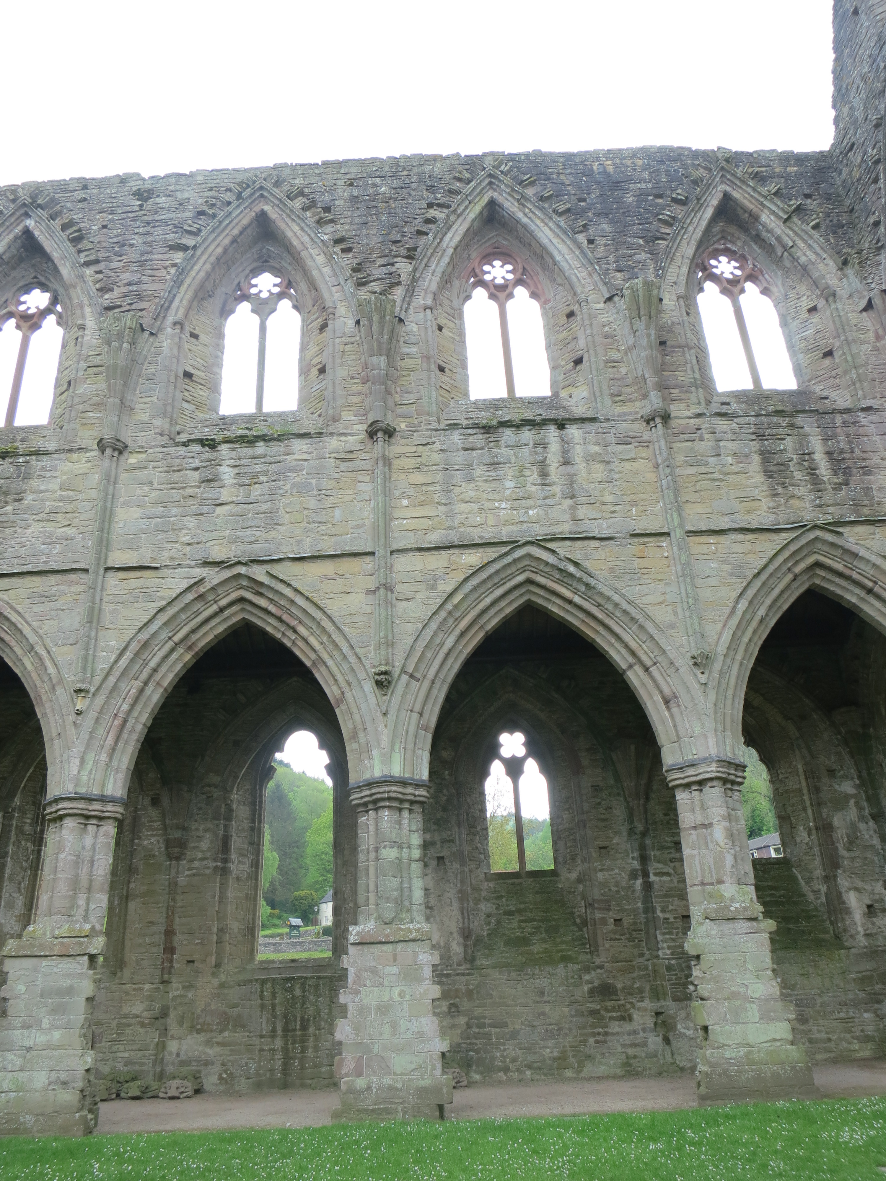
Inside the abbey

I love this architecture
The abbey used to be reached only by tramping or boating in, but now an A road runs right past, which is convenient for reaching the ruins but not so great for contemplating them in peace. But there weren’t many people there on the Sunday afternoon we arrived, so it was pretty quiet as we walked the neatly trimmed grass inside the walls of stone, under a roof of sky.
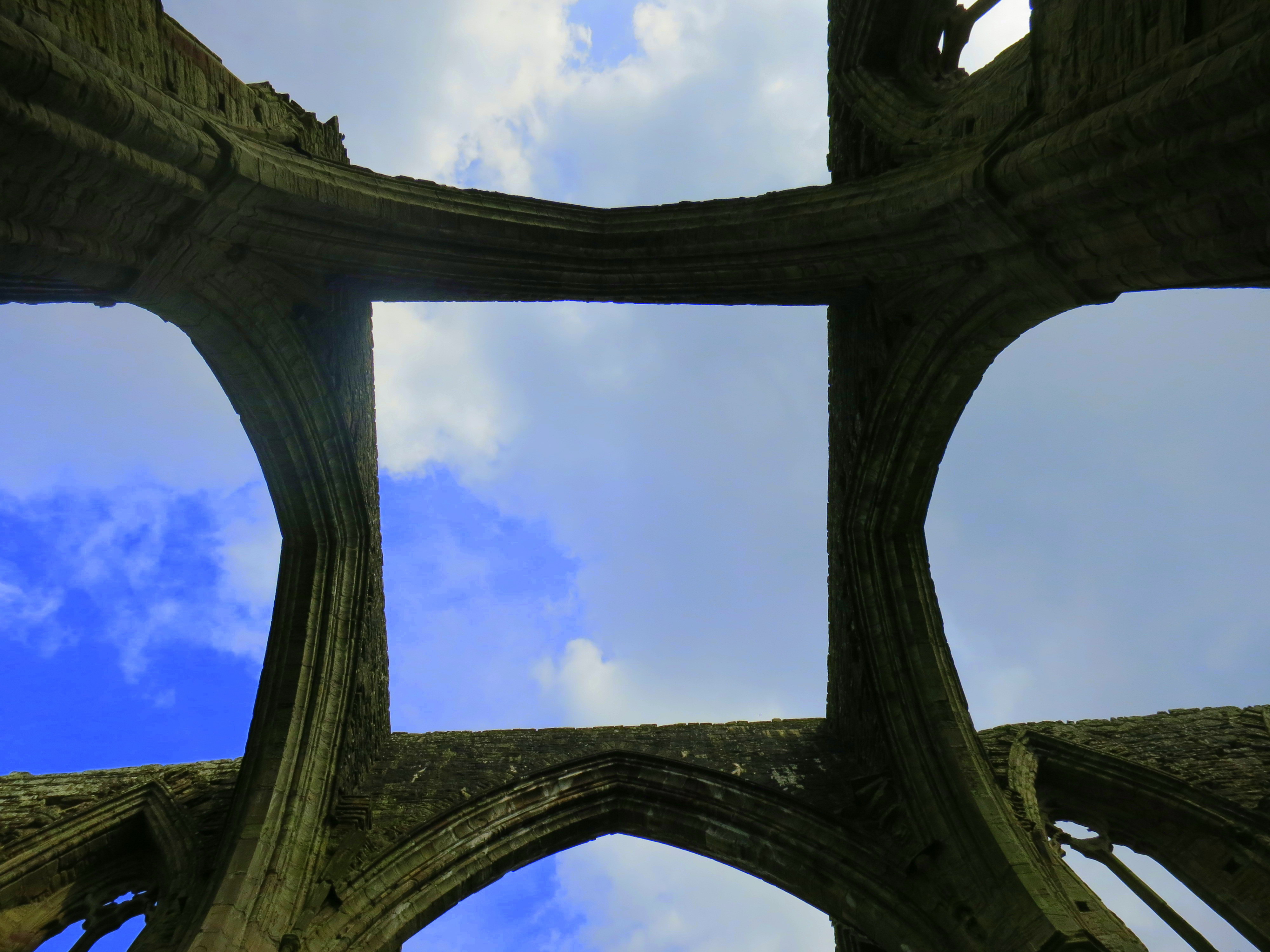
Roof of sky
Gothic arches

Described as “one of the great glories of Gothic architecture in Britain” by CADW, which runs the abbey and museum now
The abbey was the first Cistercian order established in Wales, in 1131. The monks took vows of work and silence, and Tintern Abbey was a productive place until Henry VIII dissolved the monasteries in 1536. The ruling lord of the area got the abbey, but rather than use it, he sold off its lead roof and let the building fall into ruin. A bad move for his people, who could likely have put it to some purpose, but a boon to the tourists visiting since the late 18th century, when the crumbling (and once ivy-covered) walls drew people in.
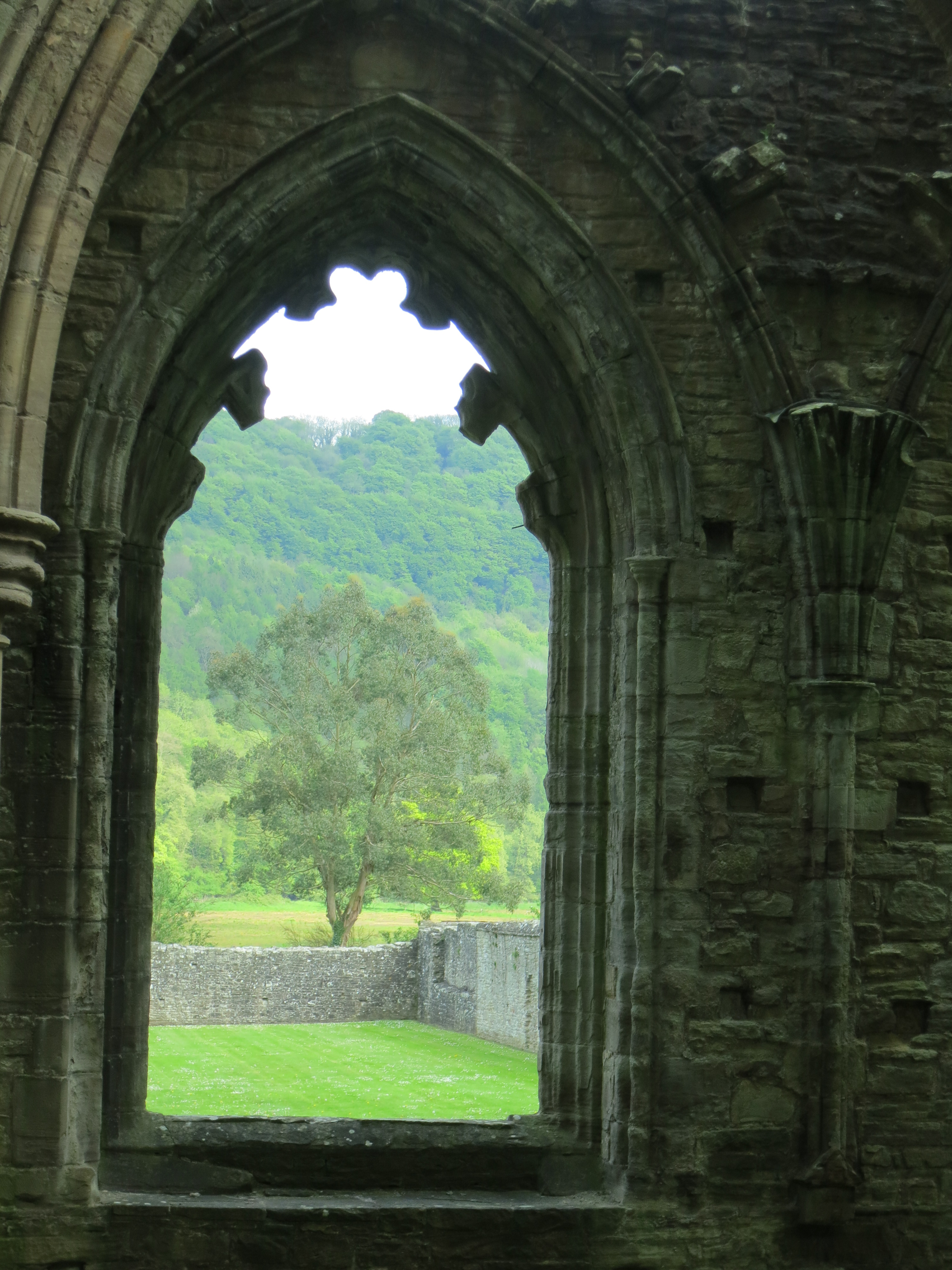
Views from inside
Revisiting beloved places is like re-reading a book; new layers of meaning and beauty are revealed. When I was here before, I was focused on retracing Wordsworth’s steps and wishing the car park away so it wouldn’t spoil my view. Now, I tried to hold in my head a picture of what I imagined the abbey looked like in its heyday alongside a picture of what it looks like now, to see the beauty in both. I still wished the car park away, though.
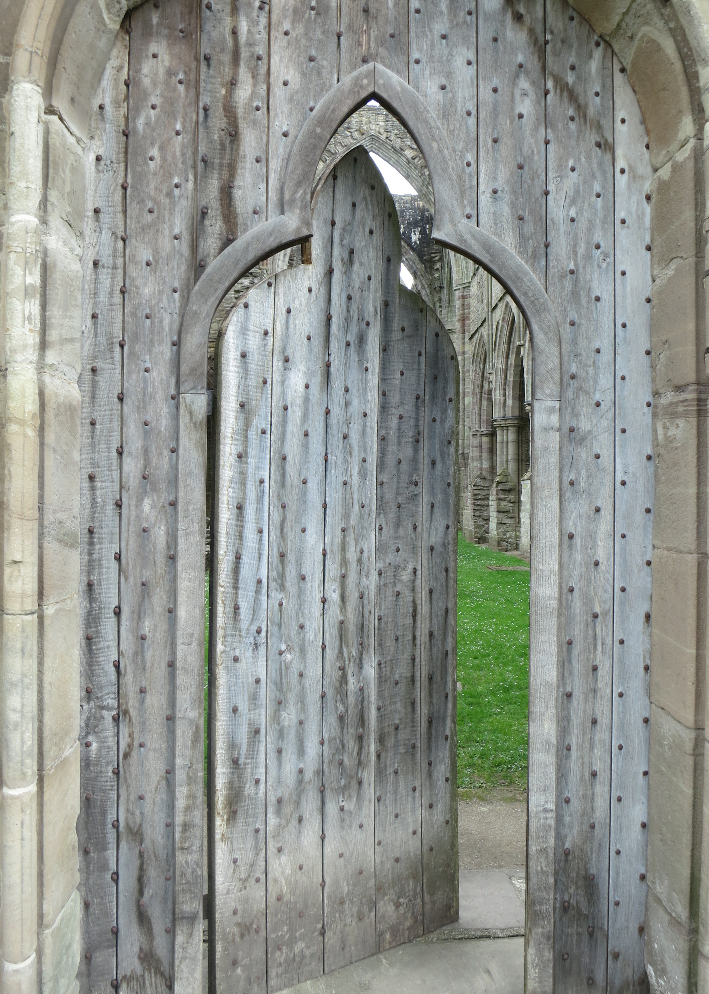
Rebuilt church door
Half a dozen jokes start with how many castles there are in the British Isles, and how easy it is to stumble over one on your way to the grocery store. When my friend Liz and I took a mini road trip to Wales in May, we found this to be entirely true. We took advantage of it and did some castleing in passing, making very minor detours to peek at centuries-old stone edifices a few miles off the beaten path.
Here are the drive-by castles of our Welsh adventure:

Castle Coch

Tretower Castle

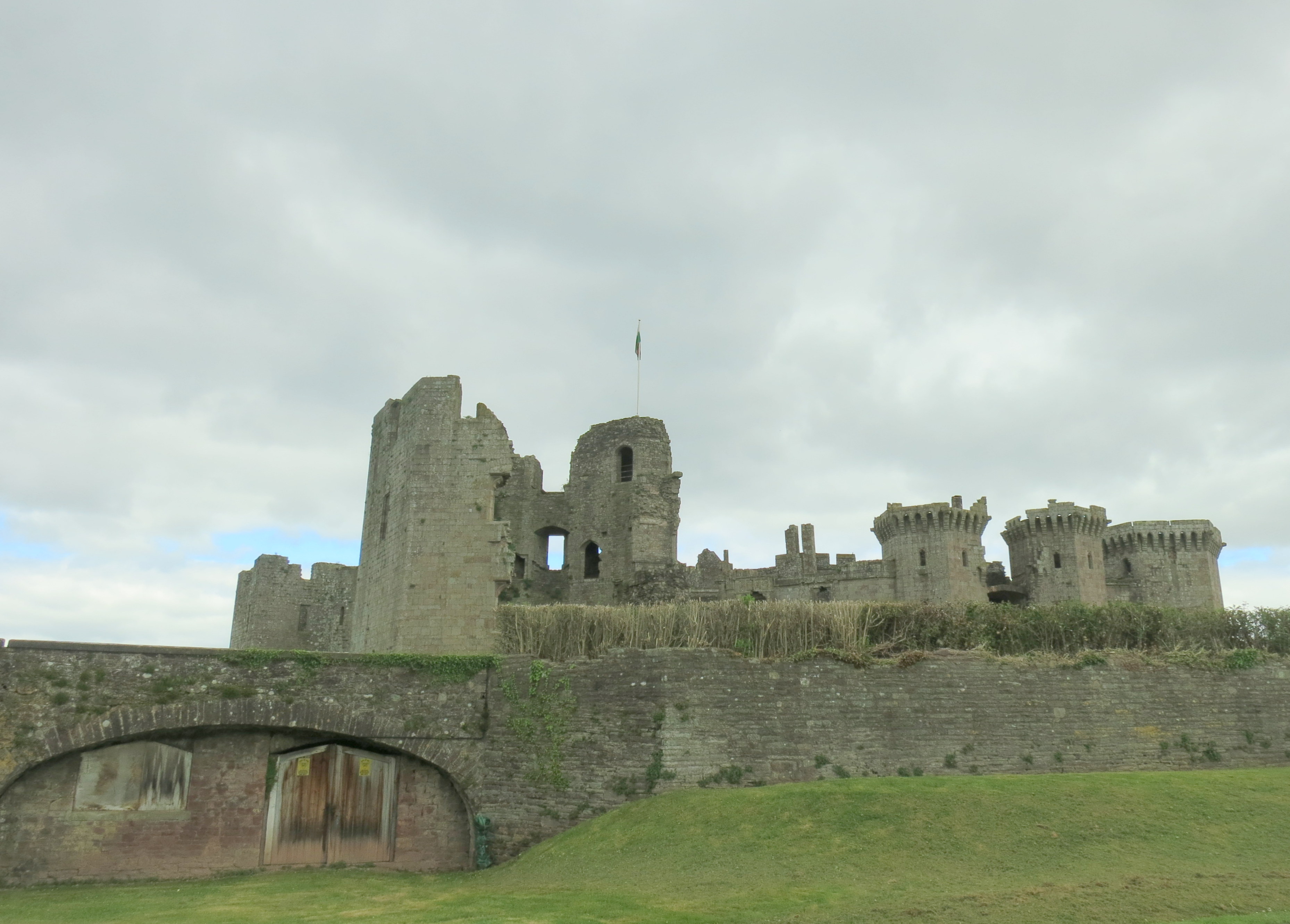
Raglan Castle

Also, a Welsh sheep
Some people count birds. Others log marathon miles. I chase waterfalls, and I saw five on my second day in the Catlins. That’s a personal record. (That’s also me plagiarizing myself from Facebook, but I liked it for a lead so here we are.)
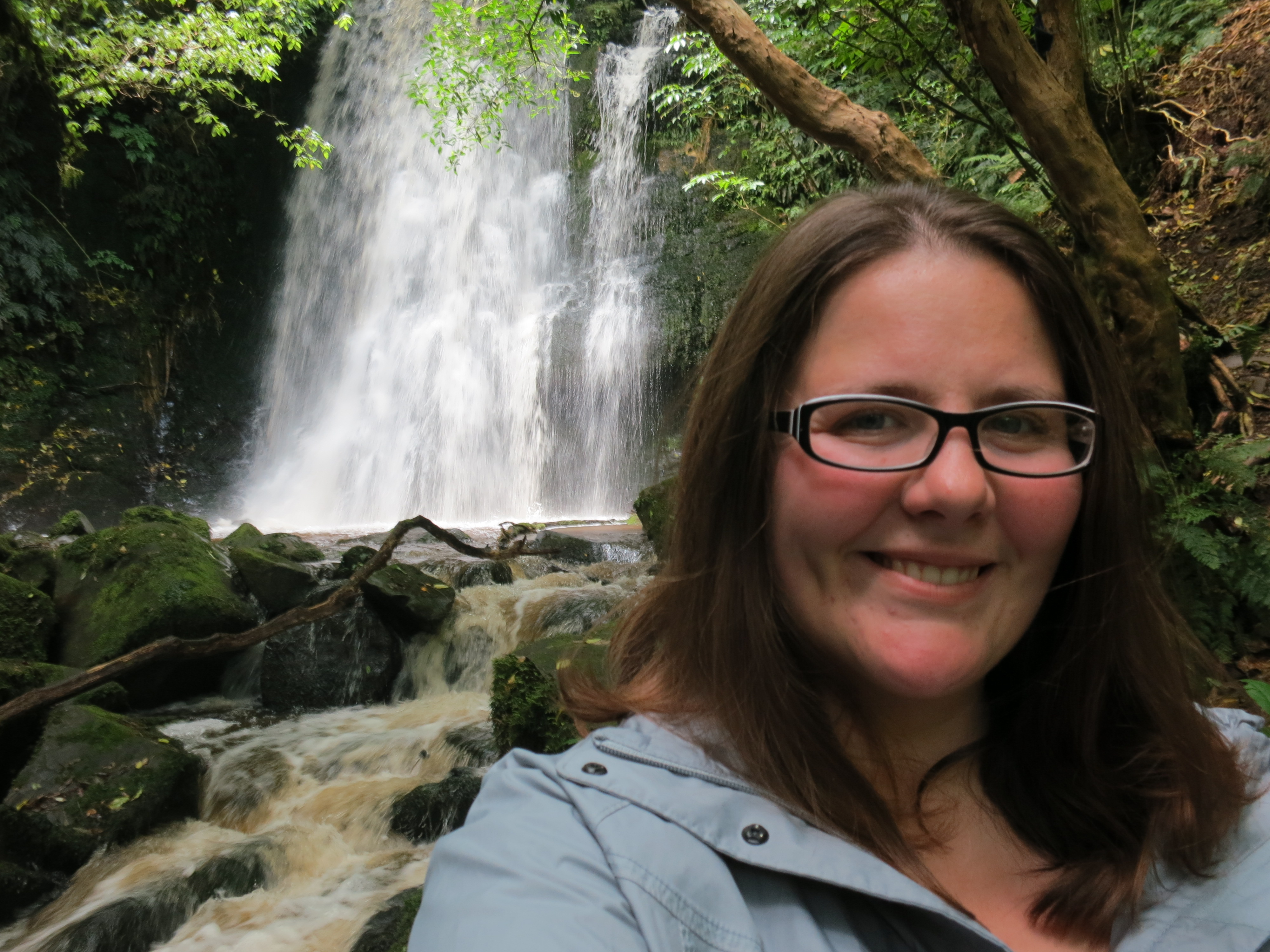
This is my “OMG waterfalls” face (at Matai Falls)
I started the day off at Jack’s Bay, where I threw a ball for an eager dog and chatted with his owner. The wind was picking up, lifting a whole layer of sand off the ground and hurrying it along to the other side of the bay. I carried on to the Owaka Teapot Gardens, which is actually the yard of someone’s home covered in teapots of all sizes and arranged in whimsical set-ups with garden gnomes and fairies. The next door neighbors know a good kitschy tourist attraction when they see one, and they set up Dollyworld, a doll and teddy bear museum. The entrepreneurial spirit is thriving in Owaka.
Morning at Jack’s Bay
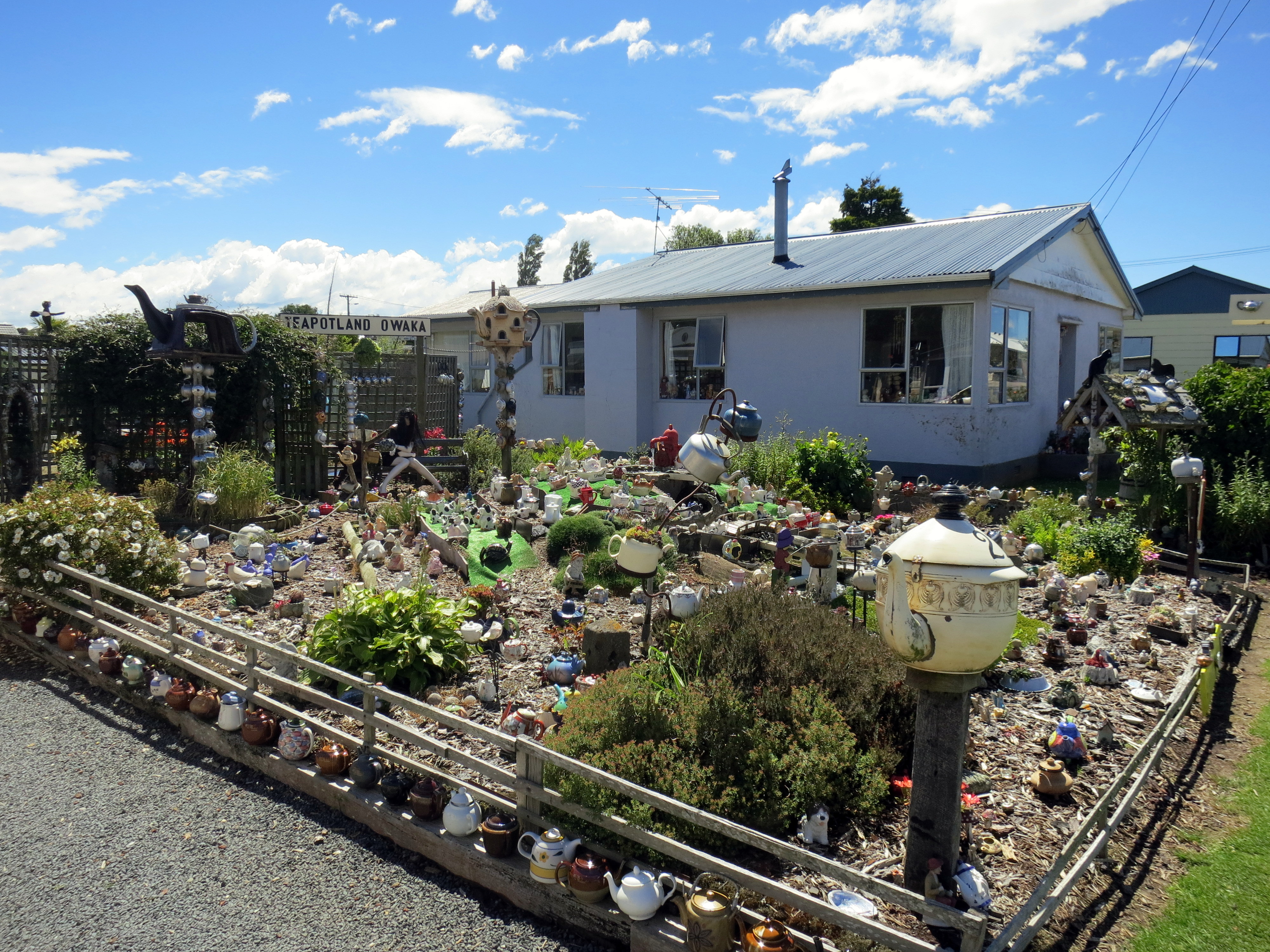
They even printed up a poem about Teapotland, which includes the lines, “In every cranny and nook/doesn’t matter where you look/Big ones, little ones, there is a teapot/Sorry, but they are all cold, not one is hot!”
I left the dolls and fairies behind for the natural world, and I spent the rest of my day falling ever more in love with this part of the world. It was a beautiful New Zealand day, which means I only had to wear my rain jacket half the time. It had rained heavily overnight, so the falls were gushing water mixed up with a bit of mud, rather than falling more prettily with clearer water. I liked it, though. Nothing like a roaring waterfall to remind you of the power of nature.
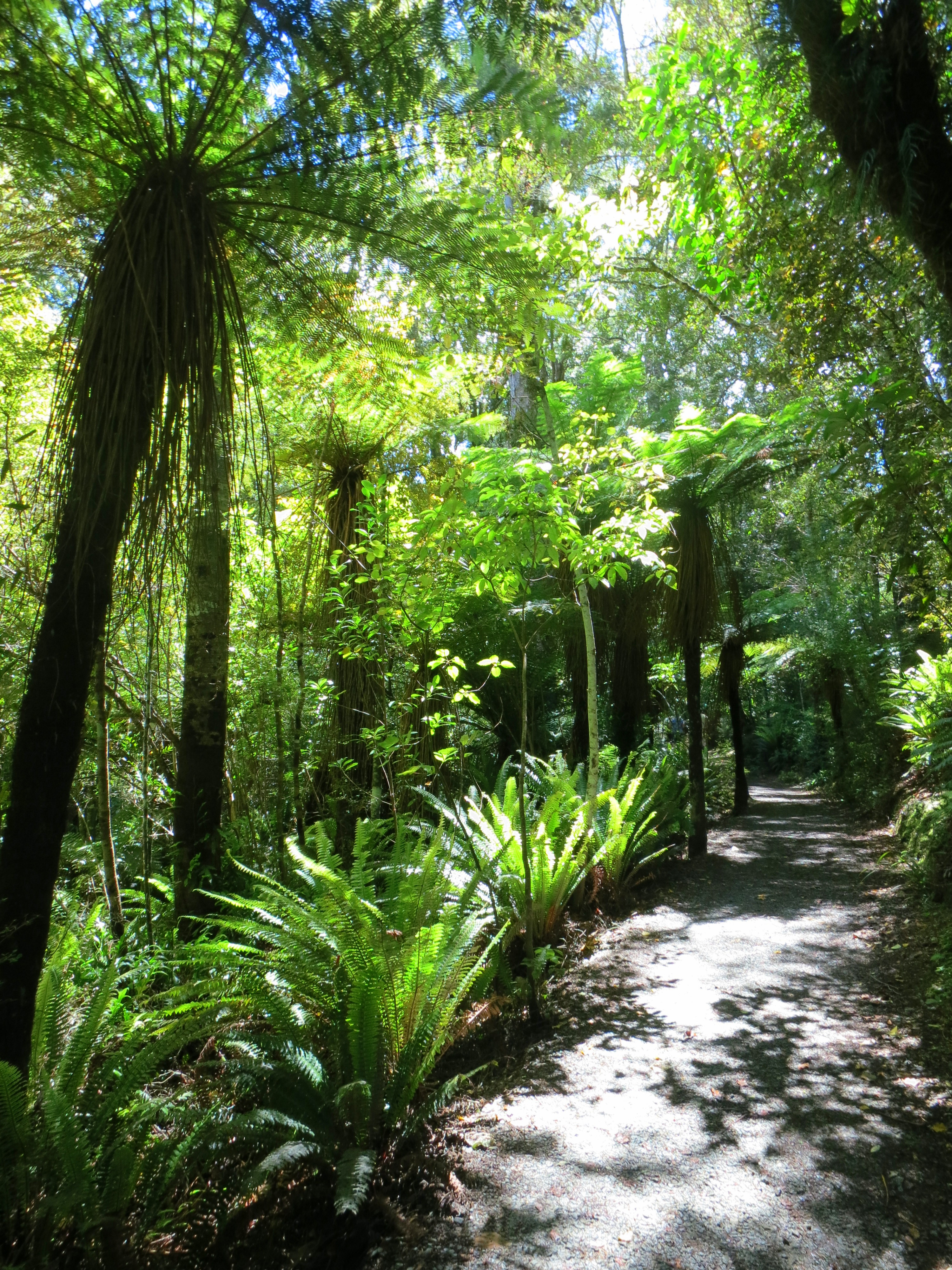
Purakaunui Falls is the most popular spot in the Catlins, and apparently the most photographed waterfalls in the country. It was an easy walk on the packed dirt path through the fern-feathered forest, across a small footbridge, and up and down a steeper track to the viewing area. I had the falls to myself for about two minutes, and then a small tour group came down, and a family with small kids, and I saw how popular the place was.

Purakaunui Falls
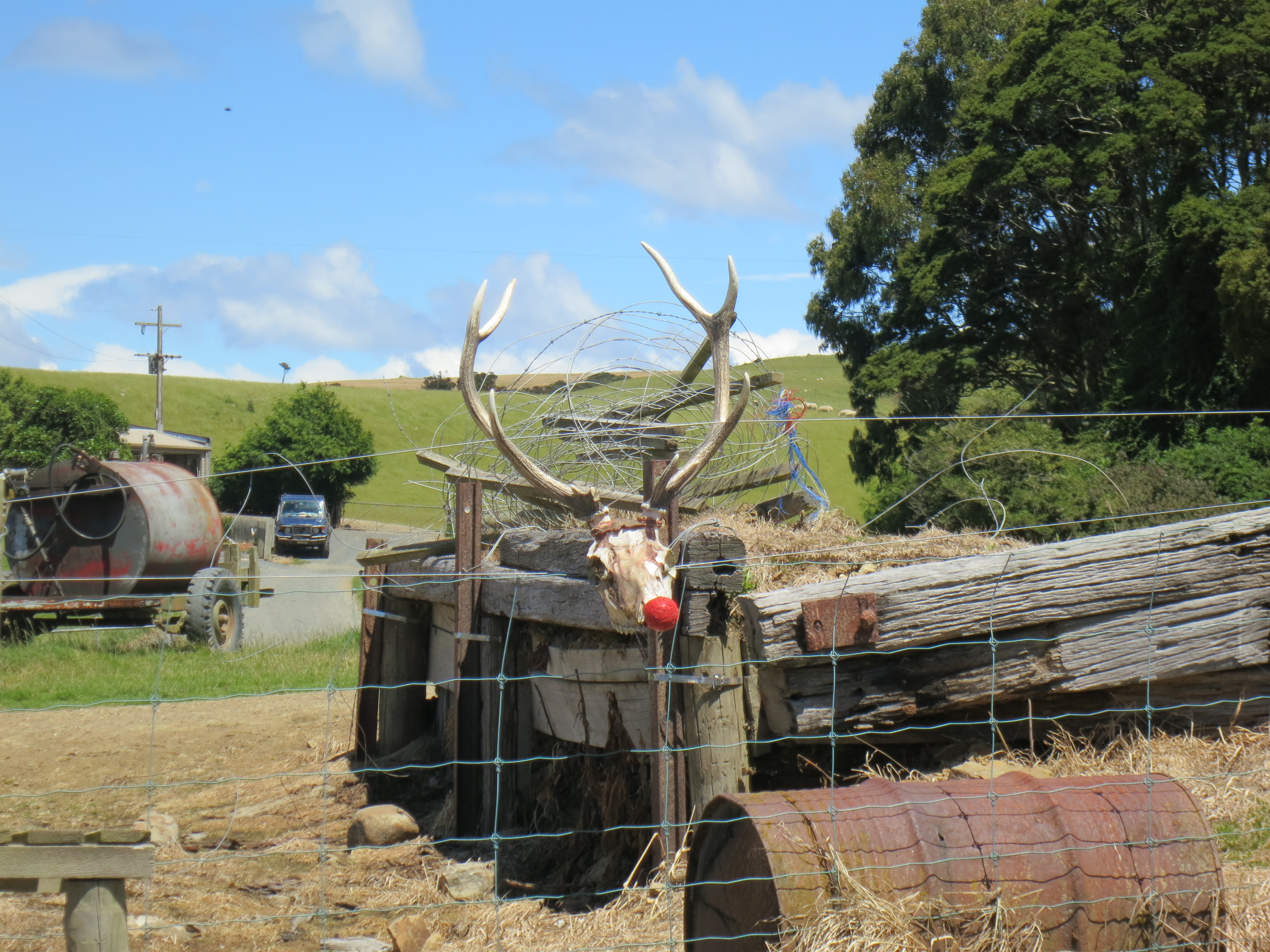
Poor Rudolph
The next stop had a one-two punch of Horseshoe Falls, and farther along that same river, Matai Falls. I only passed five other people on this trail, which suited me just fine, but the people who skipped this stop were missing out.

Horseshoe Falls
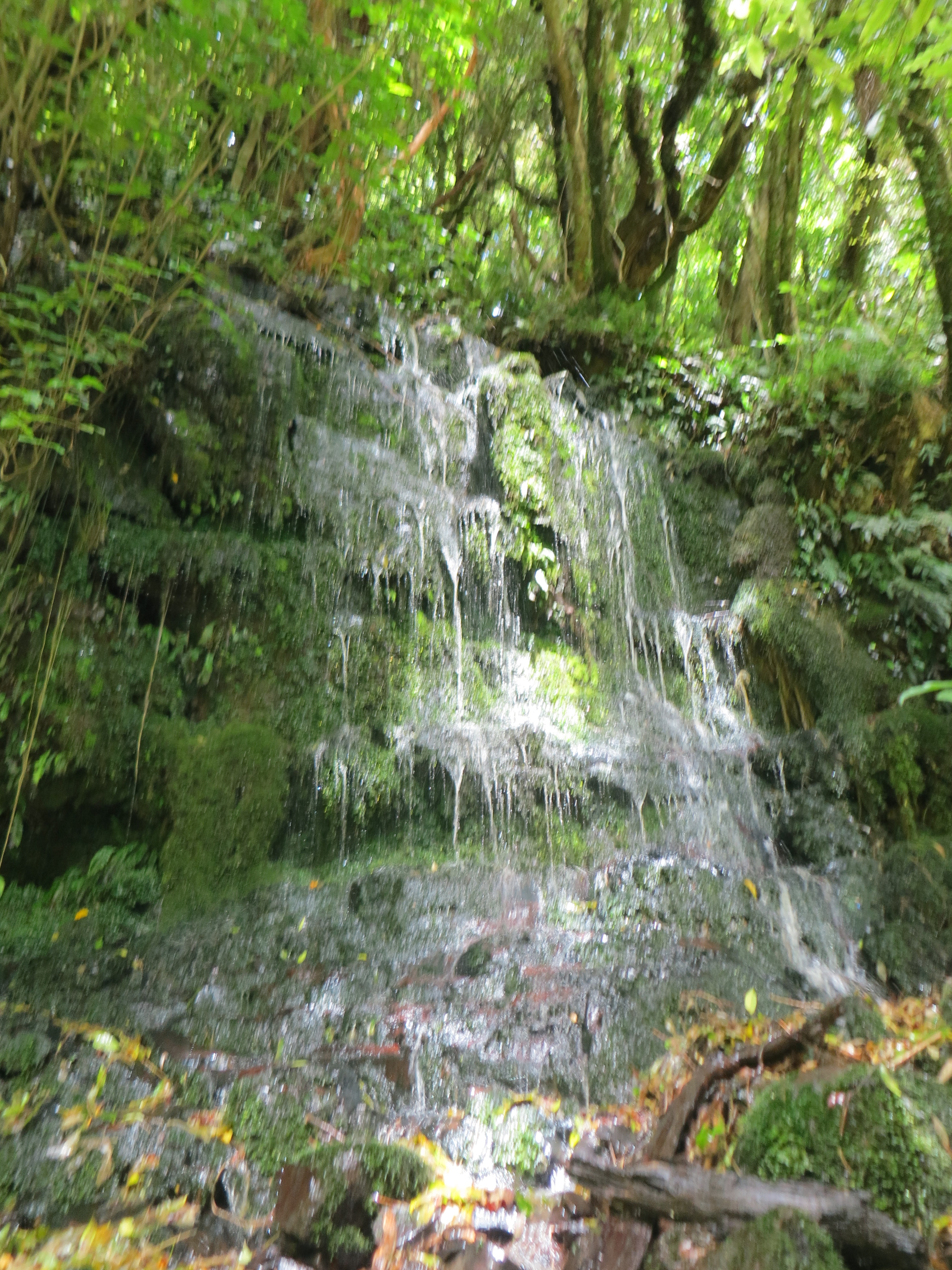
This patch of moss normally just drips, but with the heavy rains the night before, it was a mini waterfall itself.
Florence Hill Lookout was a well-signed spot, explaining the historical and ecological significance of the area. Some of the trees are over 1,000 years old, and in fact it’s the only place on the east coast of the South Island where native forest goes right down to the sea (instead of being interrupted by any of the many introduced species). This was a Maori fishing village, a Maori and Paheka whaling town, and the site of a sawmill before it became protected land.

One of the last native forests to reach the sea on the South Island
My penultimate stop for the day was McLean Falls, which involved a 30-minute walk, only 20 minutes of which could be described as leisurely. The last part of the walk was a steep climb up a switchback path, on uneven stairs made of stone and slippery packed dirt. But was it ever worth it!

Bliss
The McLean Falls were certainly the most impressive falls of the day. I sat on a rock a little to the right of the upper part of the falls and stared at them for about half an hour, mesmerized by the sights and sounds.

McLean Falls
The last falls of the day were Niagara Falls, and they barely qualify as falls at all, more like a hiccup in the river. But if my Catlins map is going to count them, then so will I. My favorite part of this stop was the sign that showed a photo of the more famous Niagara Falls, just in case you needed a comparison. Nice to see everyone has a good sense of humor about it.

Haha, good one, settlers
I spent the night at a farmstay/hostel at Slope Point. It was a working farm with a few small buildings of basic rooms for rent. I chatted with an Australian family and a French couple, and we all sat around the kitchen table listening to Van Morrison on my iPod while working on a jigsaw puzzle and eating dinner. The Aussies and French were keen hikers, so they told me about the big walks they’d been on that day, which sounded cool, but I wouldn’t have traded my day of waterfalls for anything.

Sunset at Slope Point
After Liz and I left the central part of the North Island, we stopped off at National Park (yes, that’s the actual name of the town) so that Liz could hike the Tongariro Crossing and I could bundle up against the cold and damp of the mountains while reading a good book.
I have a lot of photos of the hills and mountains of New Zealand. They are just too dramatically beautiful not to gaze at longingly mile after mile.
A couple days later, we drove south, and once the mountains were in our rearview mirror, the weather improved immediately. We got more than one radio station, we saw other cars on the road, and we started passing through towns. We must be getting closer to Wellington.
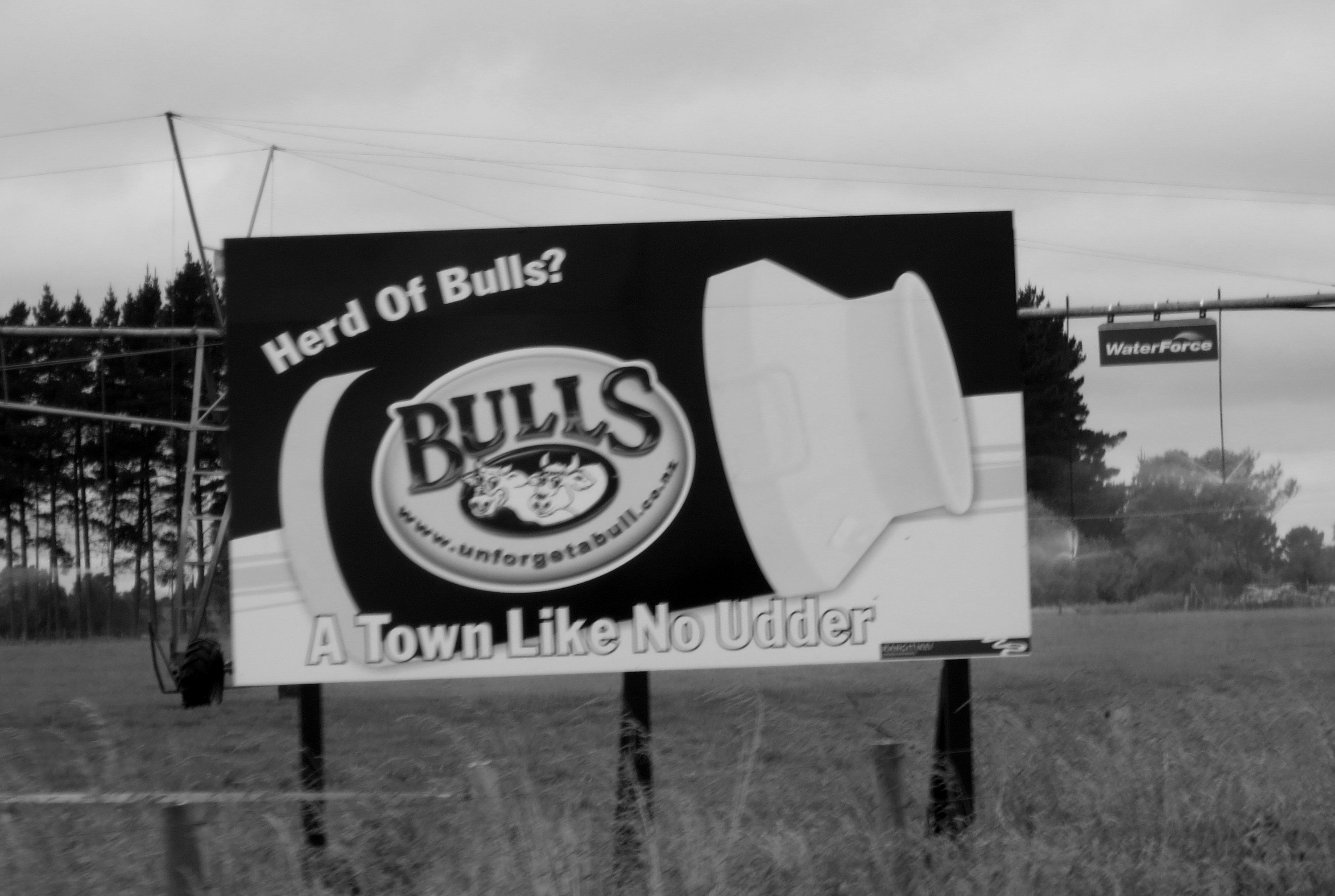
The town of Bulls delivered pun after pun as we drove through it. I also liked the “Afford-a-Bulls” $2 shop.
About 40 minutes outside of the capital city, we pulled off the highway to a town called Waikanae Beach. Liz dropped me off at my friends’ home and she carried on to Wellington for a few days. We’d meet up later in the week on the South Island. In the meantime, I’d see how the Kiwis celebrate Christmas. Spoiler: in the sun. They celebrate the (northern hemisphere’s) midwinter solstice in the sun.
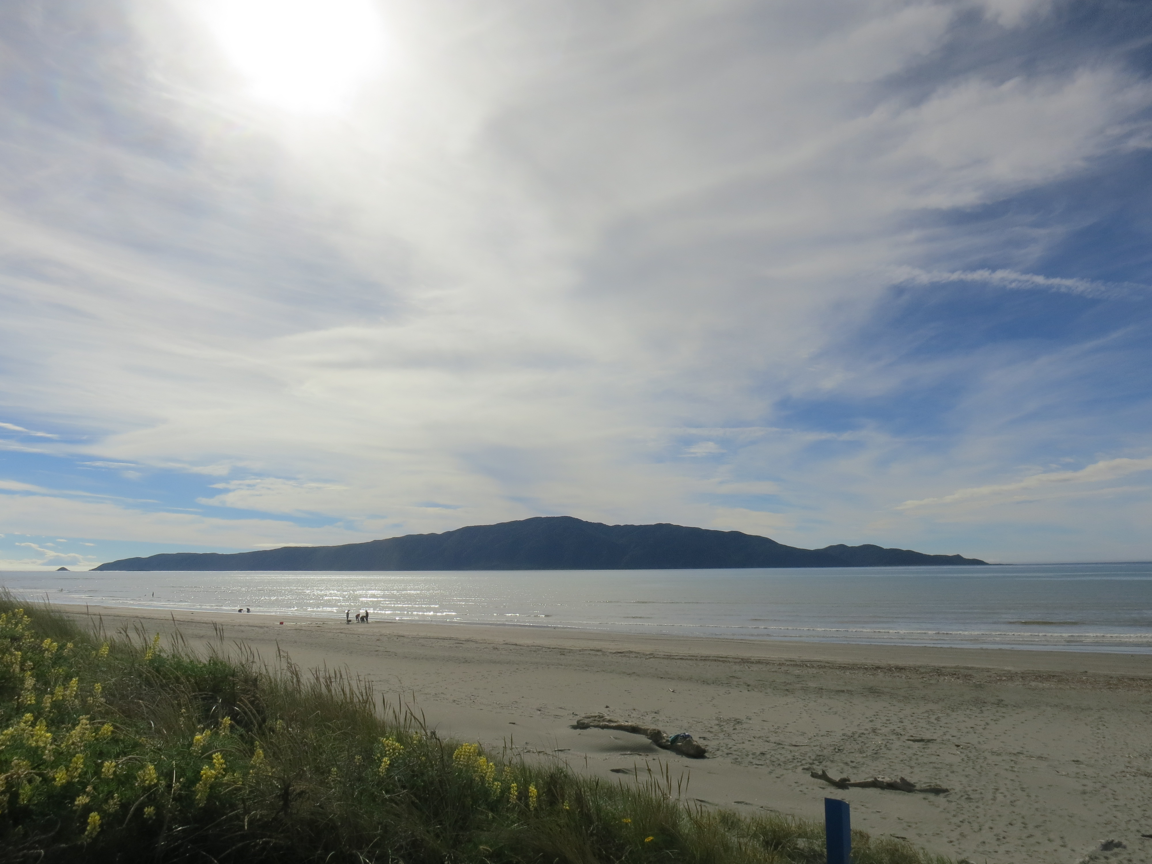
Kapiti Island off the coast
We went to the most laid-back church service I’ve ever been to (the pastor was in shorts and sandals) and sang a few carols. The words were projected on a screen at the front of the sanctuary and a guitarist led us in song. At the end of the service, ushers handed out Christingles, which are apparently common in the Church of England, though I’d not heard of them before. It’s an orange (the world), wrapped in a red ribbon (Christ’s blood), stuck with four toothpicks holding fruit and candy (the four seasons and the fruits of the earth or the sweetness of Christ’s love), and containing a candle in the center (Jesus, the light of the world). It was fun to watch the kids of the congregation mumble “Silent Night” with the rest of us while sneaking the candies off their Christingles with varying levels of surreptitiousness.

Turns out the orange wasn’t that tasty
I had a lot of fun with the 9-year-old of the house, a smart, sweet kid who explained to me all about the various things he’s collecting and which Horrible Histories episodes he likes best. We played in the ocean together, and on Christmas day we put together some of his Legos and smashed down an Angry Birds Star Wars imperial ship. We tried to out-weird each other in our Mad Libs choices, and we both dozed off after a big Christmas dinner. Such fun!
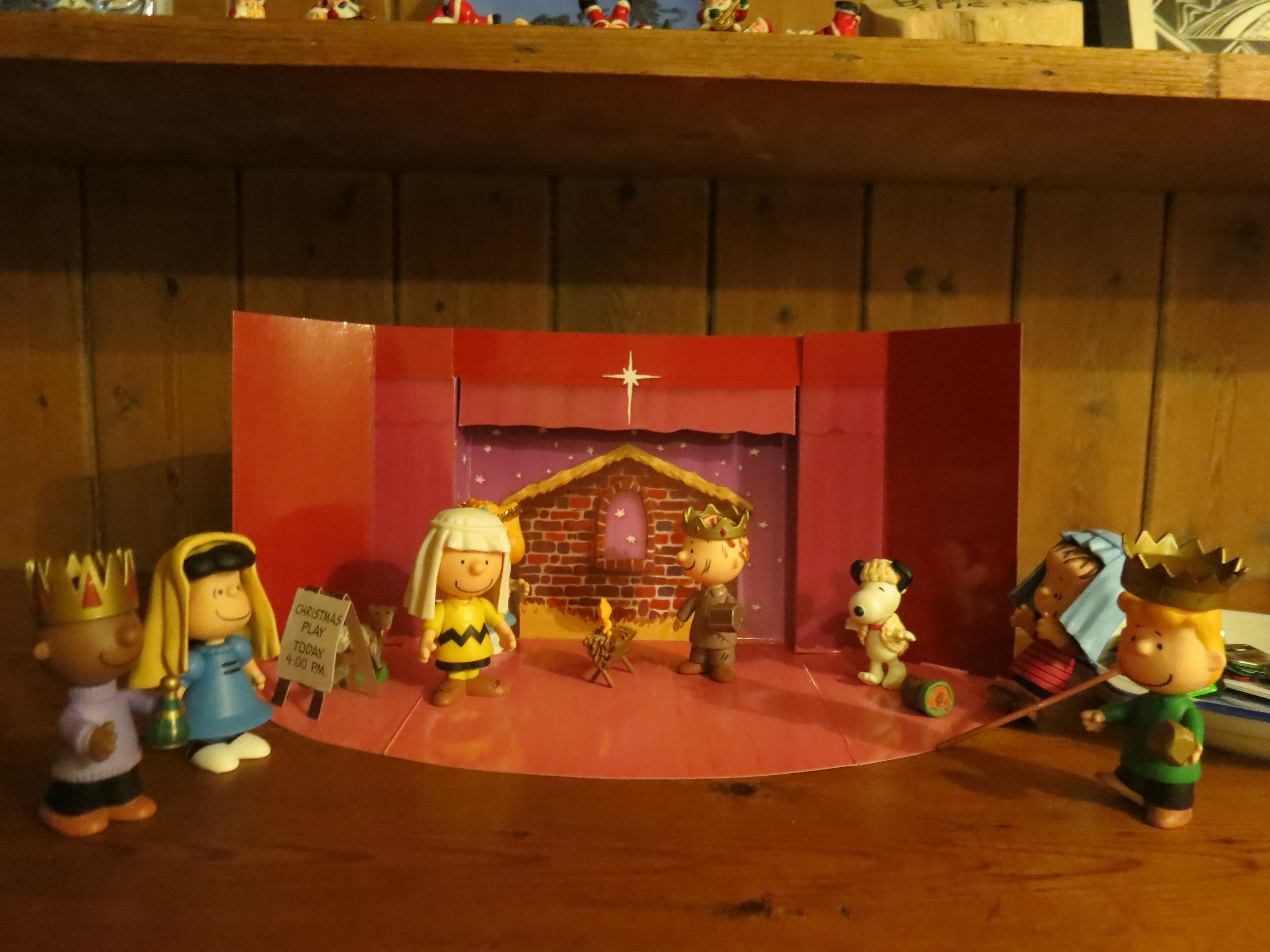
Best nativity scene
Dinner was a massive collection of food, and also delicious. Then came dessert, which also took up a whole dining table, and was also delicious. I had my first taste of pavlova; a light, tasty meringue and fruit dish. New Zealanders and Australians argue about who invented it, but they agree it is their favorite dessert.
The Kapiti coast is a popular place for Kiwis to retire; its positioned east of Kapiti Island and north of the tip of the South Island, so it’s more protected than many other parts of the North Island, and while my hosts said that Christmas was especially hot this year, they also said they always spend at least part of Christmas on the beach. What a great tradition!
In front of a pohutukawa bush, the “New Zealand Christmas tree” because it blooms right around that time of year
I’ve already mentioned how fortunate I was to have Liz as a road trip buddy in New Zealand, but I’ll say it again: I had so much fun traveling with her. We laughed a lot—both at funny things we said and ridiculous situations we found ourselves in, like leaving a camera on the hood of the car and driving for ten feet before realizing it. We made a good driving/navigating team—she drove, I squinted at a map and made my best guess, which only resulted in turning around about half the time. We even sang Christmas carols together on the drive through the Taupo Volcanic Zone, two sopranos belting out the first verse of just about every hymn we could think of as we hurtled down the first straight road we’d seen in the whole country.
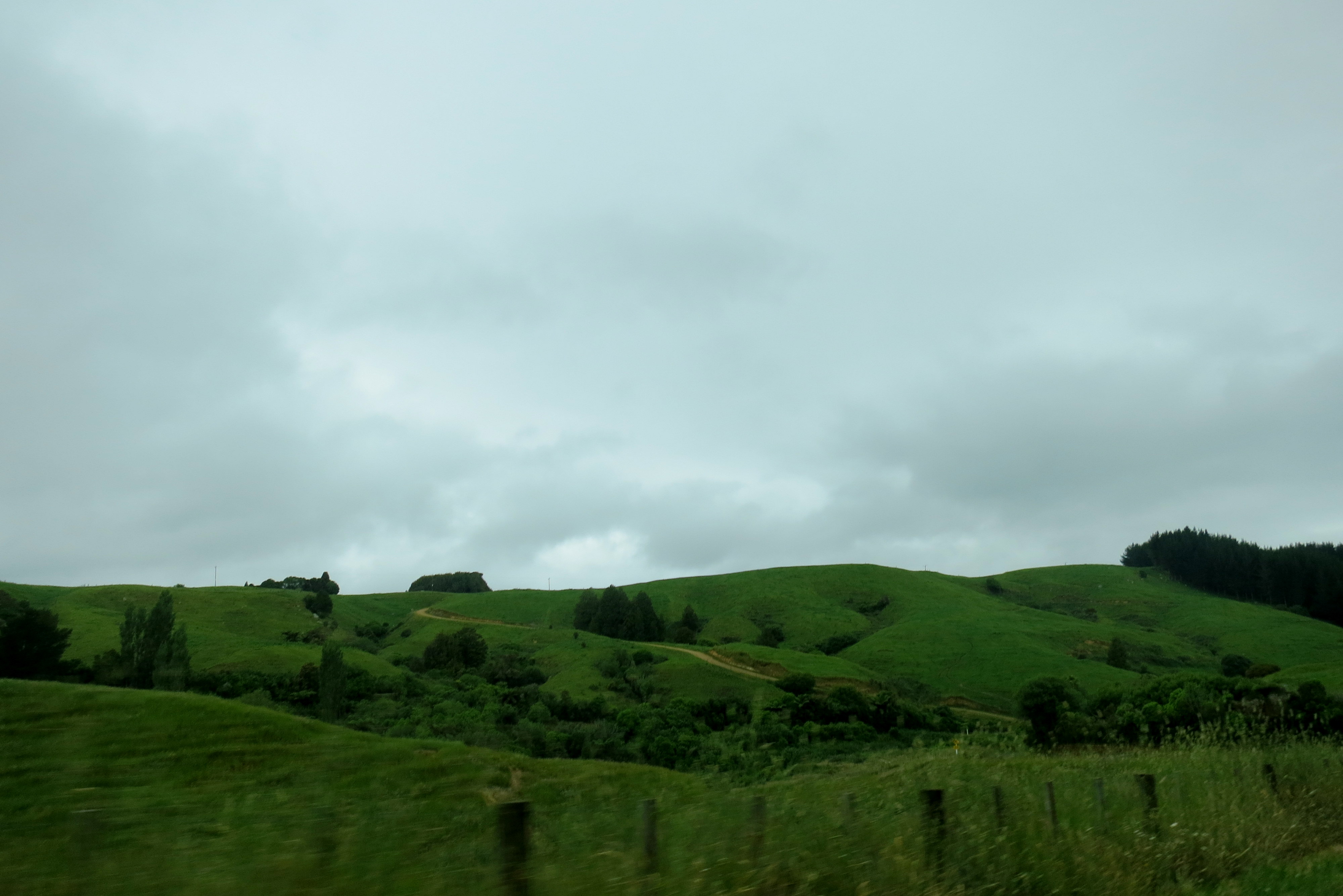
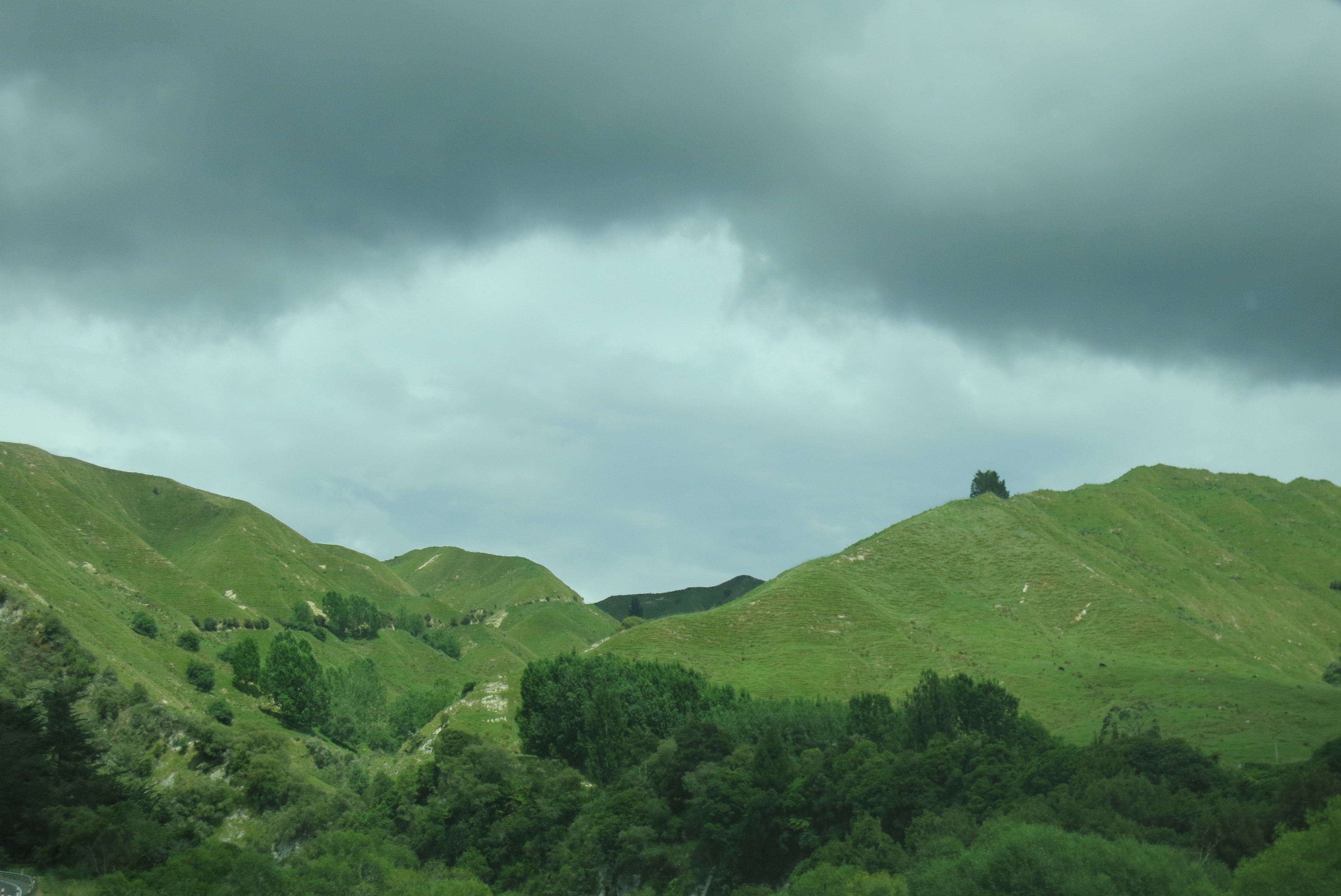
The gray skies and green hills of central North Island
Liz was a little more used to the roads in New Zealand than I, considering she’s from northern Ontario, and many Canadian roads are similarly unsealed (read: teeth-rattling gravel). What neither of us was really prepared for was how small the roads were (major highways were two-lanes just about everywhere except around Auckland and Wellington), how much they twisted and turned (we never quite got used to turning a blind corner and hoping we didn’t meet anyone crossing the center line coming the other way), or how un-signed they’d be.
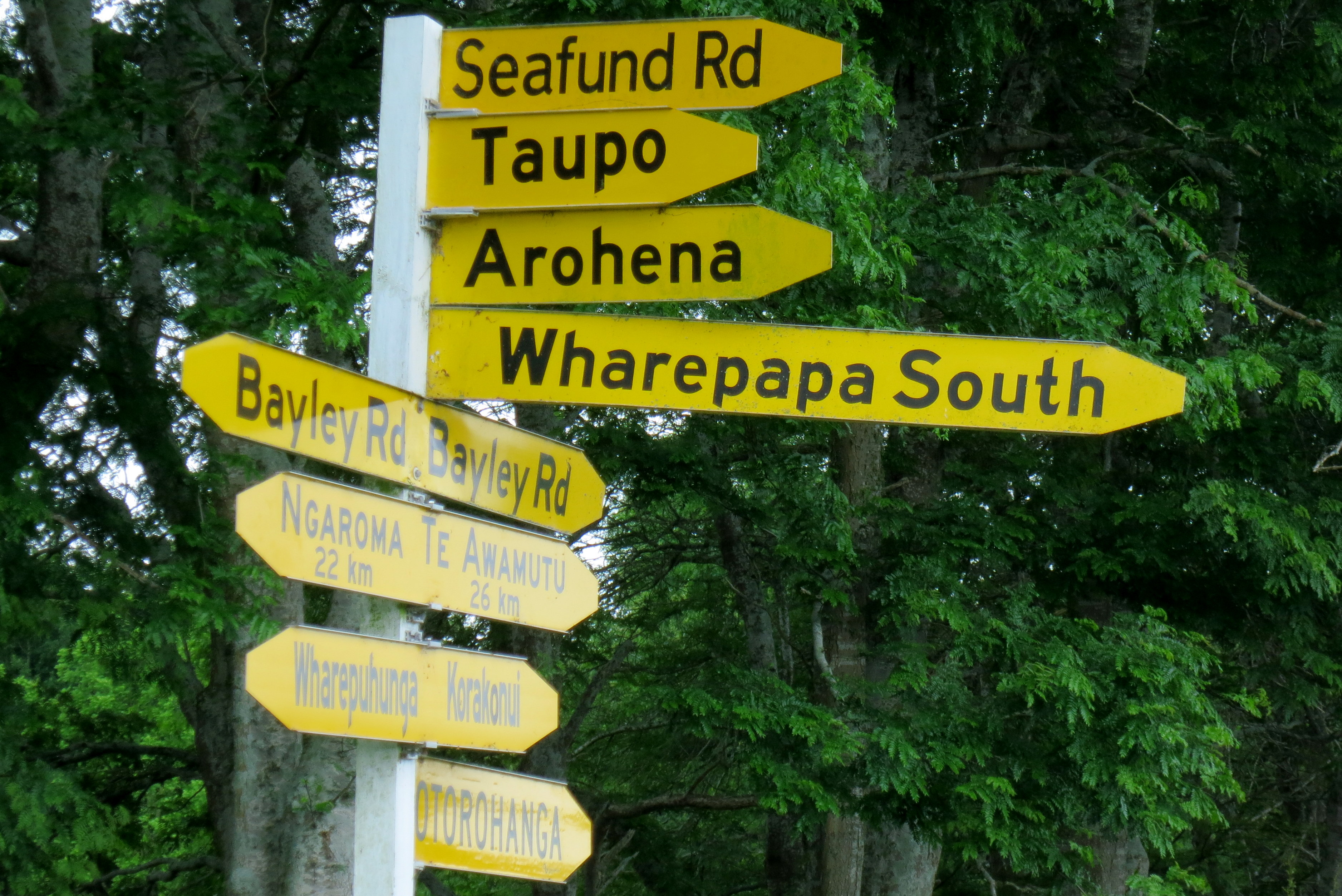
Putting a lot of signs all at once doesn’t make up for the lack of signage in a thirty-kilometer radius, NZ.
I should say, we’d see signs sometimes, but the road might have changed names somewhere along the way, and if our map wasn’t detailed enough, it wouldn’t show the name change, so we couldn’t be sure we were on the right road. Also, road signs would point out what town we were eventually heading toward, but in the same manner as if that were the next town over, so we’d see a town name with an arrow and think “ah we’re here” but then no town would materialize and twenty minutes later we’d finally be there.

Getting around the dairy country where Liz’s friends lived was particularly bewildering. The landscape was all similar—large hills with turf that look like it had been molded into many tiny ridges, the occasional collection of black rocks, and lots and lots of cows. Liz knew the area a little since she’d worked there for a few weeks, but she’d only ever driven one route. As soon as we deviated from that route, we were lost. On the day we drove to Waitomo, we borrowed the GPS from Liz’s friends, but even the GPS got turned around in the labyrinth that was central Waikato roads. The best was when the GPS had us turn right when we should have turned left, and it took us a good 40 minutes to sort out the mistake.

All this backtracking and second-guessing was mostly just fun, until it rained. And it rains a lot in New Zealand. Our worst rainy drive was probably the twenty kilometers between Franz Josef and Fox Glacier. It was 7 in the morning, Liz had been rained out of her tent the night before, and we were climbing a mountain road in the pouring rain to make it to our tour on time. Many kudos to Liz for getting us there alive; all I could do was say over and over, “It’ll be fine, we’ll get there in time.” (Since I alternated this with “I don’t know if I can do this hike” and Liz then had to reassure me, I think I wasn’t actually that helpful.)

An ominous start to an awesome day
At home, driving in sketchy conditions with poor signage can be helped with a boost from the radio, but our little Nissan Sunny rental only had a range of 78-86FM, and for the most part, we could only get one station, if any. Those mountains really did the job on scrambling any signal we might have got. Our radio was hung up on 84.0—any time we hit scan, the numbers would zoom past, 83.183.283.383.483.583.683.783.883.984.0. Boom. There it would stay, desperately trying to transmit something no doubt awesome—rock n roll, lotta soul, cosmic jive?—but not actually giving us so much as a faint crackle of static. Good thing we had lots to talk about, and the occasional song to belt from memory. When the radio did come to life, it was oh so good. The occasional Maori tune, some current New Zealand pop songs, and then the most amazing array of ‘90s Top 40 hits. Ace of Base, Backstreet Boys, Alanis, Enrique… wonderful for a nostalgic singalong or two, horrible if it’s all you could get for years!
On the way to Greymouth
This doesn’t even get to one-way bridges and cow rush hour, but that’s a post for another day. Basically, everything about road tripping in New Zealand was familiar enough to be comfortable and strange enough to be fun and funny—an ideal combination, especially when you’re sharing it with someone who feels the same way.
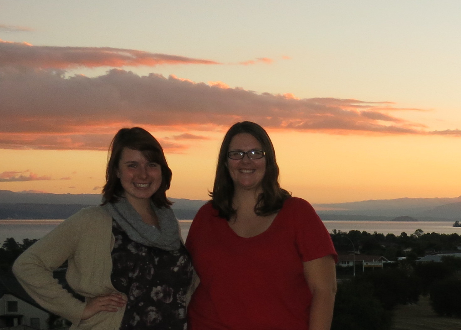
Liz and me in Taupo
I almost didn’t get to go to the Great Ocean Road, but with a little Couchsurfing magic and the luck of some very fine weather, I saw one of the loveliest stretches of Australia, not to mention some wild koalas and parrots, days before I left the country.

Great Ocean Road lookout toward Gibson Steps
I was having a marvelous time in Melbourne, so I left it a little late to organize a trip out to the GOR. I didn’t really want to do a bus tour, but I didn’t want to take on the expense of renting a car all by myself either (not to mention, the thought of driving on the other side of the road freaked me out). I tried some rideshare websites with no luck. I posted in the rideshare group on the Couchsurfing website. I was starting to think that I was going to have go on a bus tour and make a few scheduled stops for over $100, when I got a message on CS. A ride!
 Dani and Fede, from Sicily, were packing in a lot of sightseeing on Fede’s trip to visit Dani down under, so they only had a day, rather than the two I’d hoped for, to do the trip. But they were willing to split the driving between themselves, and Dani’s roommate Ali was joining in, so the costs were super reasonable. Another reminder that sometimes if you leave things to the last minute, you miss out, but sometimes, you luck out.
Color upon color
Ali’s lived all over the world, since he can teach all the romance languages and is well sought-after. In that infuriating way that all my beloved teacher friends have, he found it hard to admit when he didn’t know something, and could turn almost anything into a teaching moment, which Fede and I teased him about. Fede, on holiday from doctoring in Italy, had a wonderful way of teasing everyone and soothing tempers at the same time. Dani embodied that free-spirited attitude that movies always try to imitate but never quite get right. It was a great group to join for a long day of sightseeing.

Near Torquay
Ali and I braced ourselves in the back as Dani got used to driving on the left, bumping up against several curbs and almost a few parked cars along the way. After some exclamations, arm waving, and yelling (all of which made me smile with fond memories of living in Rome), we got settled in to the drive. It takes about an hour, an hour and a half, to get from Melbourne down to the coast, but once you’re there, the drive becomes consistently beautiful.

Split Point Lighthouse at Aireys Inlet
We went to the Split Point lighthouse at Aireys Inlet and had a good view of what looked like might become a stormy day. (Happily, it did not.) Afterward, we wended our way up a hill into the bush a bit to Erskine Falls. We perched ourselves on the benches at the lookout and ate our lunch amid the foliage and the dull roar of the falls.

Erskine Falls
Back on the coast proper, Ali played DJ, occasionally putting on a song in Italian that made both Dani and Fede groan. He’d grin and explain that this was a particularly well-known ballad or pop song, and Fede would say, “Really, no, we cannot hear this.” I imagine it’s like every time someone plays Foreigner around me.
So far, we’d been following the advice of various Italian and English guidebooks, but at this point I said we should make a stop recommended by another Couchsurfer. We pulled off at Kennett River, which consists of a general store and campground. My travel companions got coffees while I asked the barista for directions to the “road with the koalas.” She pointed to the road next to the campground and said, “what you’re looking for is a gray basketball in a tree.” With these succinct instructions, we set off across the road.
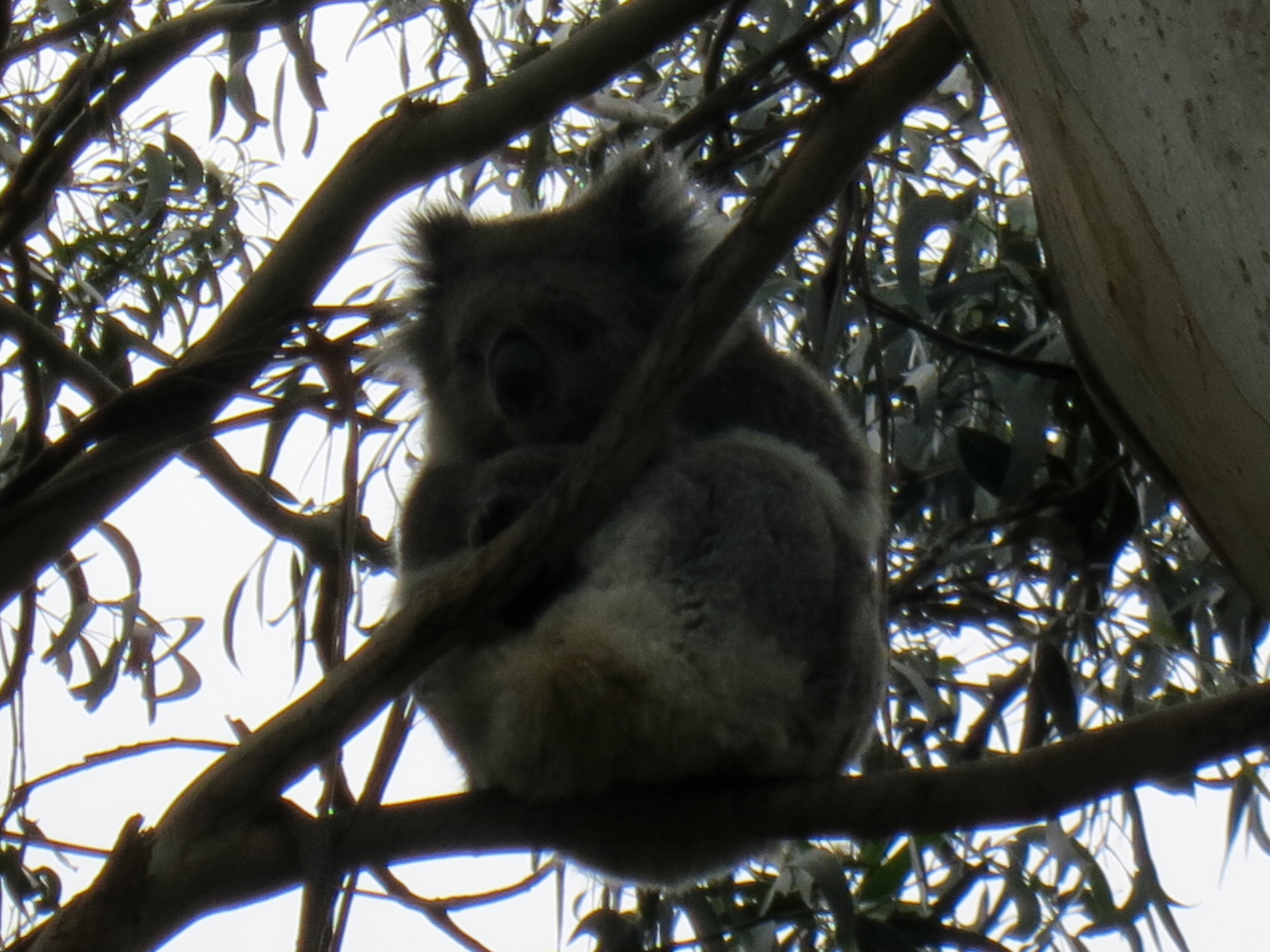
Koala yoga
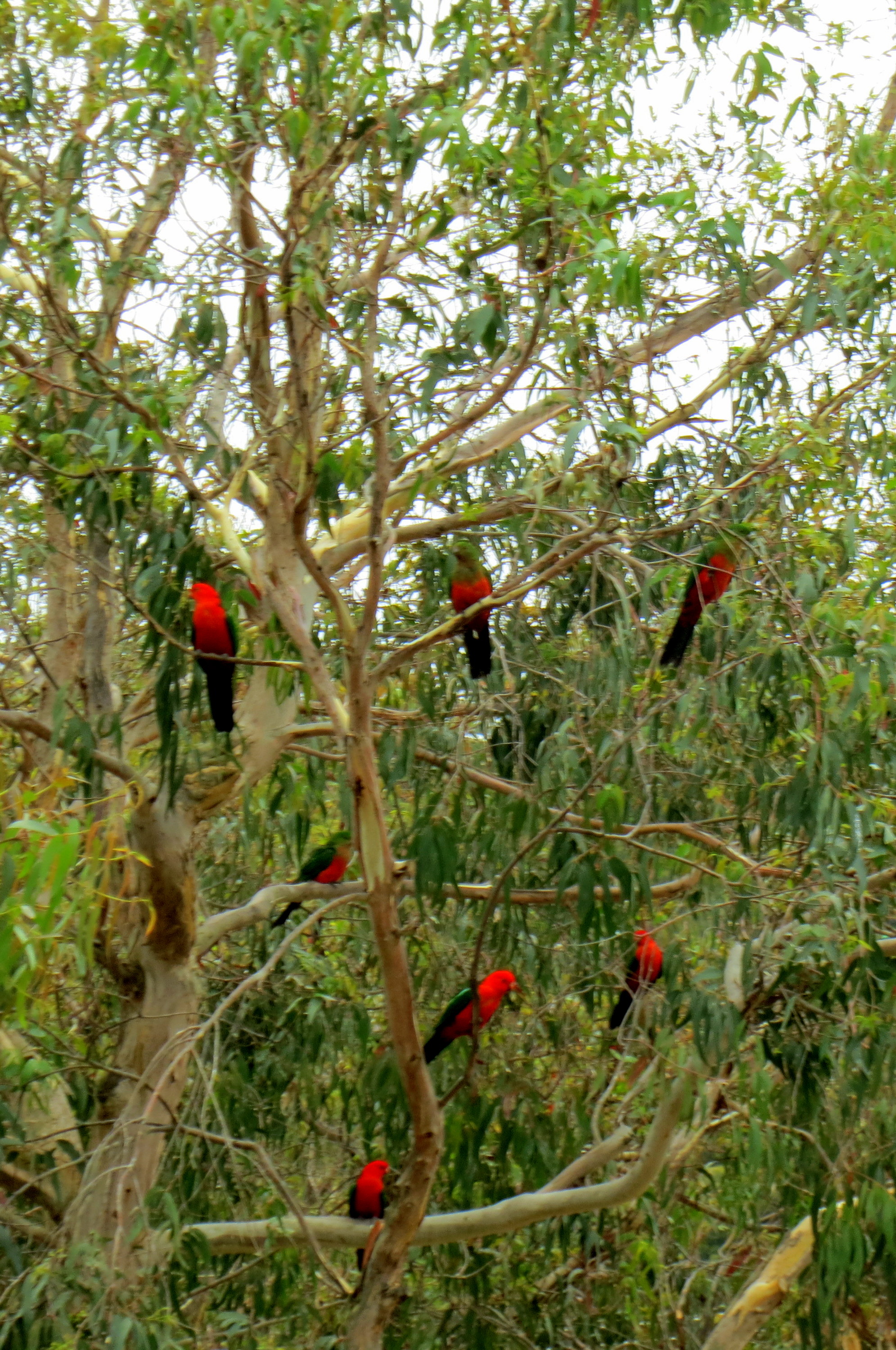
Almost immediately, we saw a koala! It did, indeed, look sort of like a gray basketball, curled up as it was up in its tree. It appeared to be sleeping, which koalas do almost all the time. We went to the other side of the tree to get a better look, when whoosh–a bunch of birds flew right at us. Look at them:

Good thing I never saw “The Birds,” or this might have freaked me out
Dozens of colorful birds, all eager to flap around us, squawk in the trees, and generally cause a wonderful distraction. The internet tells me that I saw cockatiels, cockatoos, crimson rosellas, and Australian king parrots. One bird landed on Fede’s back, and then they all got the idea, and soon Dani and Ali were covered in birds as well. But none came to me! Maybe I had the wrong shampoo or something.

Cockatoo strut
So I’m a little ashamed to say that when another group of tourists offered us their bread to feed the birds, I took some, and I was thrilled when a king parrot pecked at my outstretched palm, and finally made the leap over to my arm.
It deliberated about moving for a long time
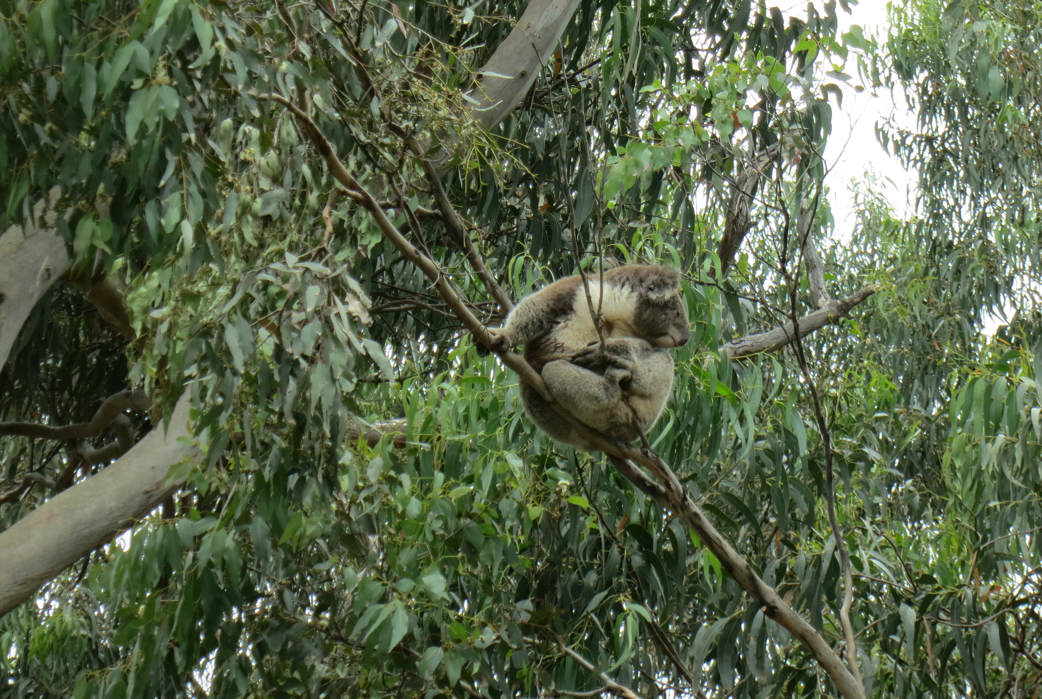
We saw two more koalas in the gum trees. One was ever-so-slowly shifting position, while the other remained resolutely asleep. As we reluctantly started to leave, we had another rush of birds, and this time, with no prompting, one landed on my head! I have never been so honored to have something attack my scalp as I was at that moment.
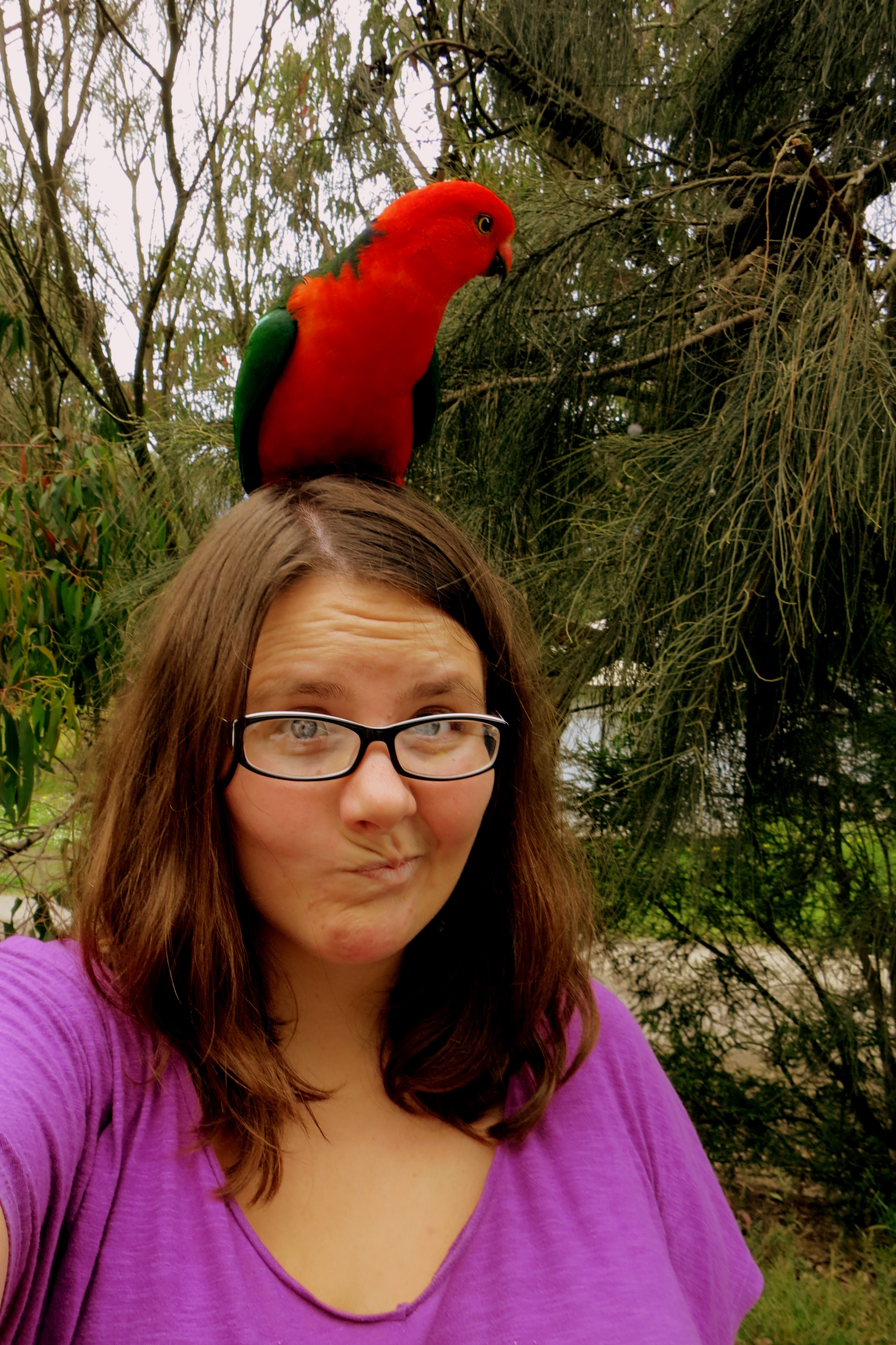
Hanging with royalty (that’s an Australian king parrot)
It was hard to leave the playful birds and adorable koalas, but there was more to see, so we pressed on. We arrived at the Gibson Steps and descended those steep stairs to the beach to get a better look. We passed a kangaroo corpse, which is a strange thing to see when the animal isn’t roadkill, and I wondered how it got down to the beach, or if it had fallen off the cliff and that’s what killed it? I’m sure there’s a Kangaroo Kops number I could call to get to the bottom of this.
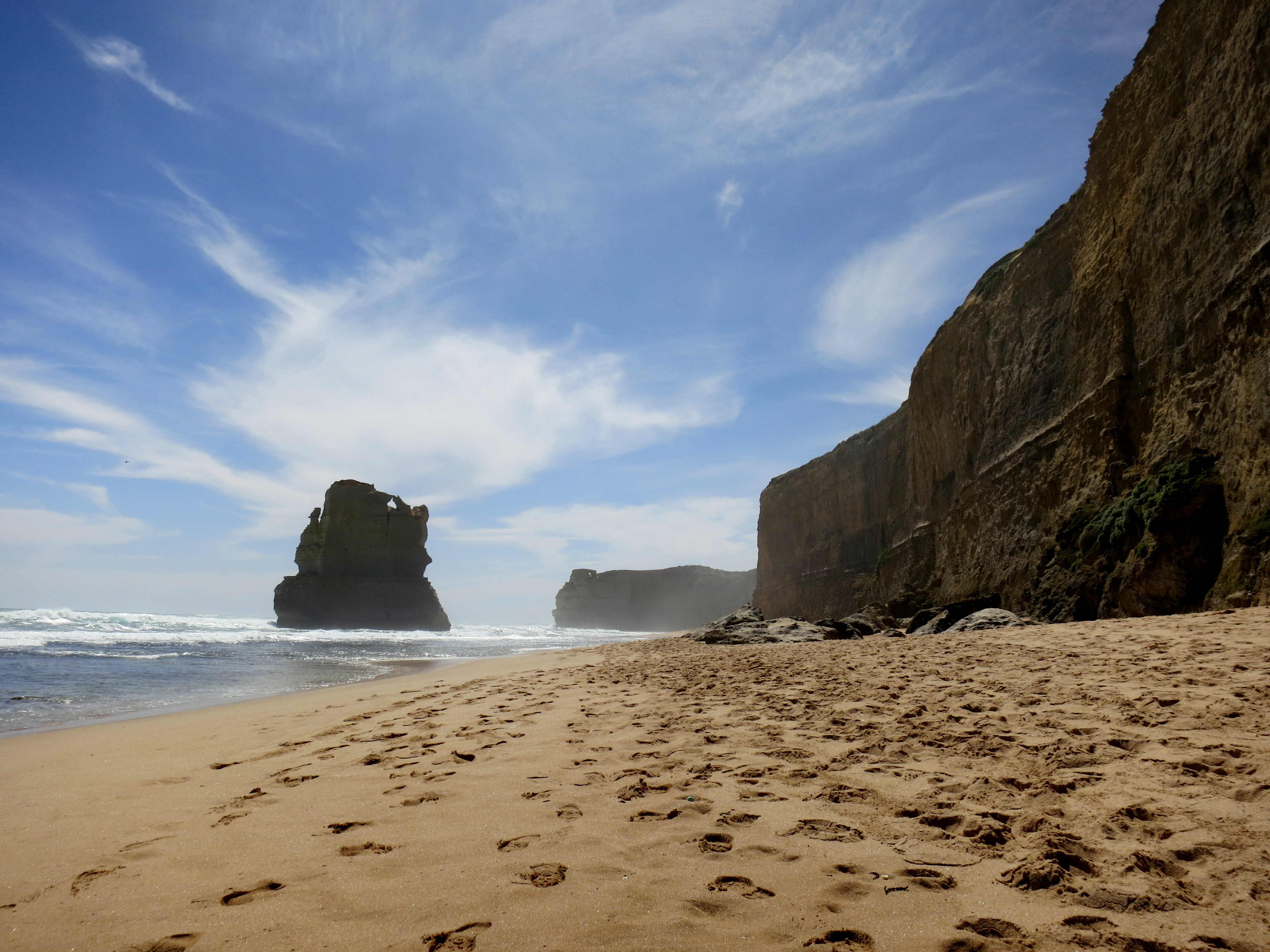
At Gibson Steps
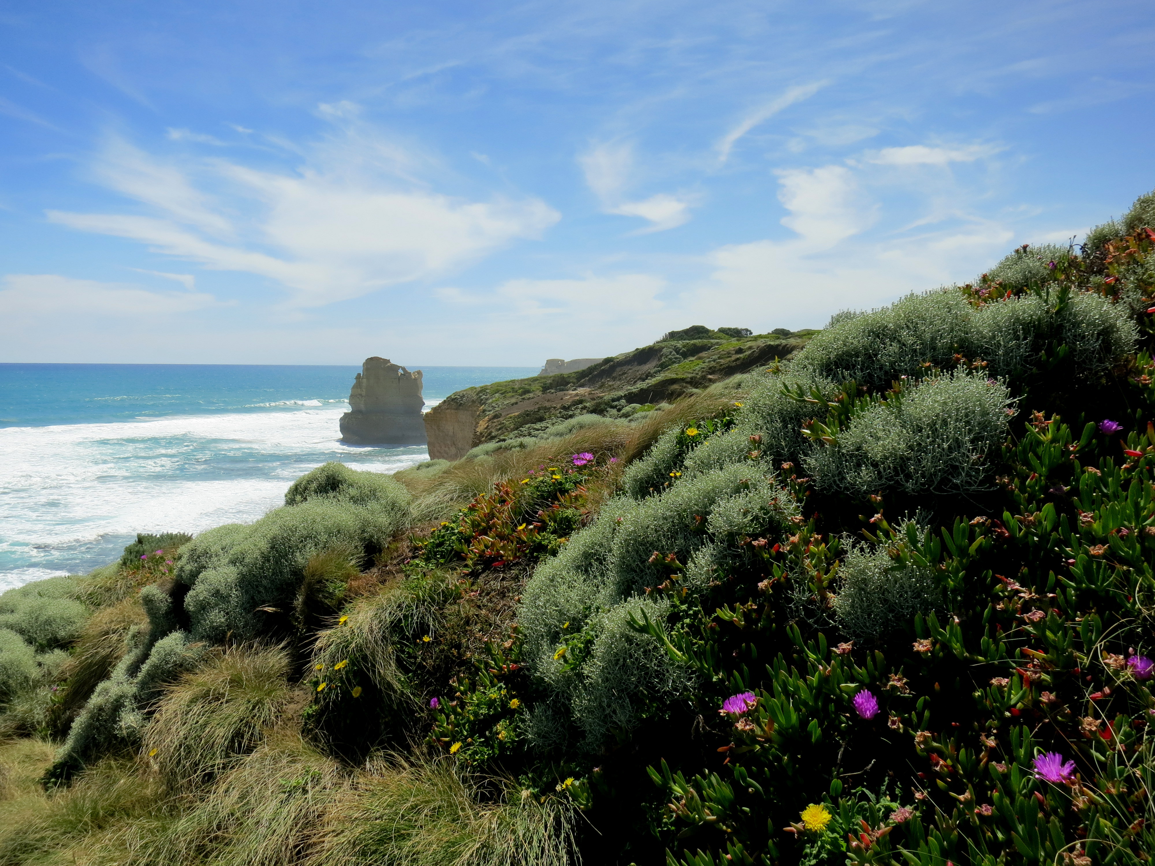
A long haul back up the steps and a short drive later, we arrived at the 12 Apostles. This is one of the most popular destinations in Australia, so perhaps it shouldn’t have surprised me to see a visitor’s center set up and hundreds of people milling about, but because we’d been four of only 30 people, tops, at all our stops so far, I was a little taken aback. Here, as at Stonehenge in England, you park on one side of the road, then follow an underpass path to get to the attraction.

Subtle signage
The 12 Apostles were stuffily renamed in the ’50s; they were originally called the Sow and Piglets, which is much more evocative. They’re limestone rock stacks, which used to be part of the mainland, then eroded into arches, then eroded further into stacks. There are 8 left today. The light was terrible when we were there, but another thing about a rideshare is you can’t insist you stay an extra several hours to get less harsh sunlight for your photos.
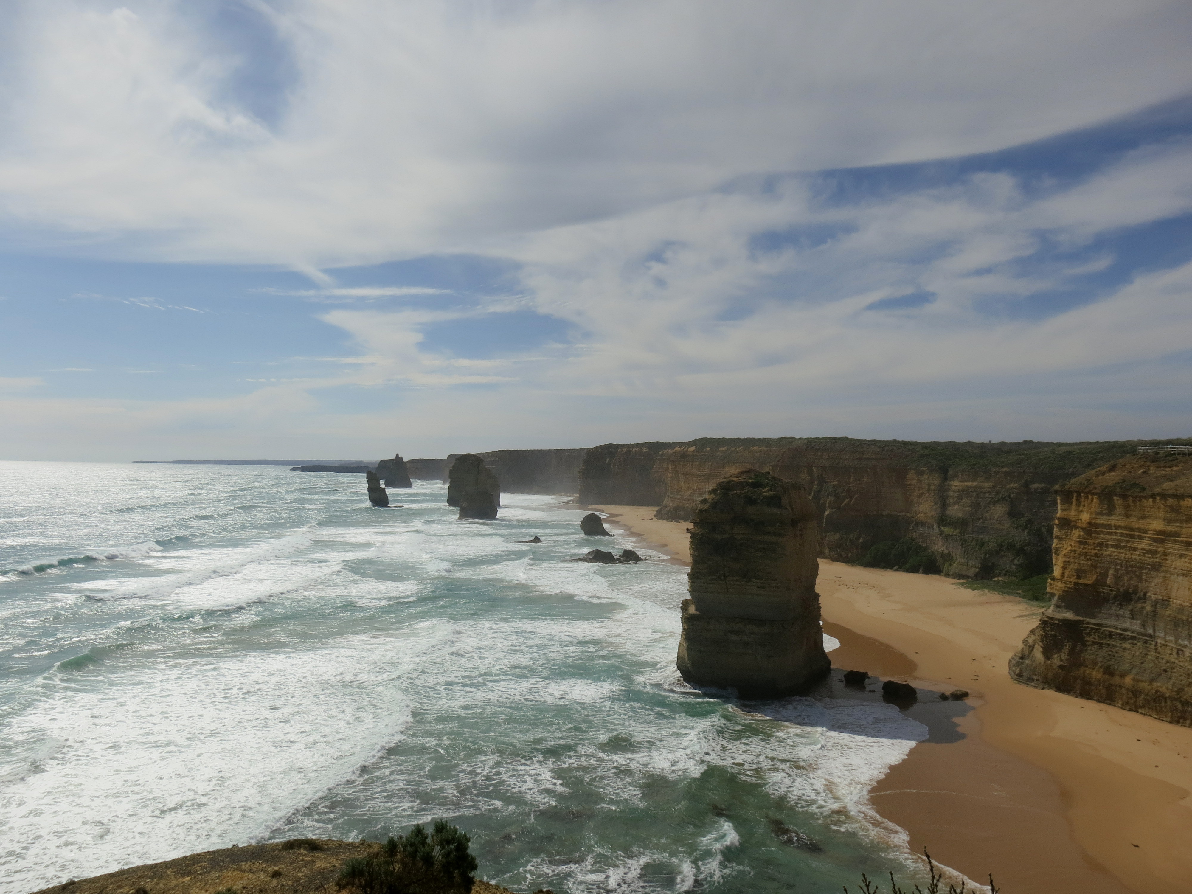
12 Apostles
In fact, once we’d admired the rocks and the ocean, Dani said we should head back so no one had to drive in the dark, which is a sensible suggestion. So we cut through inland roads that Theresa had told me about, and sped back to Melbourne, exclaiming over the wildlife and the coastline, and happy to be road tripping together.
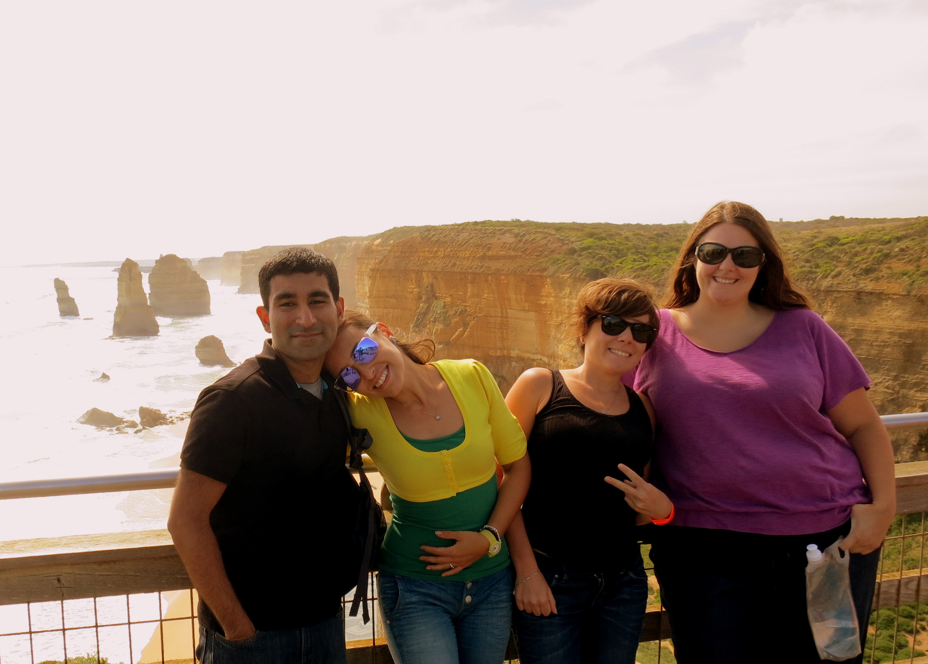
Ali, Dani, Fede, me
