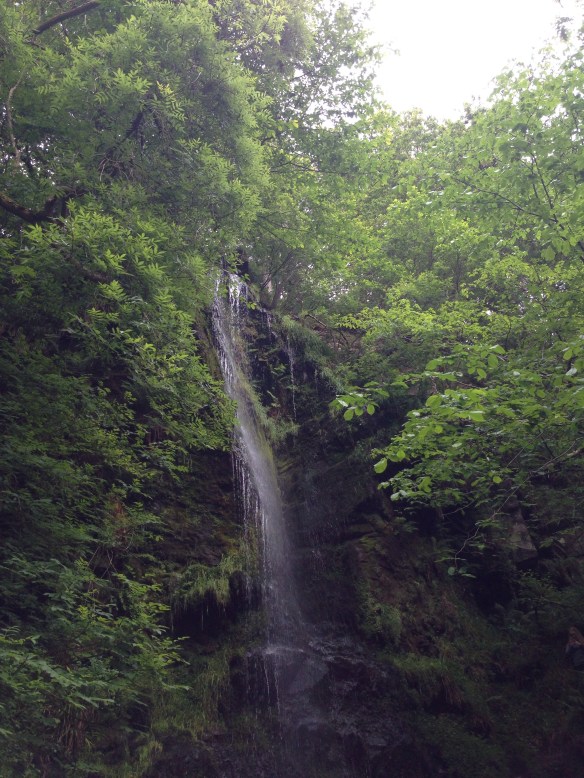
Mallyan Spout, Yorkshire, England; June 16, 2018

Mallyan Spout, Yorkshire, England; June 16, 2018

Bond Falls, Michigan; August 31, 2016
The sights of the Golden Circle are so stunning that it doesn’t matter whether you visit in summer or winter, so I booked a seat on a minibus tour when I visited Iceland in early February this year. We left Reykjavik as the sun started to rise and returned as it set over the ocean. In between, we visited Thingvellir National Park, the Strokkur geyser, and Gullfoss waterfall–a circuit that’s a classic for a reason.

Gulfoss, Iceland
Thingvellir
Thingvellir is hugely important for historic and geographic reasons. It’s both where the Icelandic Parliament was established way back in the 10th century, and it’s where the North American tectonic plate separates from the Eurasian tectonic plate. Democracy trembling in the earthquakes of the continents drifting apart.


The first assembly met here in 930, and continued to meet even as the Norwegians and then the Danish claimed Iceland for their own, until eventually the Danish king held absolute rule and the assembly was no longer allowed to serve its purpose. Today, the prime minister’s summer home sits in the valley near one of the possible locations of the ‘law rock’ from which the law was read and assembly decisions made.


While continental plates are rubbing up against one another in the Pacific and causing tsunamis, on this side of the world they’re pulling apart and causing earthquakes. Most of the Mid-Atlantic Ridge–the longest mountain range in the world–runs along the ocean floor, and the only place you can walk along it on land is here in Iceland. The Icelandic government have put a path down at the base of the ridge, so as you walk down the path you’re leaving the North American continental plate and entering a rift valley; off in the distance you can see the ridge of the Eurasian plate rising above this volcanic island. Few things in this world are singular, and I cherish those that are.


Geysers
Iceland quietly has so many original and unusual natural wonders. One of those is the spouting hot spring from which we get the word “geyser” — Geysir, the first such spring Europeans learned about. Geysir hasn’t spouted in many years, but literally yards away lies Strokkur, which makes up for Geysir’s inactivity by going off every 5-10 minutes, nearly as reliably as Old Faithful of Yellowstone in America.


These two springs sit in a valley full of geothermal activity, and every family in the area either has their own natural hot spring as a source of energy, or they rent from their neighbors. Geothermal energy is also what powers the capital city of Reykjavik, although those springs are not in this valley.


Gullfoss
By the time we got to Gullfoss, I was starting to creak in the cold wind. It’s colder in the interior of the island than it is out on the coast, so when I’d come back from the South Shore tour the day before and blithely remarked on how the weather wasn’t so bad, I was not prepared for Gullfoss. Both my camera and my phone just shut themselves down (happily, they recovered when I warmed the batteries later). It wasn’t even too terrible, numbers-wise; our guide said it was -14 Celsius, and I know I’ve been in worse in Chicago. The wind wasn’t awful and there was no precipitation. But it was still really, really cold, and I had to do some finger exercises to keep them from losing feeling.


But Gullfoss is a waterfall, so as you can imagine, dearest fellow travelers, I didn’t really care how cold it was. What a waterfall! The Hvítá River spreads wide across the landscape, and rushes down in several stages, before plunging to a much narrower space below. It’s dramatic and magnificent. The blue of the water and the white of the snow shone in the sunlight, and I had one of those moments of being aware that my eyes weren’t quite up to the task of taking in all that they were seeing.


Horses and Faxafoss
One of the reasons I booked the Iceland Horizons tour was I’d read that they made a couple extra stops that other bus tours didn’t: we stopped by the side of the road to meet some horses, and our last stop of the day was Faxafoss waterfall. Even knowing this, I hadn’t planned ahead and didn’t have any snacks to feed the horses, who were unimpressed with my lack of offerings, and who can blame them. They did let me admire them from a slight distance, though.


To end the day with a bonus waterfall, with no one else around but the people from my bus, was a pleasure.

Faxafoss

Despite the fact that I grew up in the Midwest and have driven through some white-knuckle weather in my time, it’s been two years since I last grappled with winter driving conditions and I might have lost my edge, so when I went to Iceland in early February I decided to go on tours rather than rent a car. This was absolutely the right choice, given how much I stared out the window and snapped blurry photos during the drive, and also the fact that I saw two cars in a ditch within a mile of each other.

10am sunrise

Iceland landscape

Hekla, the most active volcano on Iceland (about six years overdue for an eruption)
My first tour was to the south shore of the island (Icelanders always refer to it as “the island,” not “Iceland” or “the country” or anything–fair enough, it is half the size of the isle of Great Britain, which is itself the size of the state of Michigan; it’s not big, is what I mean). I went on a Reykjavik Excursions bus with about 50 other tourists, our driver, and our guide, whose name in Icelandic means “Raven Battle,” but we could just call her Raven. Iceland: where your tour guide is definitely descended from Vikings.

Seljalandsfoss
Sunrise in Iceland in February is around 10am, which means that we had some great views from the bus as we headed south and east. Our first stop was a quick one, at the entrance to the farm that sits at the bottom of Eyjafjallajökull, the volcano that erupted in 2010 and stranded travelers for days because of all the ash it threw into the atmosphere. It was dozing peacefully when I saw it.

Eyjafjallajökull
Next came the part of the tour that reminded me I was on a guided tour for 50 people. We disembarked in the parking lot of the Mýrdalsjökull glacier, and Raven told us to be back in a strict thirty minutes because we had a schedule to keep to. If I hadn’t had my friend’s Yaktrax strapped to my boots, I wouldn’t have made it more than a few hundred yards in that whole time. But with those, I was able to walk on the ice rather than slip-slide along it tentatively. Still, with only a few breaks for photos, I didn’t make it to the viewing point. I got just around the corner so I could see that particular shade of glacial blue, and then I had to rush back. Even so, I was the last one on the bus. Worth it.


As we drove to our next destination, Reynisfjara, Raven warned us at length and in some detail about the extreme dangers of the riptides at this beach. I started to wonder if she was giving us safety tips or just describing our impending doom. But I didn’t touch the water’s edge even once, and I made it through okay. The black sand of the beach here is a dramatic contrast to the whitecapped blue of the ocean, and some stepping stone-type rocks near a cave on the southeastern edge are a big attraction.


After lunch in the town of Vík, we went to the Skógar Museum and listened to an excellent introduction to how Icelanders lived for centuries. In sum: it was really difficult. The only mammal native to the island is the Arctic fox, so the original settlers brought over cows, horses, sheep, etc. Then there was a “little Ice Age” that started in the 14th century, during which time many people and animals died, and the settlers were no longer able to grow most of the crops they’d grown before. All because temperatures had dropped by a couple degrees Celsius. People built turf houses, which are literally blocks of earth cut out of the ground and piled up like bricks to make a small house. Then they’d search the beaches for driftwood to use as roofing material. Seeing as how the original settlers chopped down anything resembling a tree in a very short period of time, there was no wood or other fuel on the island, so they just didn’t have heat. They used the geothermal hot spots when they could for cooking and such, but they didn’t really master that til the 20th century.


The original settlers came from Norway and Ireland; basically Vikings stopped by Ireland and stole a bunch of women for wives on their way to Iceland, a horrible but effective method of diversifying your gene pool. Some think the fact that Iceland has sagas while other Nordic countries aren’t well-known for them is because of the strong storytelling tradition of the Celts.
Unsurprisingly, the Skógafoss waterfall is next to the Skóga Museum. (The suffix “foss” means “falls” so I guess “the Skógafoss waterfall” is redundant in the way of “the ATM machine” but anyway.) Despite the freezing temperatures, the river rushed down the cliff impressively. I was surprised by the grey color of the water as it fell, especially as the snow on the banks of the river was a clean white and the sky was a bright blue. That’s probably due to the sediment that was in the river, I suppose. Whatever color it was, it was a sight to behold, and I liked the fairly unusual angle we got to approach the falls from–I walked along the riverside right up to the base of the falls, with no barriers or anything in the way, and no forest to walk like you usually have to when getting to a waterfall.
Our last stop was another waterfall–Seljalandsfoss. Just as at Skógafoss, you walk along the river right up to the base of the falls. I love waterfalls in any setting, but I really enjoyed the unusual approach of an empty landscape, the magnificence of the snow-covered plains, the craggy cliff, the waterfall rushing down. There’s even another, smaller waterfall a little way down the cliff, so I got a bonus waterfall. I was very happy.


The beginning of sunset

Misty reflections

We drove back along the coast, mountains climbing up out of farmland on the right, the sun setting over the Atlantic Ocean to my left. Even in dark winter, I don’t usually see sunrise and sunset in the same day, so kudos to the latitudinal position of this lovely island for allowing that.

Sunset on the ride home
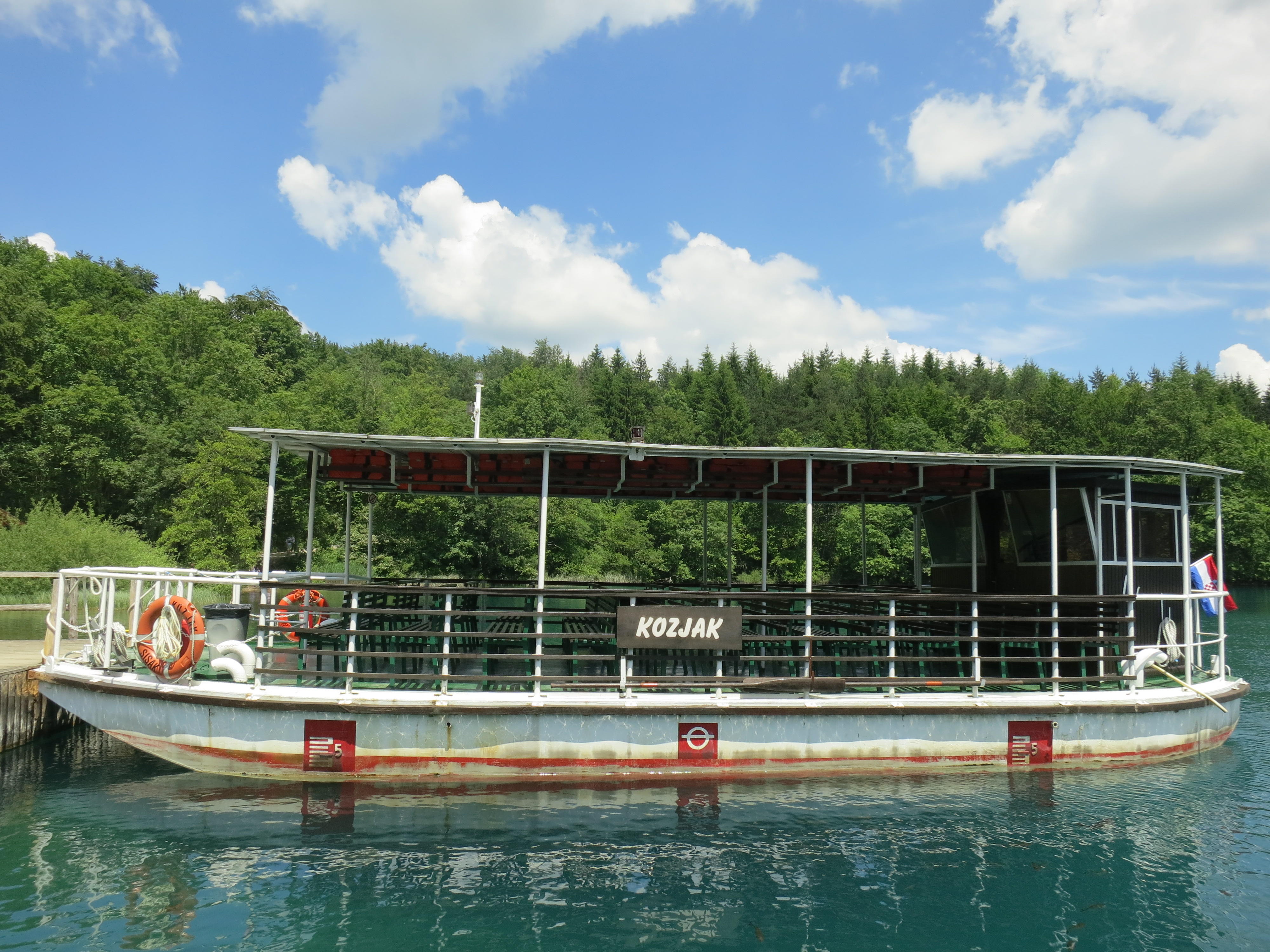
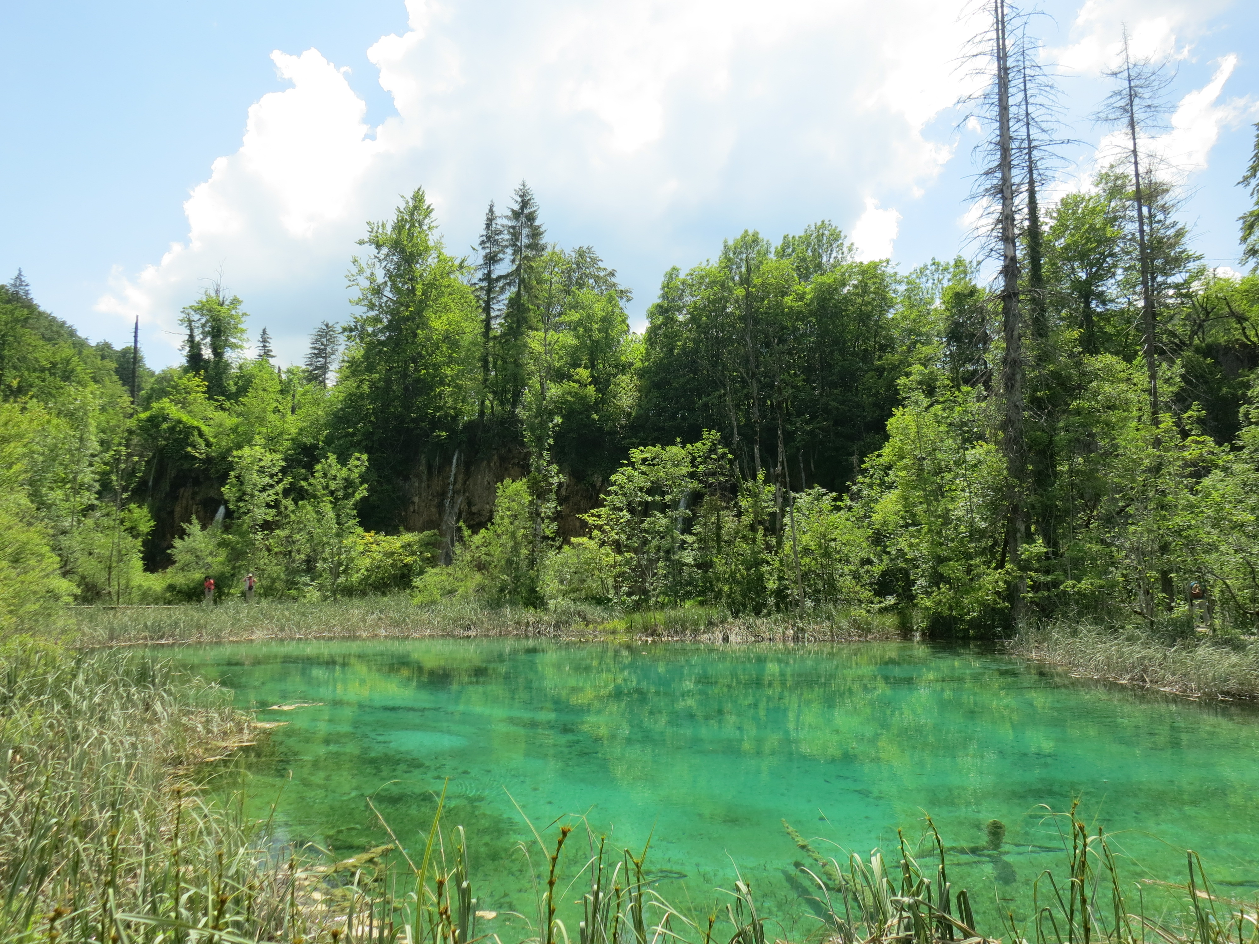
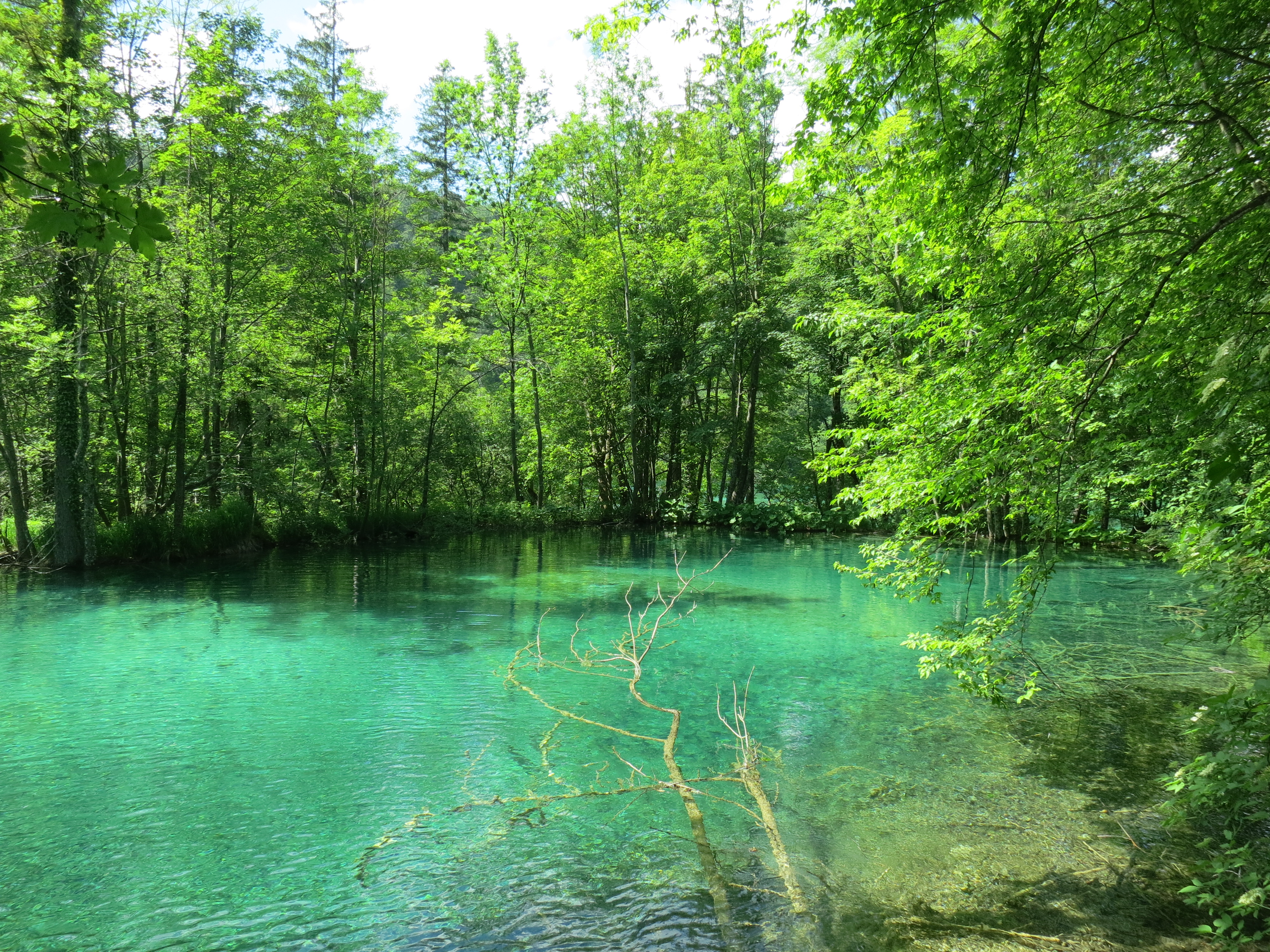
Plitvice (plit-vit-suh) Lakes in northern Croatia are some of the most beautiful inland waters I’ve seen, and frankly, there isn’t much to say other than variations on “wow,” so I’ll just leave you with a bunch of pretty photos to start your Monday off right.


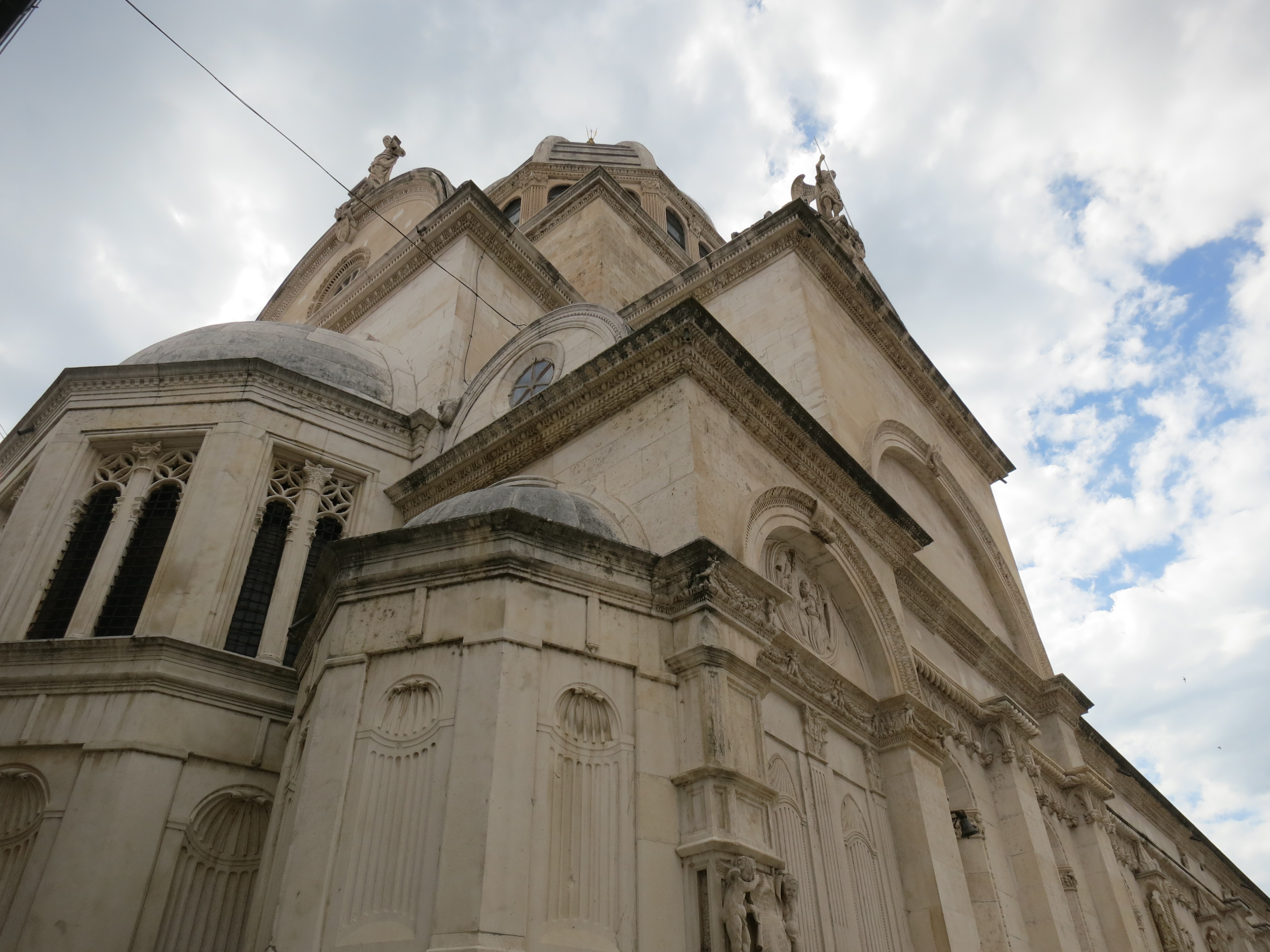
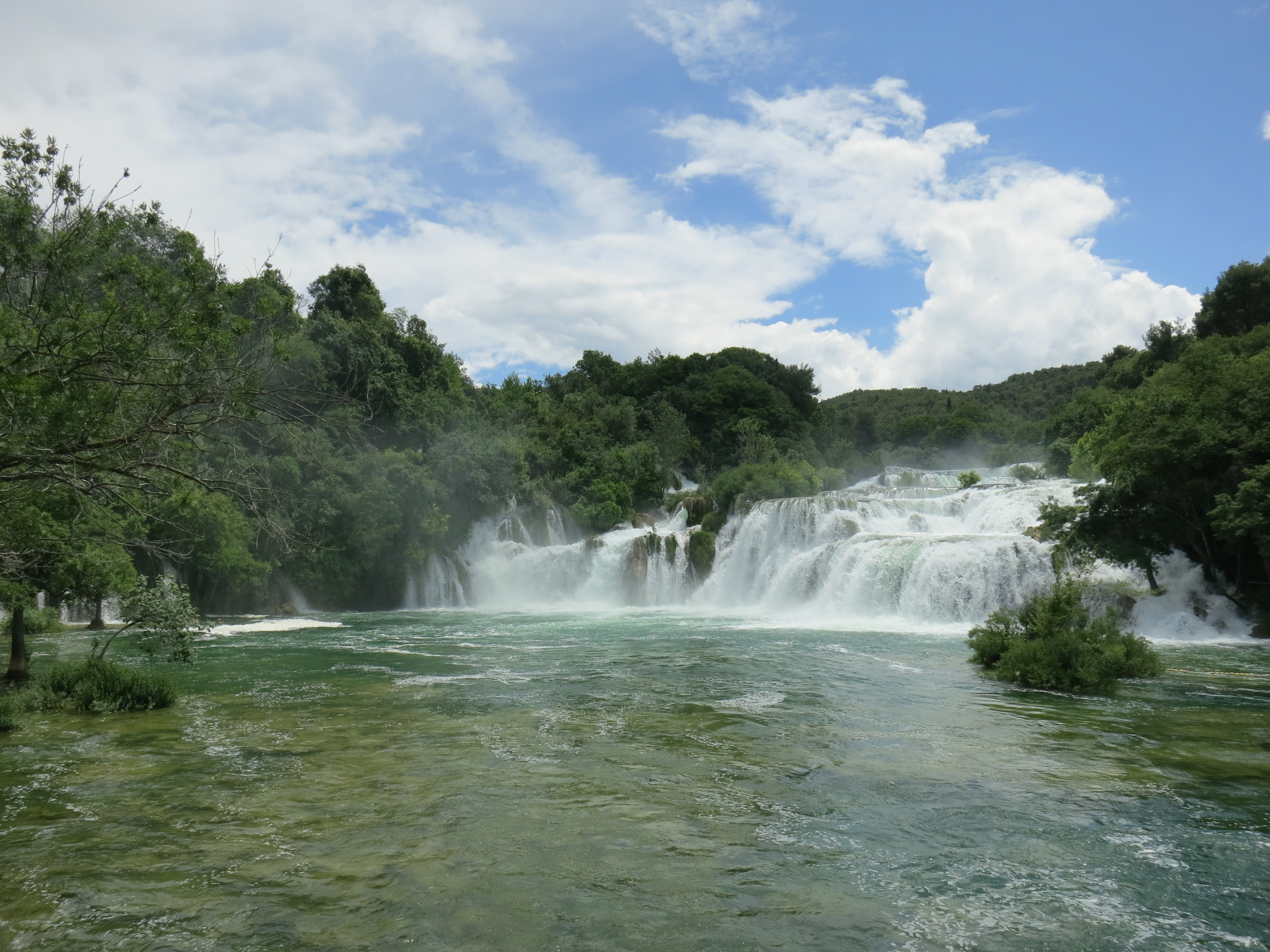
Sibenik is famous for two things: its cathedral, and the nearby waterfalls of Krka National Park. Rightfully so, because these things of beauty stand out.
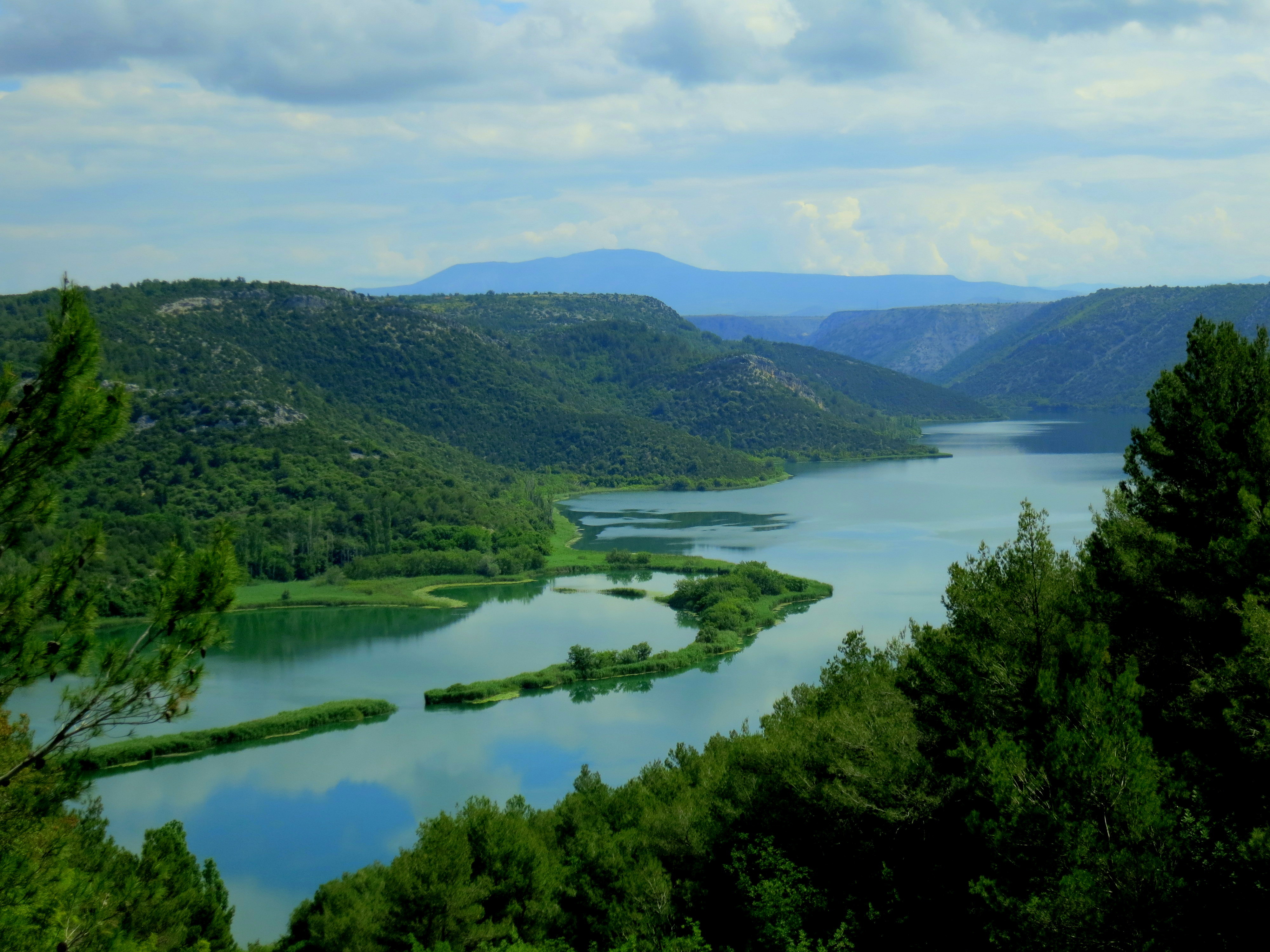
The Krka River
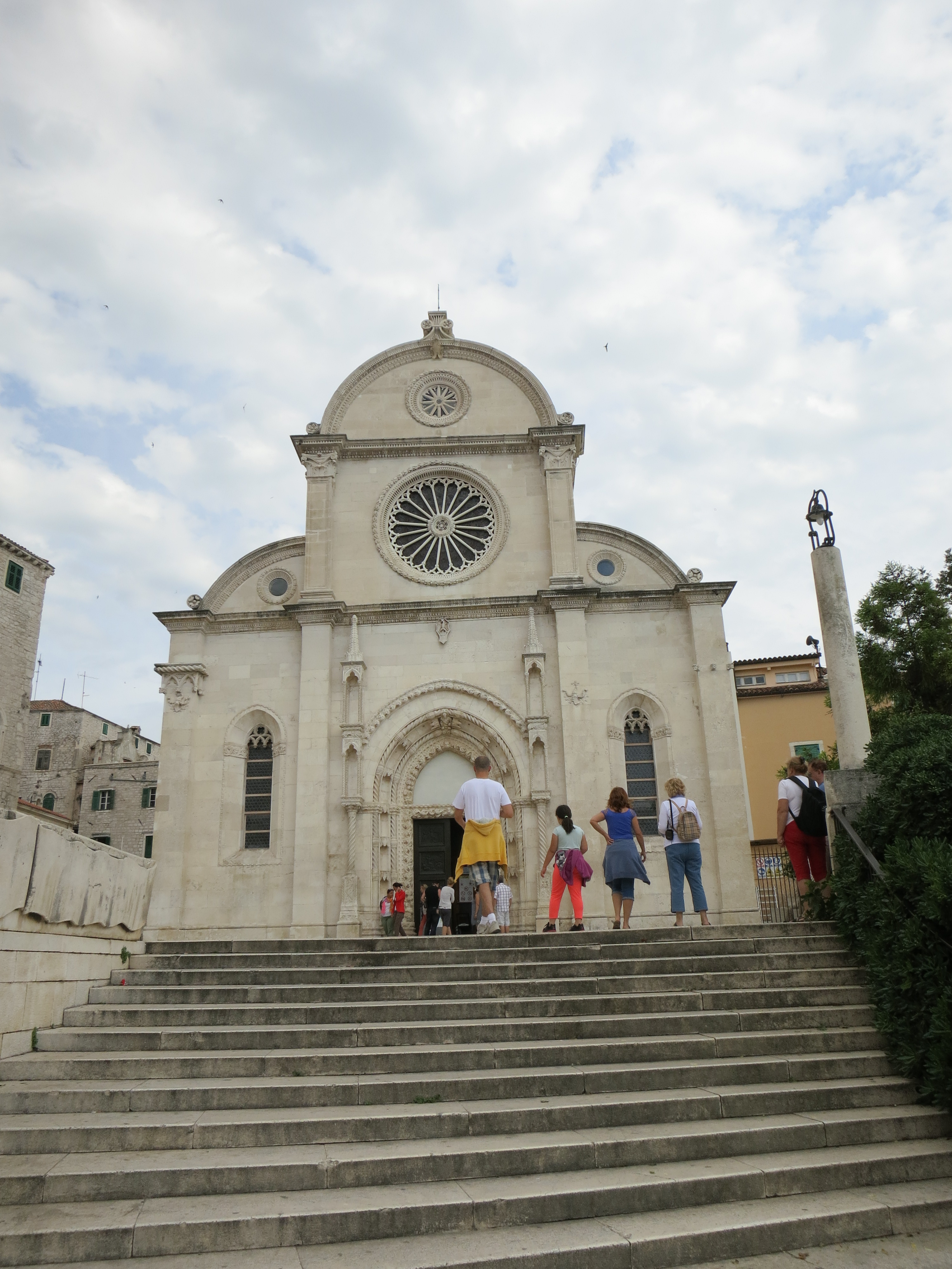
St James’ Cathedral
St. James’ Cathedral is a World Heritage site, as its construction over a period of more than 100 years incorporated different styles and building techniques in a unique way. The only material used was stone from the quarries of the island of Brac, and it was fitted together in a way more similar to shipbuilding or cabinet-making than traditional building construction, which is one of the reasons it’s listed.
A Renaissance exterior
Also, being built between 1431 and 1555 meant that the cathedral bridged the Gothic and Renaissance styles. There are flourishes around the interior that echo famous cathedrals in other cities, and a baptistry famous for its intricate designs.

The transept

Cheery church iconography
My favorite part, though, was the frieze around part of the exterior, which was decorated with faces carved in the stone. Stories go that these are the faces of donors to the project, and the unpopular donors are depicted in unflattering statuary.
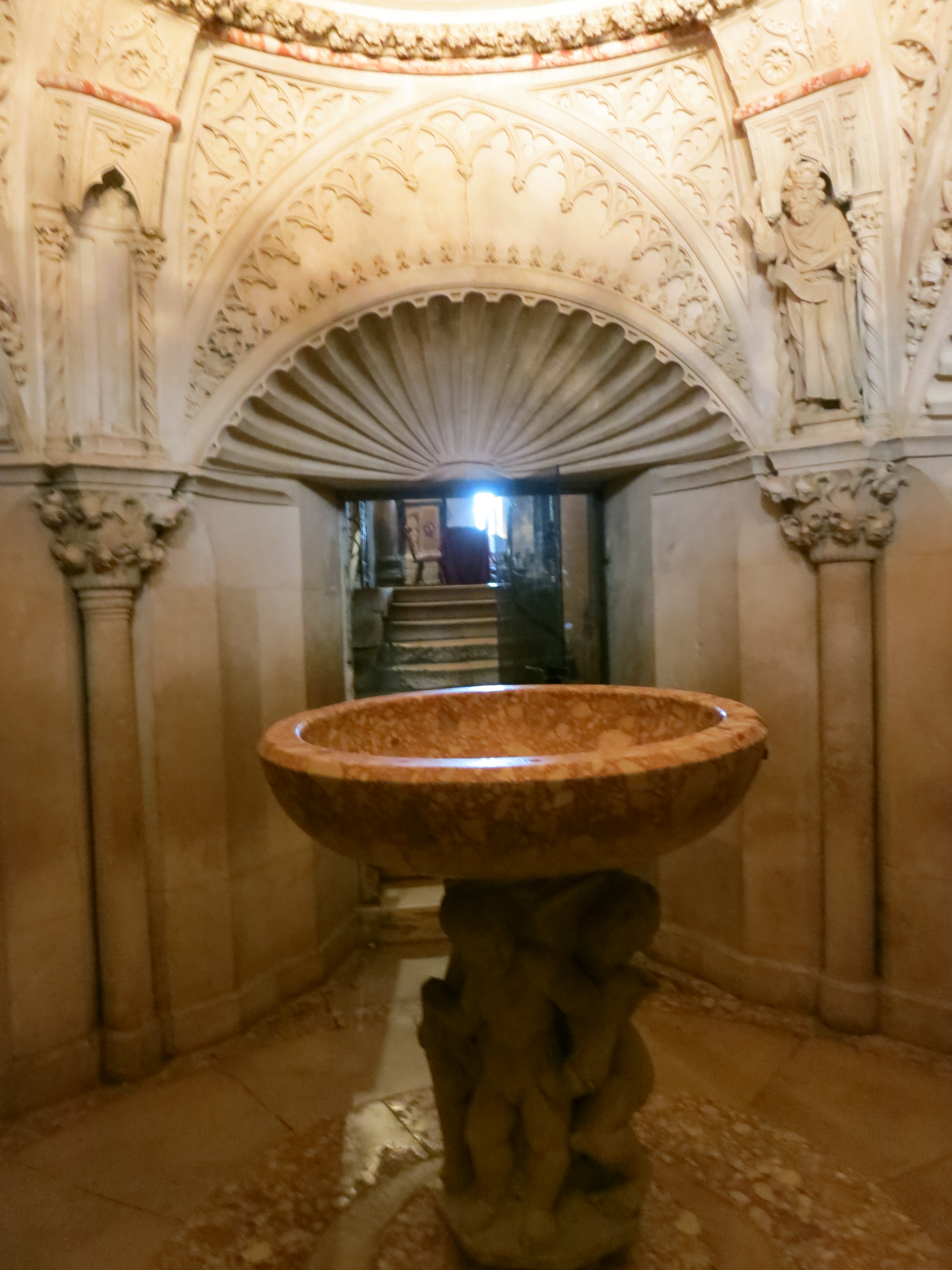
The baptistry

The baptistry ceiling
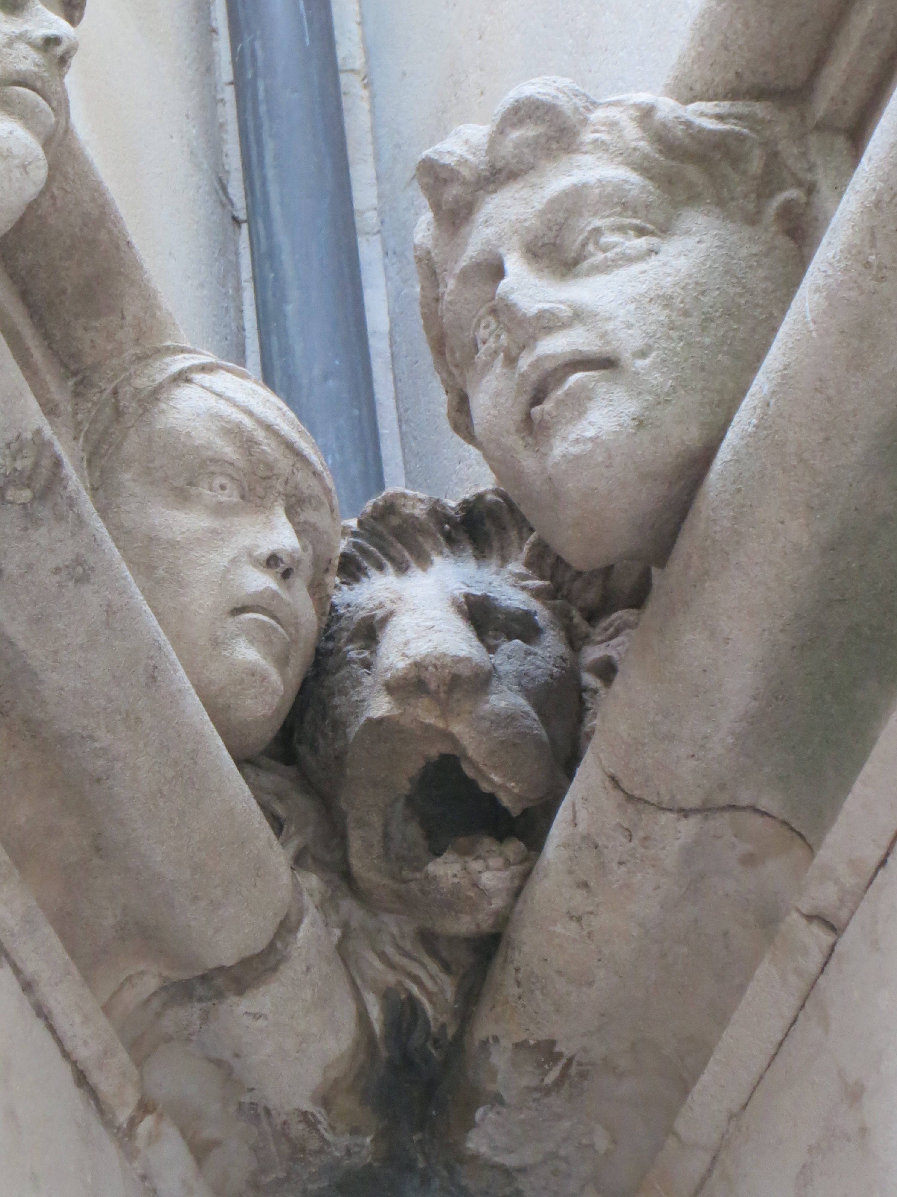
If we don’t look at the lion, maybe he won’t eat us. Don’t look at the lion, man…
Krka National Park is lovely. I met some people who didn’t like how accessible it was–they wanted their waterfalls earned through a couple hours of hiking–but the waterfalls aren’t a spectacular reveal here, so I don’t see the point. The park consists of a blue-green river flowing over little ridges, small changes in gradation, one after another, so it’s more like collections of tiered falls separated by expanses of river. The water flows at a good rate, so by the time it reaches the lower falls, which are actually a decent height at 47 meters tall, it’s rushing over and splashing down magnificently.

Ribbit
The lower falls

It only took fifteen minutes of following this guy to get this shot
I visited the park with a young French woman I met at my hostel. We walked along the boardwalks trying to photograph bright green frogs and iridescent dragonflies, stopped for lunch at the bottom of the lower falls, and then decided that despite the slight chill in the air, we’d brave going in. It was cold but fun, and we got a workout in walking against the current.


Overlooking Sibenik

Laure and I doing our best to look glamorous and not fall over
I appreciate that the traditional way to get to a waterfall is to hike to it, but when I was in Baños, Ecuador, I discovered another way: party bus. There’s a series of waterfalls along Rio Pastaza just outside of town. You can bike it, but if you are still suffering from a sprained ankle in pursuit of a different set of waterfalls, for example, that option becomes less appealing. So you can take a chiva instead.
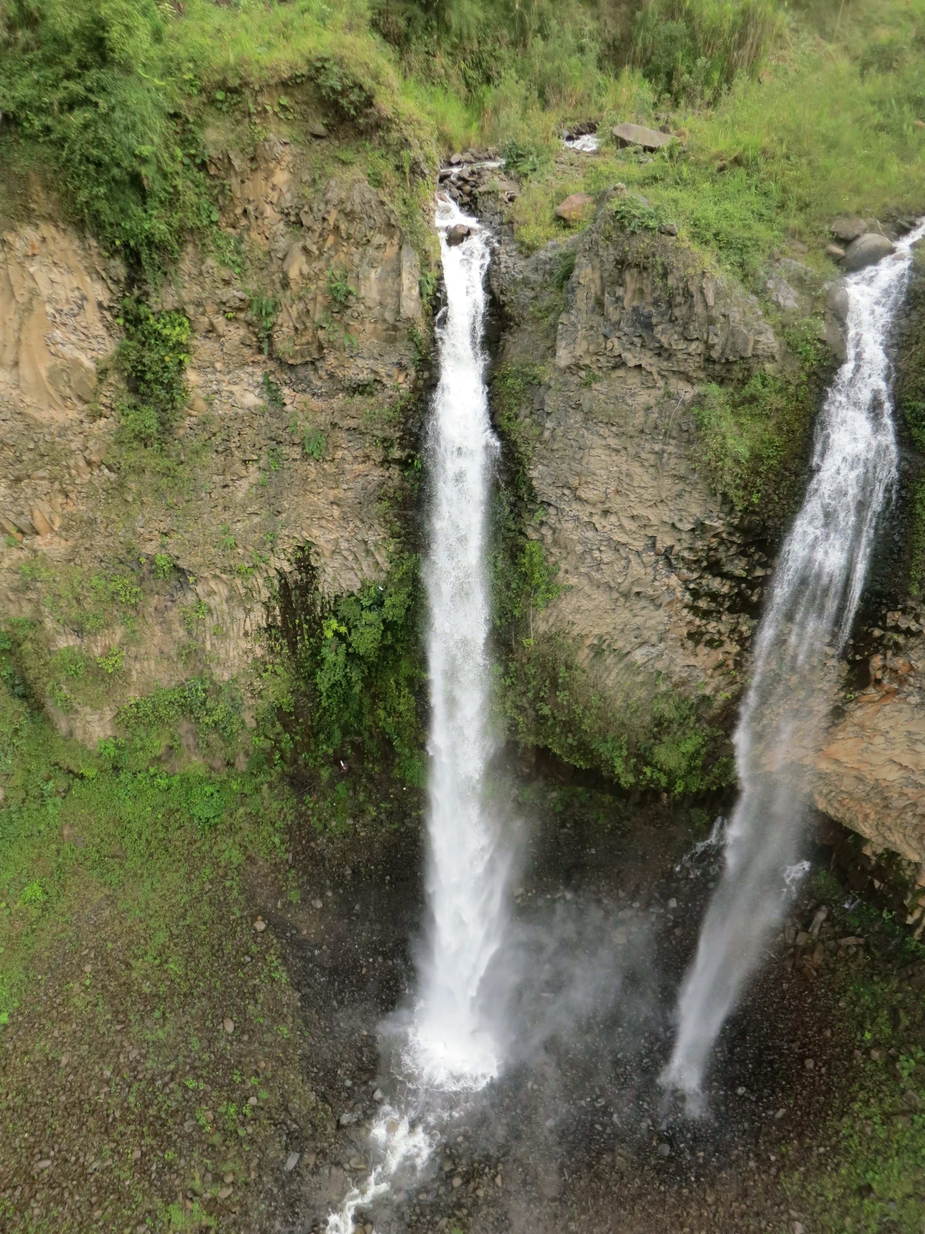
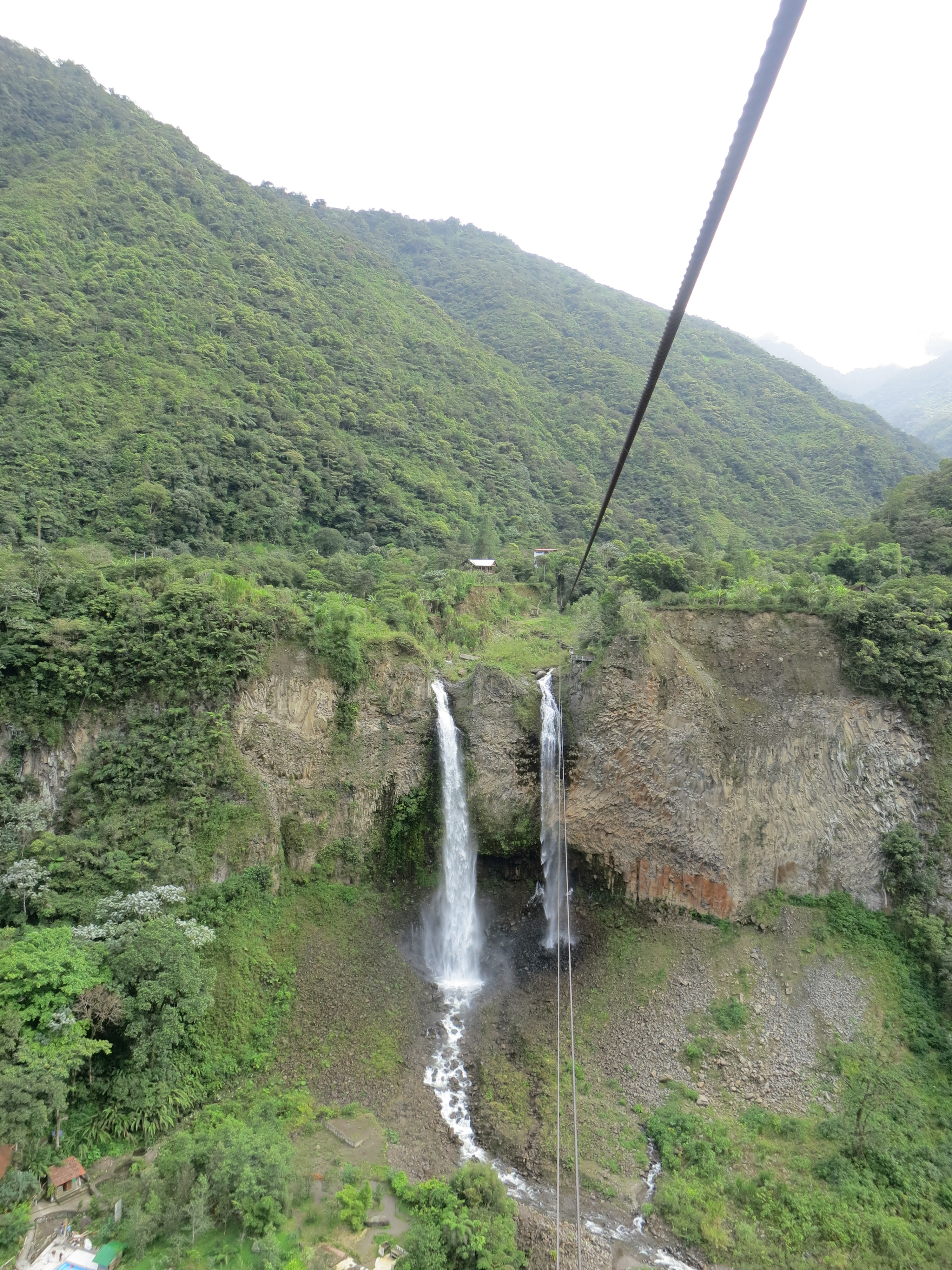
Double waterfall
“Chiva” means “goat” in Spanish, and in several Latin American countries, it’s the nickname given to party buses: covered, open-sided trucks outfitted with disco balls and massive sound systems. The chivas used for the waterfalls tours are equipped with rows of benches, too. I joined a few other tourists and we enjoyed the bizarre experience of being blasted with loud salsa music in the early afternoon as we sped along a two-lane highway.

Chiva!
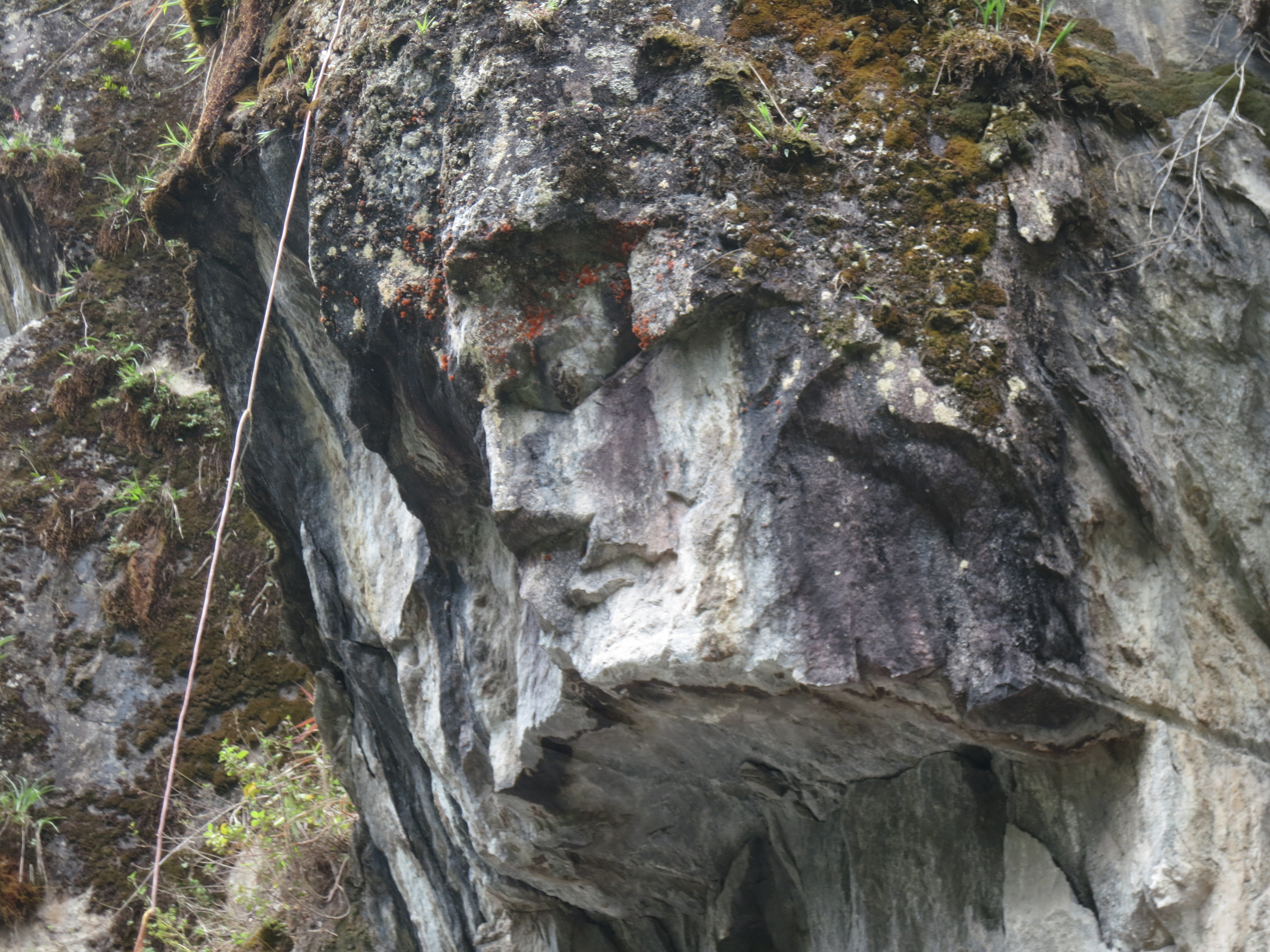
Jesus in the Rock
Of course, the guide talked in Spanish, so I only understood a little, but frankly, you don’t need to understand words to appreciate a waterfall. We went in a cable car that zipped us across a ravine, to the edge of two waterfalls, which tumbled into the river below as we swung on the cable above. Party bus and then cable car door-to-door service–there are lots of ways to get to a waterfall.
Cable car to the waterfall
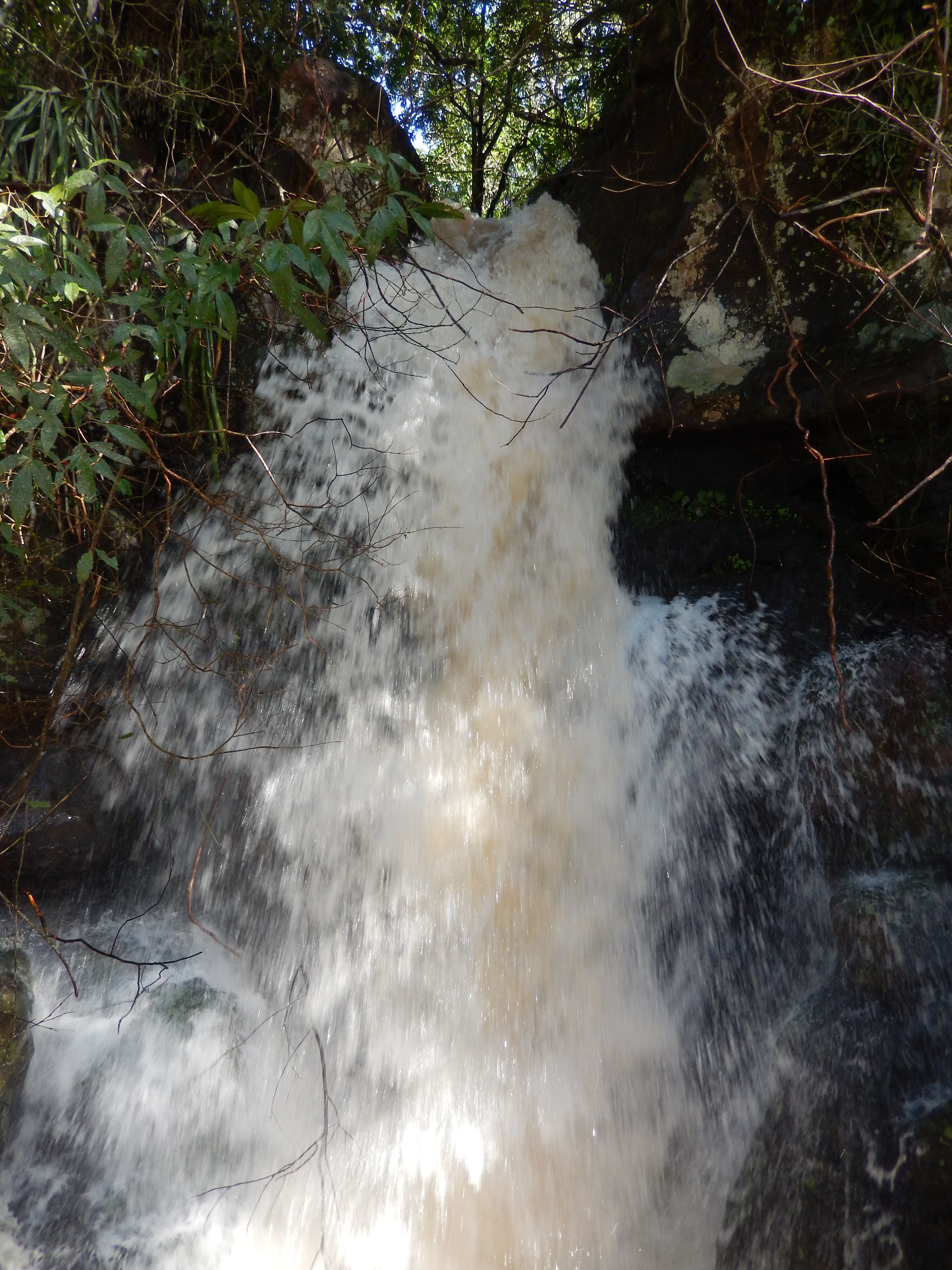
After an interlude wherein the guide wheedled and cajoled to get us all to go on his friend’s zipline, we carried on to the final stop. Here, we had a twenty-minute walk along a beautiful path, down a tricky bit of hill, to a wooden bridge. This was a serious bridge–it was so steep, you had to hold on to a rope anchored to the shore, and use it to walk midway down the bridge. The bridge swayed in the breeze, but once you held on to the sides to steady yourself, you could look around and appreciate the biggest waterfall of the day, roaring down the side of the nearby hill.

The final waterfall on the trip

Serious bridge
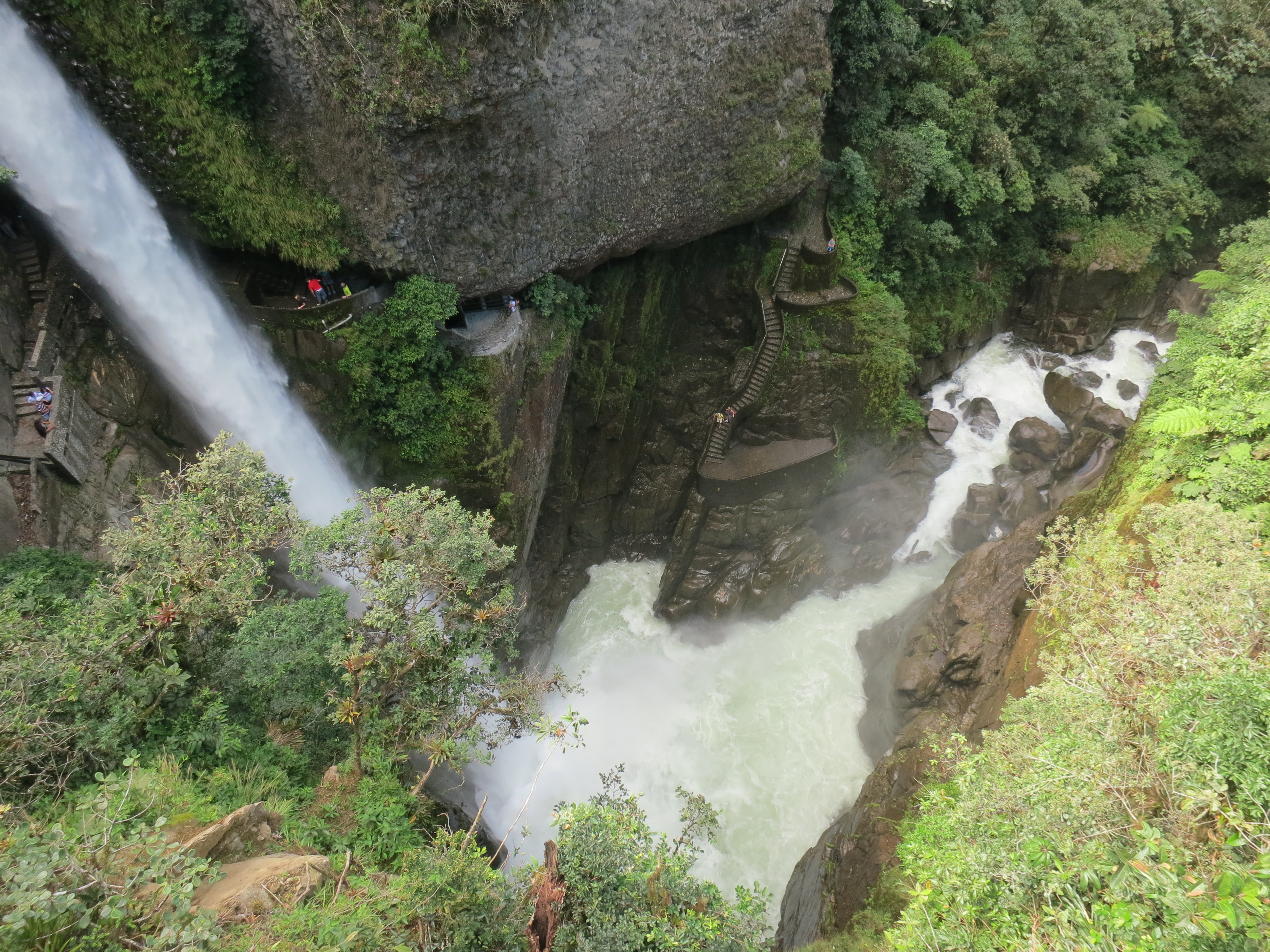
It’s a long way down
The music on the ride back into town was just as loud as the ride out had been, although now we were all pumped up from seeing the waterfalls, we were more ready to groove along. Baños–the only place I’ve been where you can reggaeton your way to a natural wonder.

The river valley

Adventure!
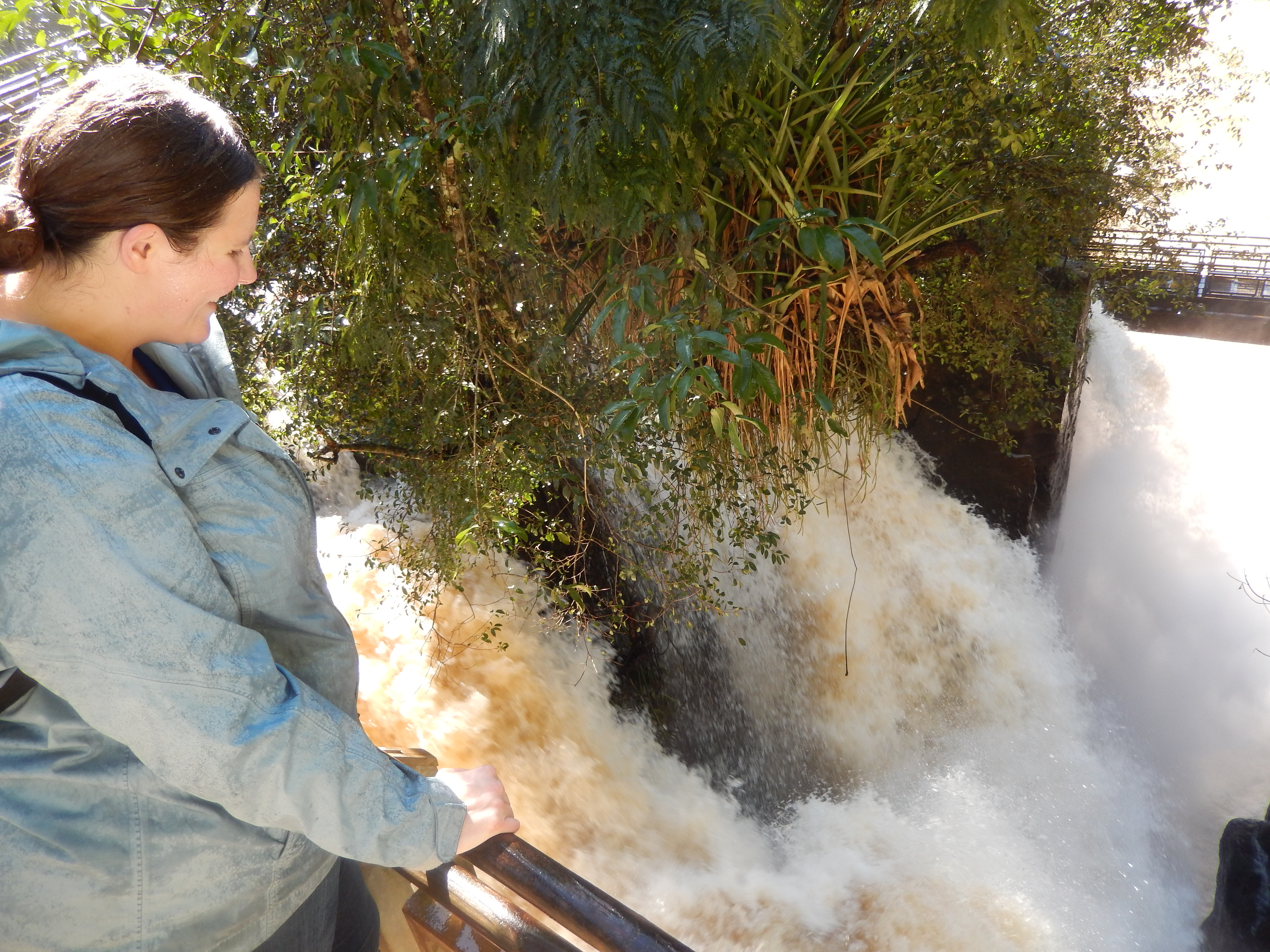
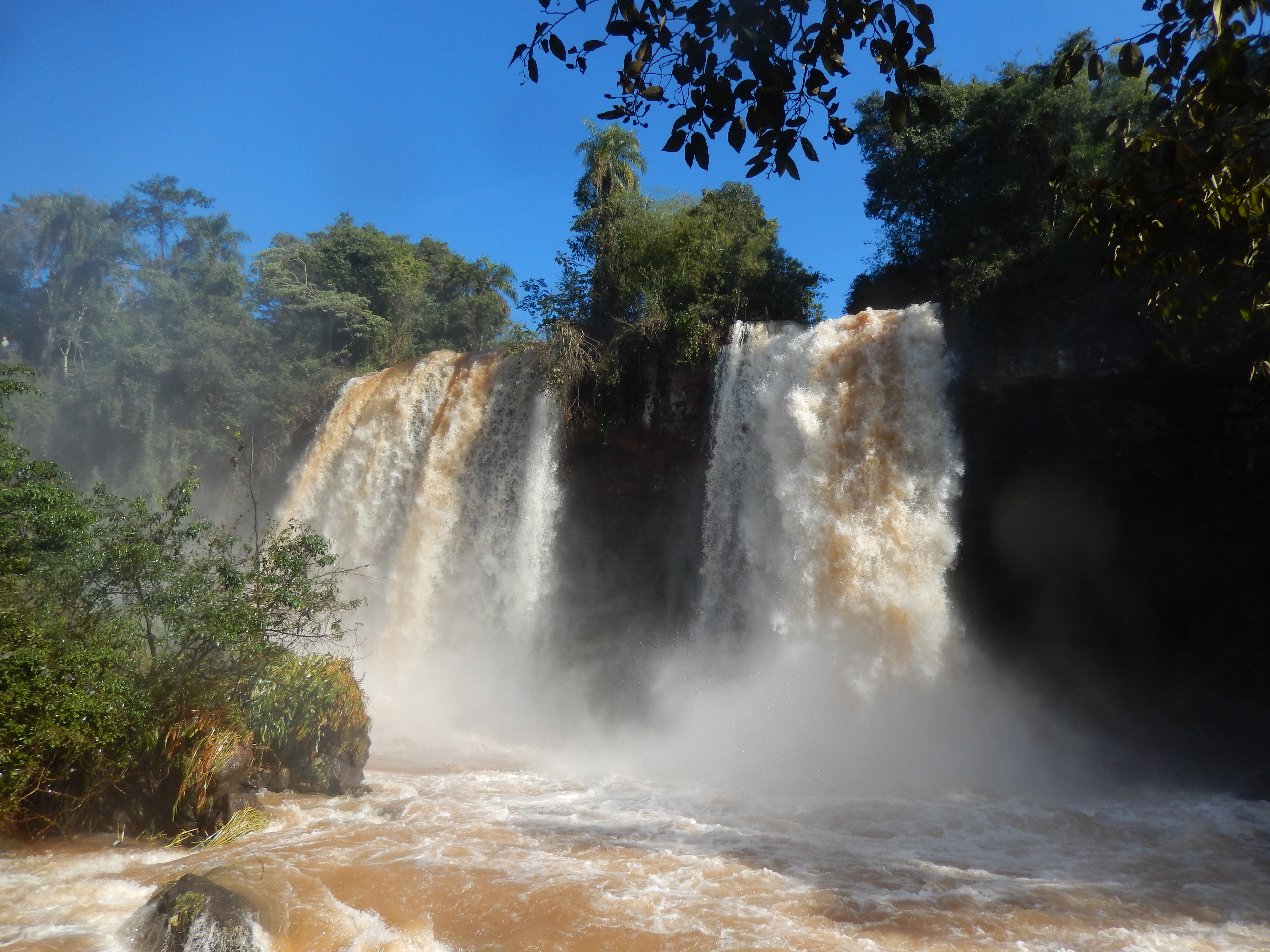
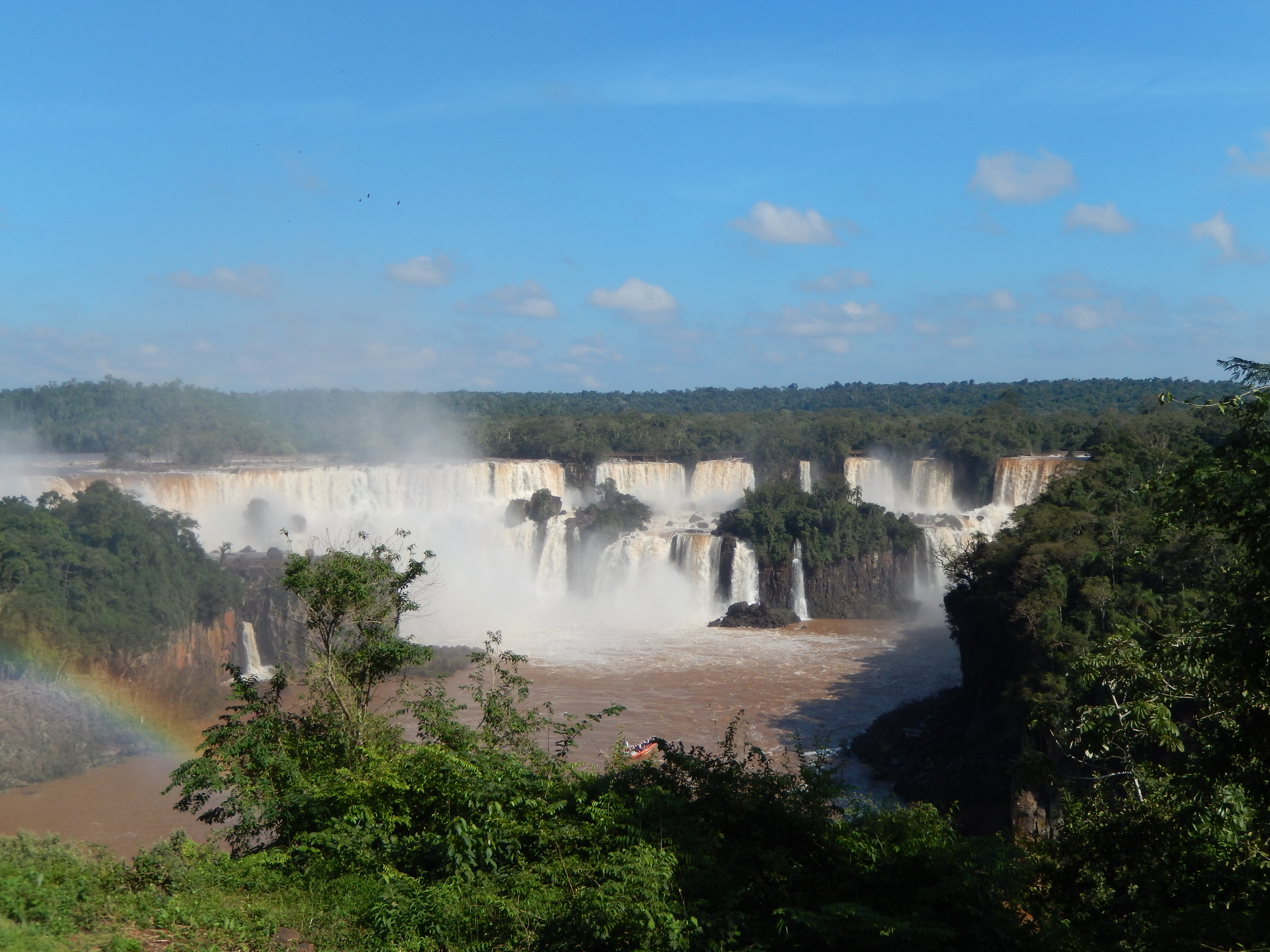
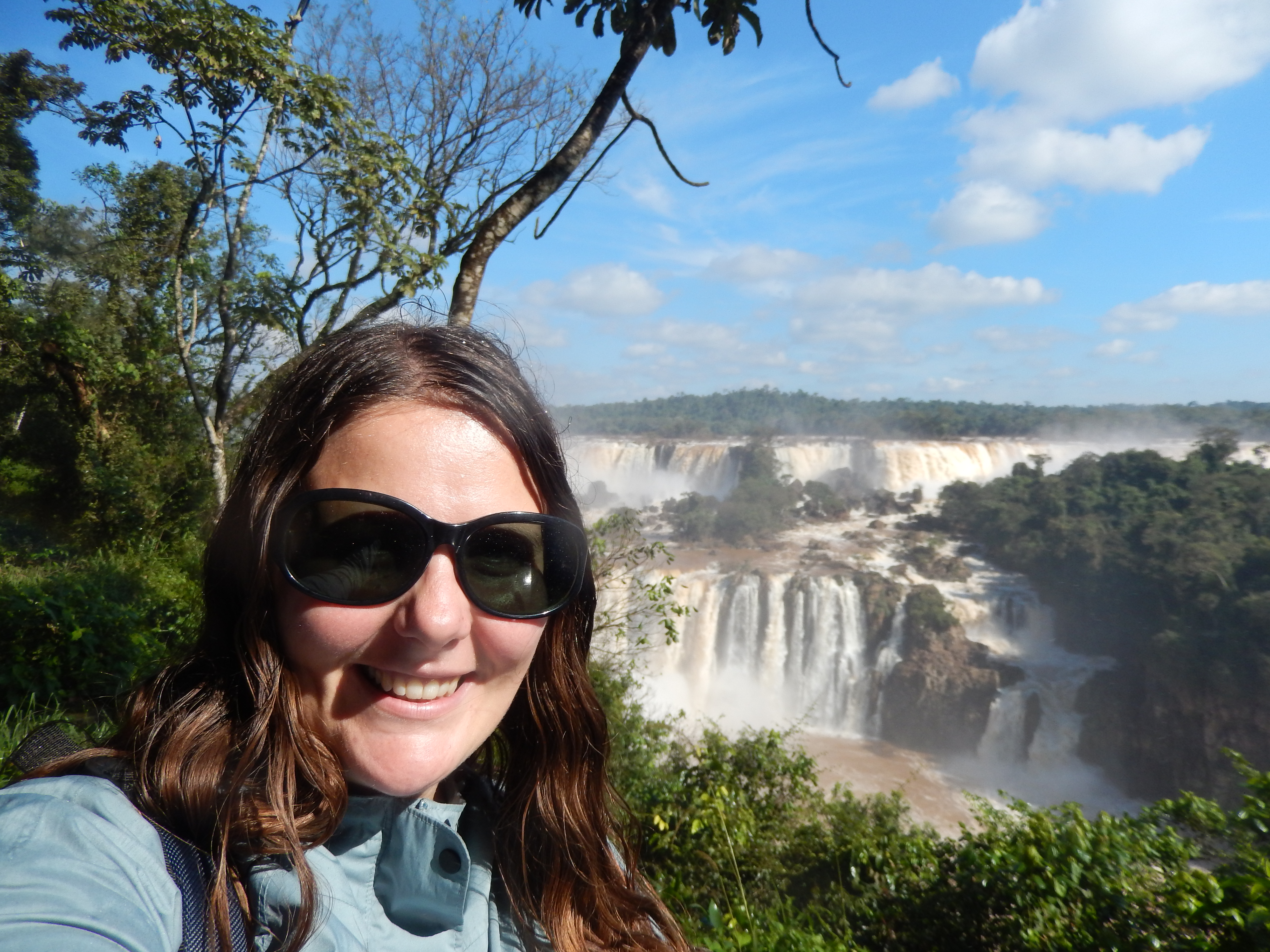
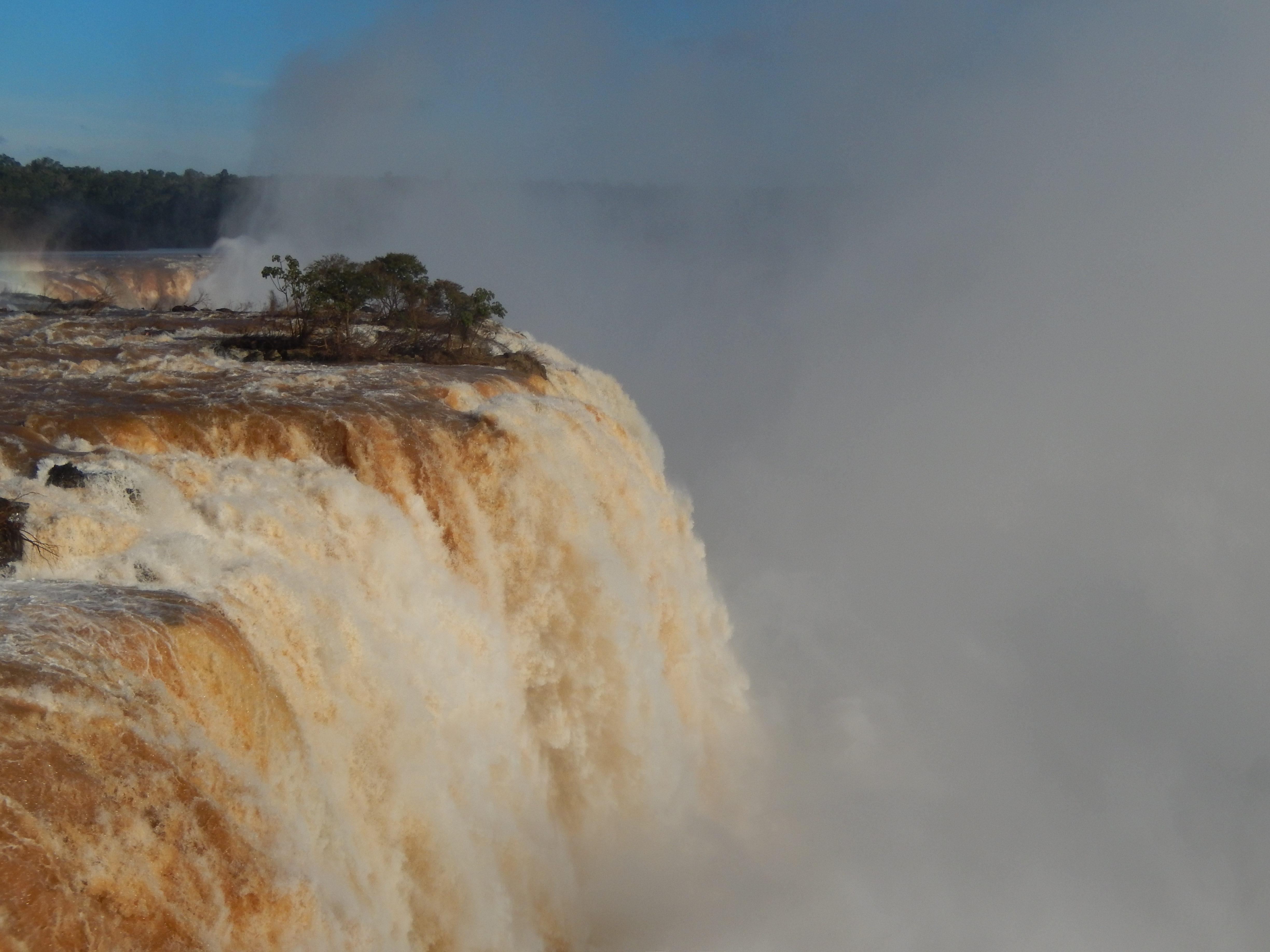
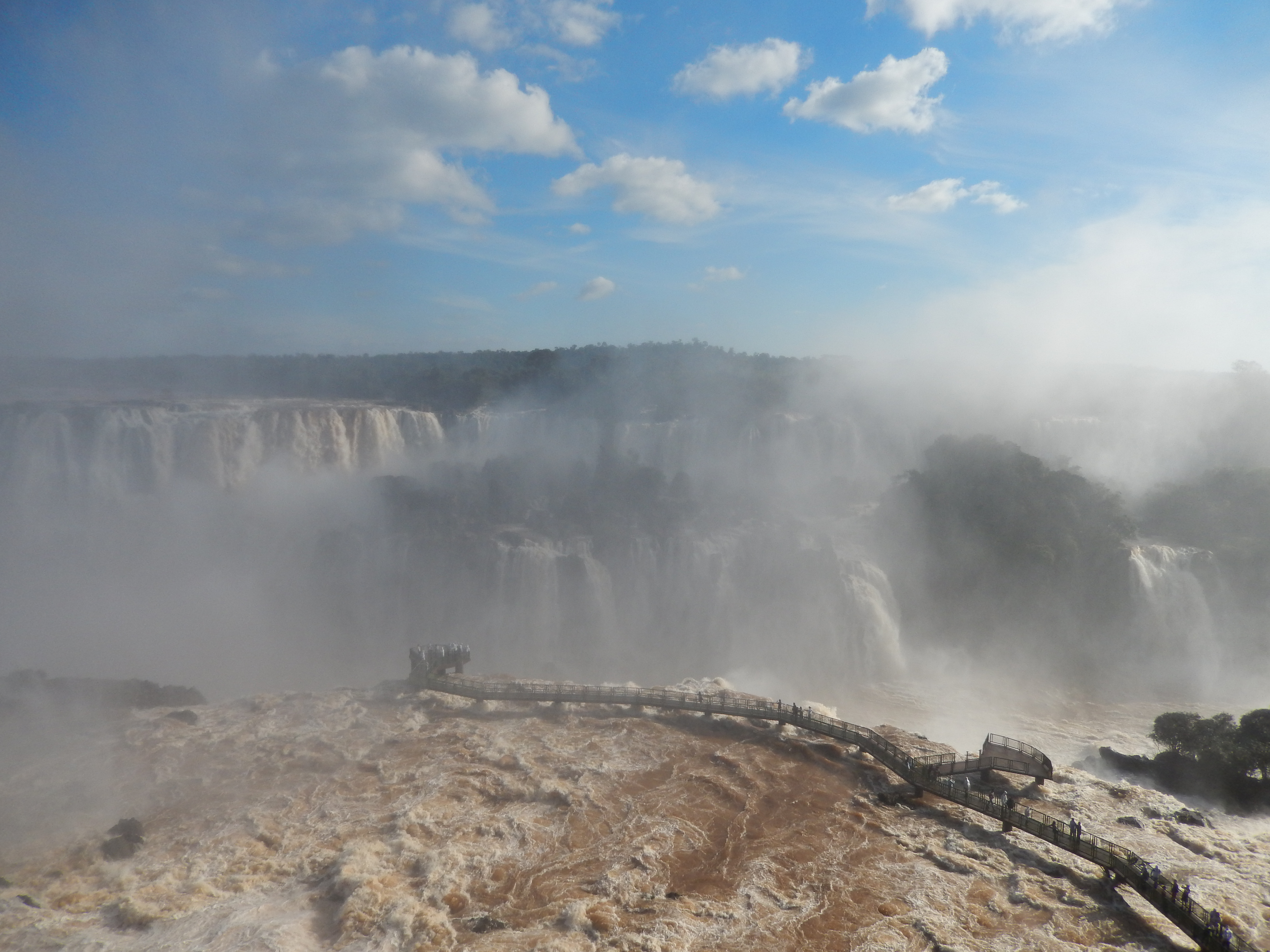
Dearest fellow travelers, I have been to many amazing places and seen many incredible things on this trip, like Uluru and Angkor and Machu Picchu, and while those all awed me, none filled me with joy the way Iguazu Falls did. I walked a lot the two days I visited the falls, but my sorest muscles are in my face, from the non-stop grinning.

GRINNING
The week before I visited, there were such heavy rains that the subsequent flooding at the falls set records. This meant that a couple of the cool walks were closed on the Argentinian side–the bridges over the falls in those areas had been swept away–but there was still plenty to see.
Here, let’s look at a bunch of photos together:
The water levels were the highest they’ve been in decades
Mesmerized

Looking down was a rush

And then there was this
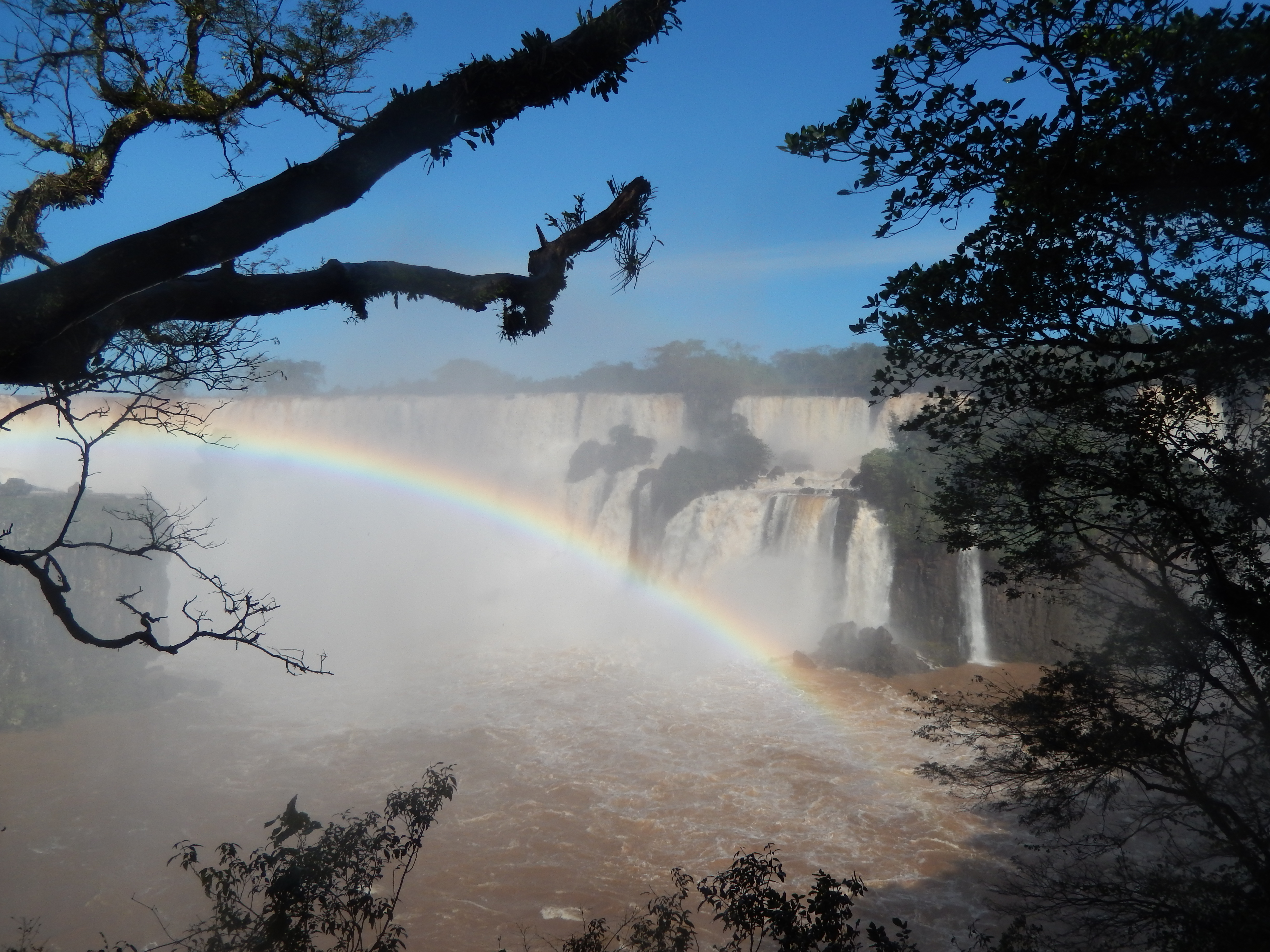
Dozens of rainbows

I got pretty soaked standing in the shadow of this one
Dos Hermanas–the two sisters–at the end of the Lower Trail

Looking down from the Upper Trail

And more wonders

The island in the middle of the falls; it was too dangerous to approach when I visited, because of the water levels

That would be part of the Upper Trail. That section is currently closed.
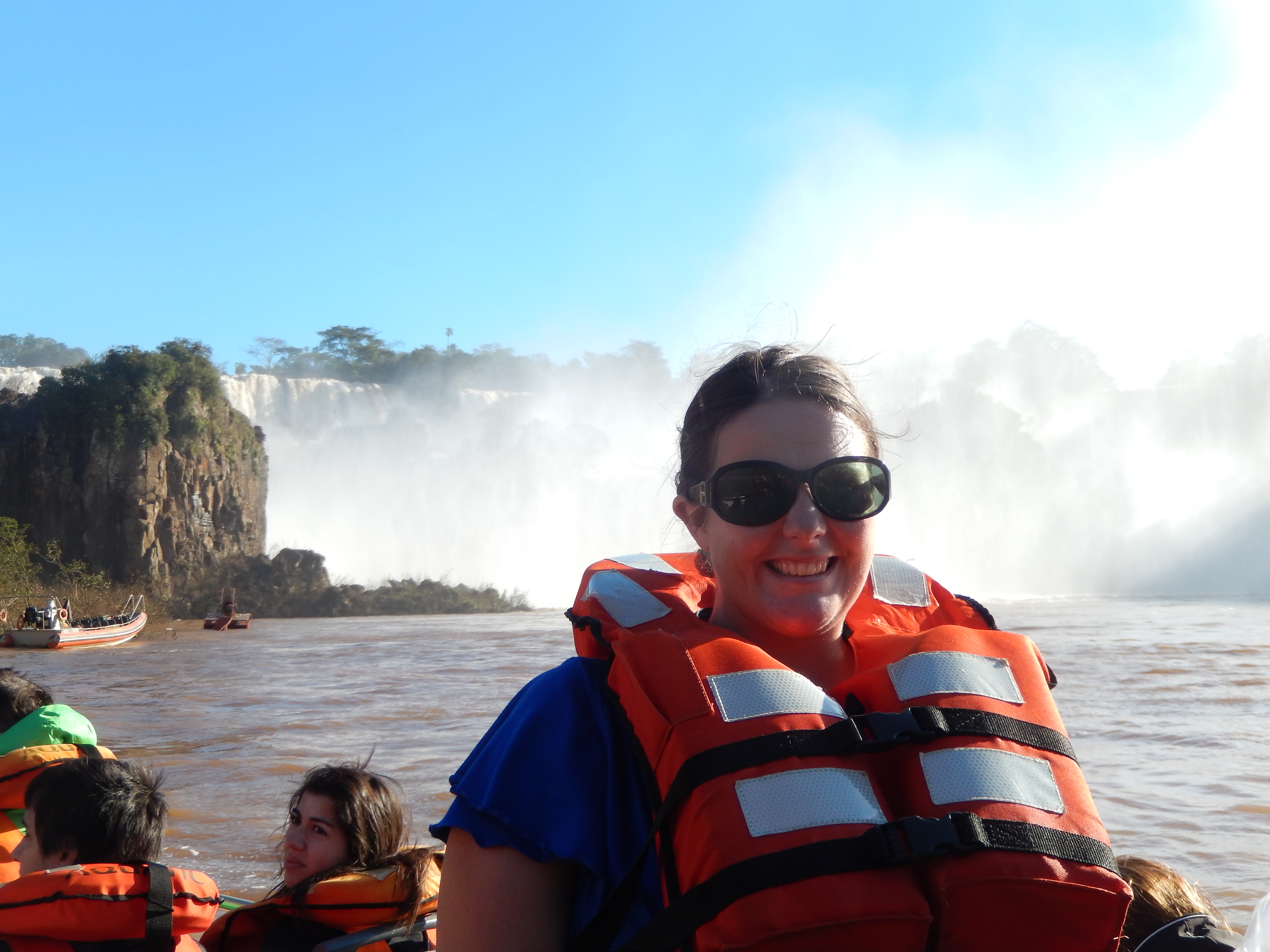
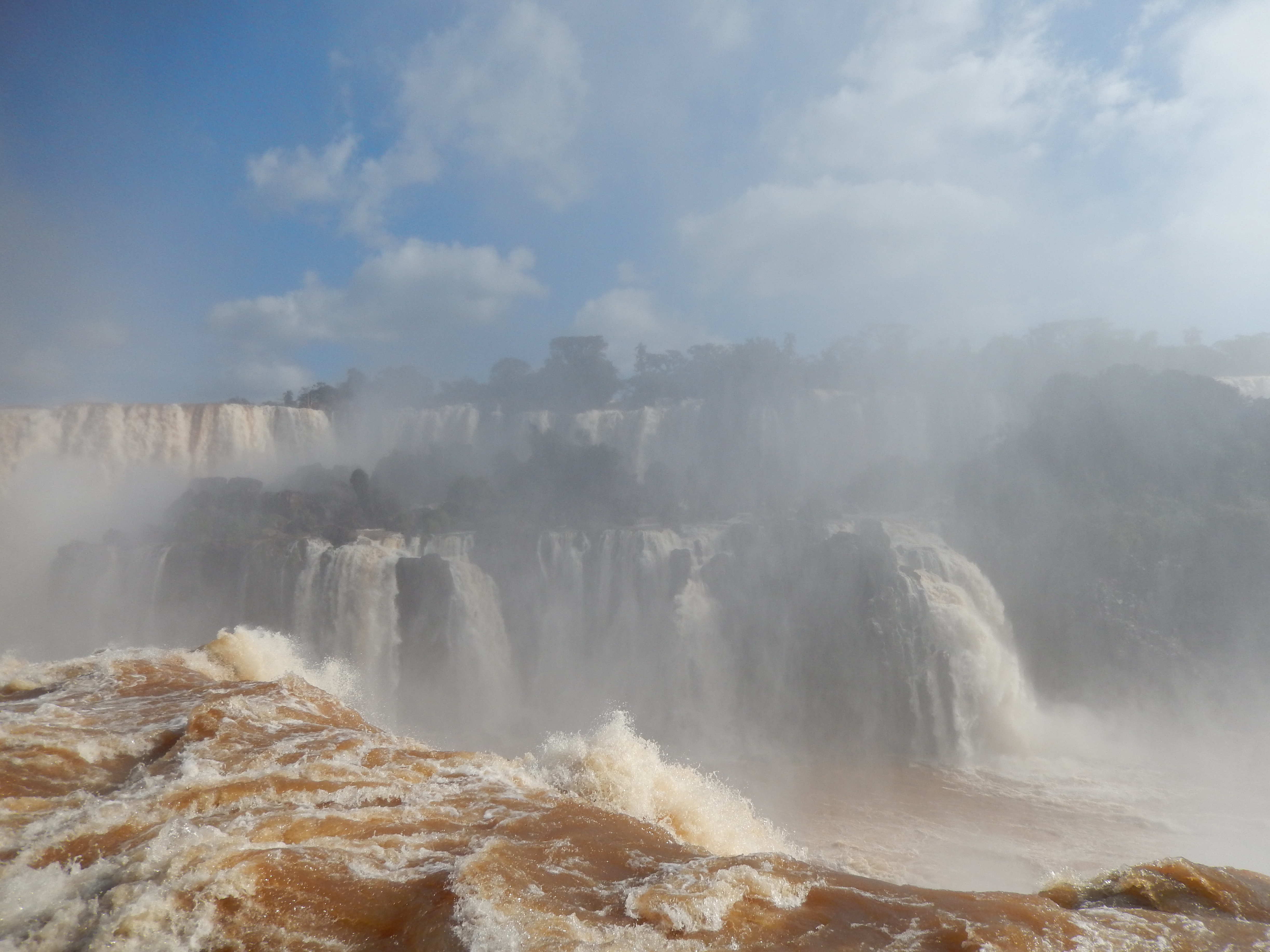
I went on a boat ride to get up close and personal. This is before we went farther in and got completely, 100% soaked.

There was a lot of mist in the late afternoon, when I went, so the falls didn’t translate as well on camera, but they looked really cool from the boat

River-level view
And now a break, in which I show you pictures of raccoon-like animals that you might think are kind of cute but are actually vicious little food thieves and biters. Coatis are wild animals native to the area, and although the ones outside the tourist areas keep to themselves (as wild animals ought), the ones in the tourist areas have figured out that they can get food a lot more easily by begging and outright taking it from tourists. I had food in my bag, and when the bag was hanging by my side while I took a selfie, a coati pounced on it! I won that fight, but yikes.

They creep up on you
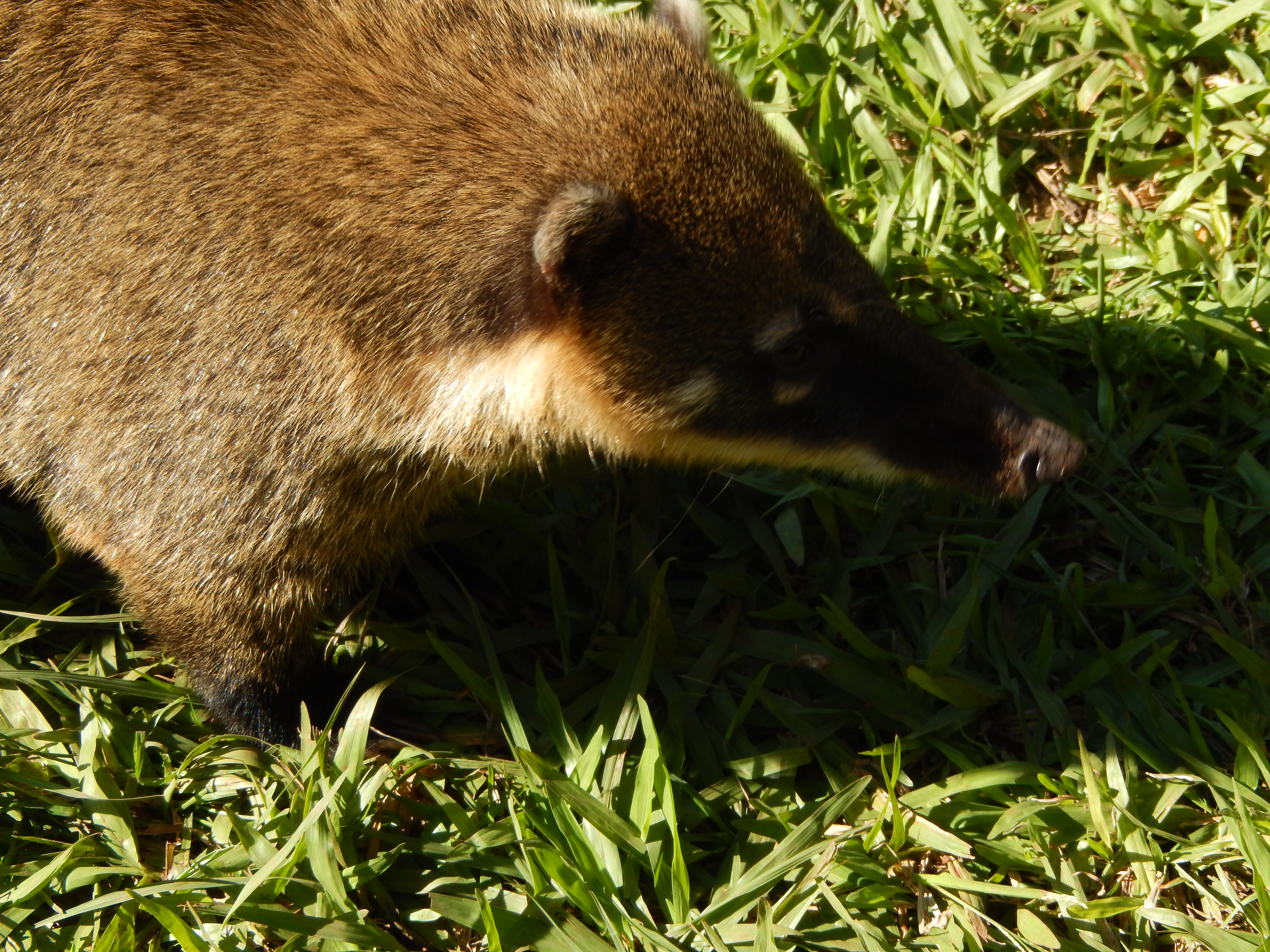
With their little anteater-like faces

And their indignant raccoon-like tails

The Brazil park had this guy running around taking photos with kids, which I think sends a confusing message: Don’t touch or feed them! But also, cuddly friend!
Back to the beautiful, this time on day 2, when I went to the Brazilian side of the falls:
I mean, this is a pretty good introduction to the falls

Good job, Nature

Now you’re just showing off
More grinning

You can walk out in the middle of the falls in the upper level on the Brazilian side

You might get a little damp doing so (people heading out on the ramp looked at me, aghast, as I headed back in–one woman grabbed my arm and said something in concern, and one man laughed out loud at my bedraggled state)
Right in the middle of the action
You can also go up an elevator for a view pretty high up
Which was a cool perspective

The Brazilian side

The Argentinian side
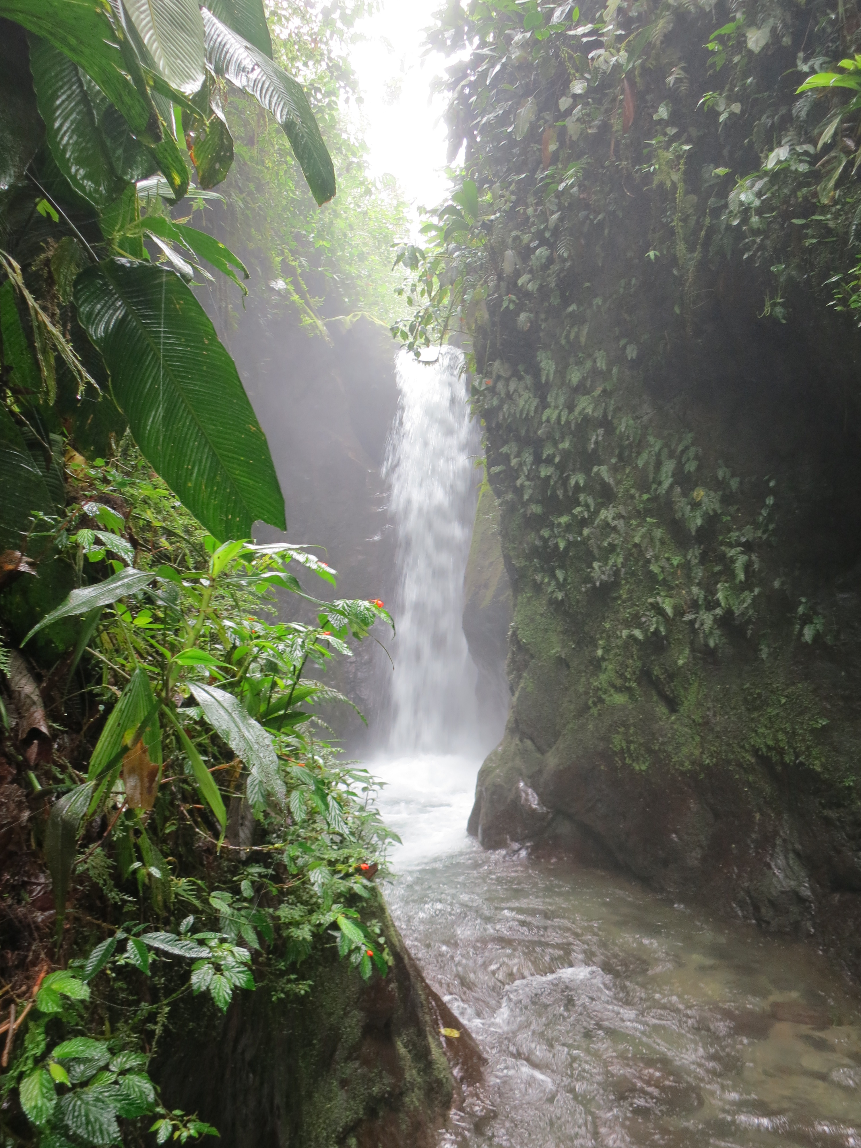
It’s no secret that waterfalls are my favorite natural phenomenon (a phenomenon, yes; although it’s just gravity tugging at a stream, it always seems more than that). I’ve wondered how far I might go to see them, and after my visit to Mindo, Ecuador, I have a partial answer: I’ll walk two hours on a sprained ankle to see a waterfall.
The last waterfall of the hike
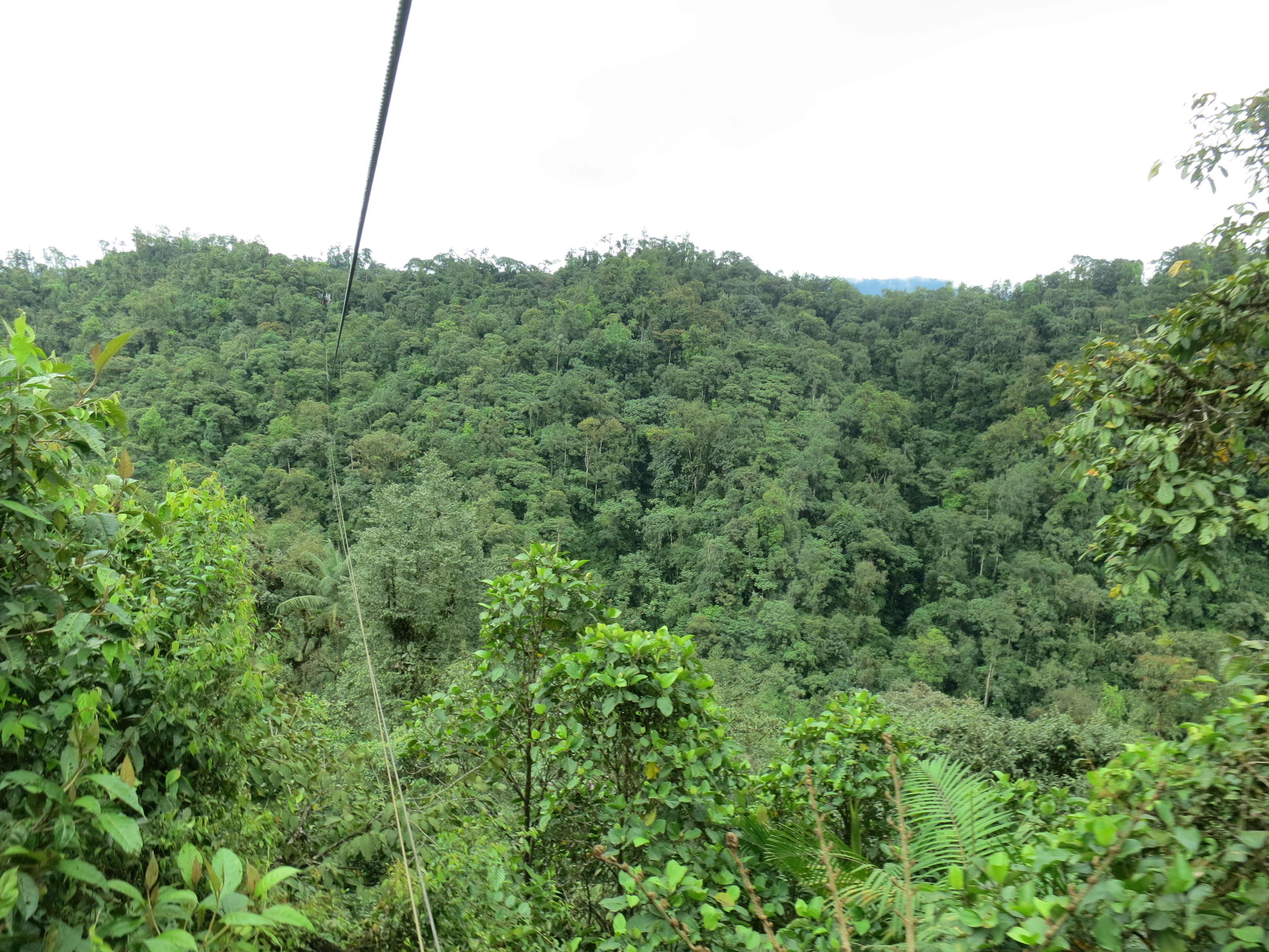
Mindo is a small town about two and a half hours outside of Quito, in a cloud forest–wonderful phrase–in the mountains. The town itself consists of about six streets, but it sees a lot of tourism in high season, because it’s a great spot for birdwatching, and they’ve also turned it into a little adventure sports destination. Of course, the first thing my eye was drawn to in the hostel’s brochure was “cascada”–waterfall.

You can see why it’s called a cloud forest
Getting to the series of waterfalls was a small adventure in itself. A small group of us piled into the cab and flatbed of a local man’s pickup truck, and he drove us out of town, up the very bumpy unpaved road, for $2 per person. Then four of us climbed into a tiny, open-topped wire cage suspended from a cable, and we whizzed across the treetops. It was exhilarating, just one minute long, but it felt like flying.

The tiny cable car
We were quite high up
On the other side, we descended and the cable car worker gave us a small, mostly useless map of the park, so we could decide which waterfalls to visit in which order. The trail, made of packed dirt and smooth stones, was a bit treacherous, as the daily afternoon rains had made the stones slick and the dirt sloppy mud. Within fifteen minutes, I’d slipped and fallen on my butt. When I stood up, I felt the all-too-familiar twinge of a twisted ankle, but I hobbled down to the waterfall anyway. It was okay, but small and a little far away, so I decided to ignore the throbbing in my ankle and go on to the next few. These were much lovelier, and worth the painful walk.
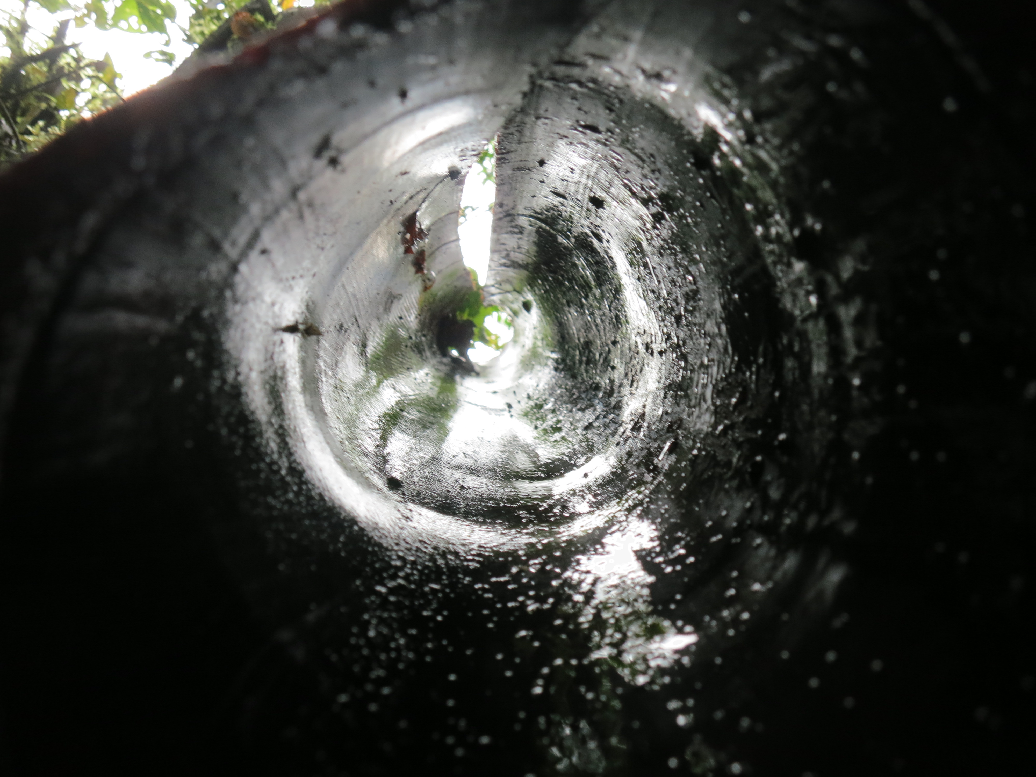
Looking through a hollow tree branch
A couple let you get very up close and personal: at one, I had to wade through shallow waters downstream from the waterfall, to continue on the trail on the other side. At another, I kicked off my shoes and scrambled up a rock to better admire the waterfall, while other visitors battled the strong current to get right up to the crashing water itself. A whole gaggle of teenagers on a field trip splashed their way to the base of the waterfall and took selfies, including one couple that demanded their friend photograph them making out in the spray. Ah, youth.

I didn’t go on any early-morning birdwatching tours in Mindo, but I did want to see at least some. I split a cab ride up to a private home about ten kilometers out of town, called Mindo Lindo (“beautiful Mindo”). The owner, Pedro, told us to take a walk around the grounds, which consisted of dense trees and bushes.

Hand-planted jungle
When we returned, he informed us that he and his wife had moved here twenty years ago, when it was all grass, and they’d planed the forest by hand, even ferrying in water in buckets, as the river hadn’t been diverted yet. After five years, there were enough trees and insects for hummingbirds to be attracted to the area, and now there are 28 types of hummingbirds on the five acres they own.

There were so many, flitting here, alighting there
We saw eight different types of hummingbirds in the feeder-laden trees next to the porch. Pedro let us take turns holding one of the feeders, and the birds flew right up to us, some perching on the feeder, but most fluttering right next to it as they dipped their thin beaks in the sugar water. They were different colors, but all had an iridescent shine to them. They made a thrumming sound, which wasn’t their tiny heartbeats but their rapid wingbeats.
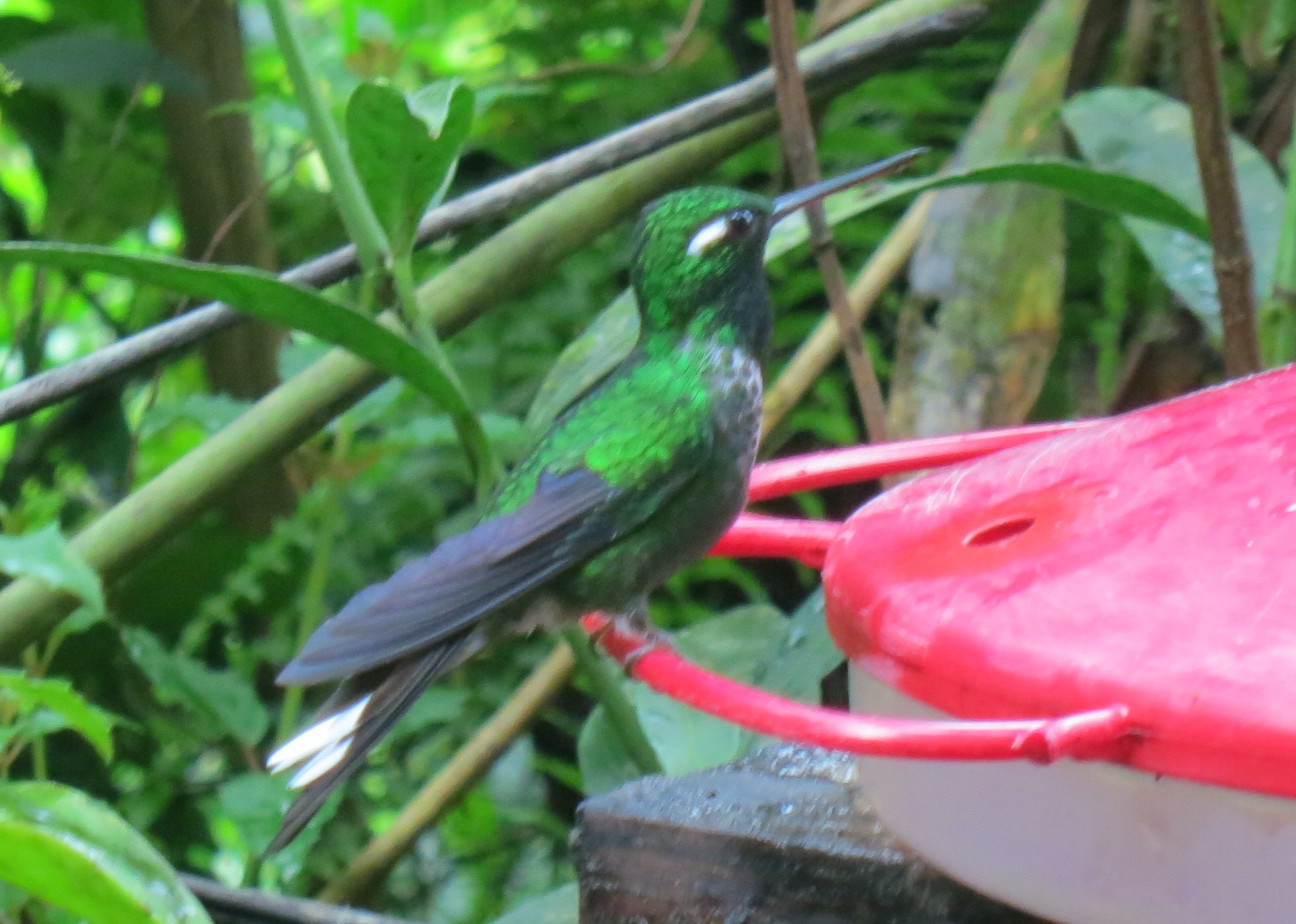

Pedro explained that different hummingbirds fed from different flowers, based on the curve of the hummingbird’s beak and the curve of the flower’s stamen. He opened up a book of birds and pointed out the ones we were looking at, and then he fed us granadillas and lemongrass tea as the afternoon sun glinted off the blur of wings in front of us.


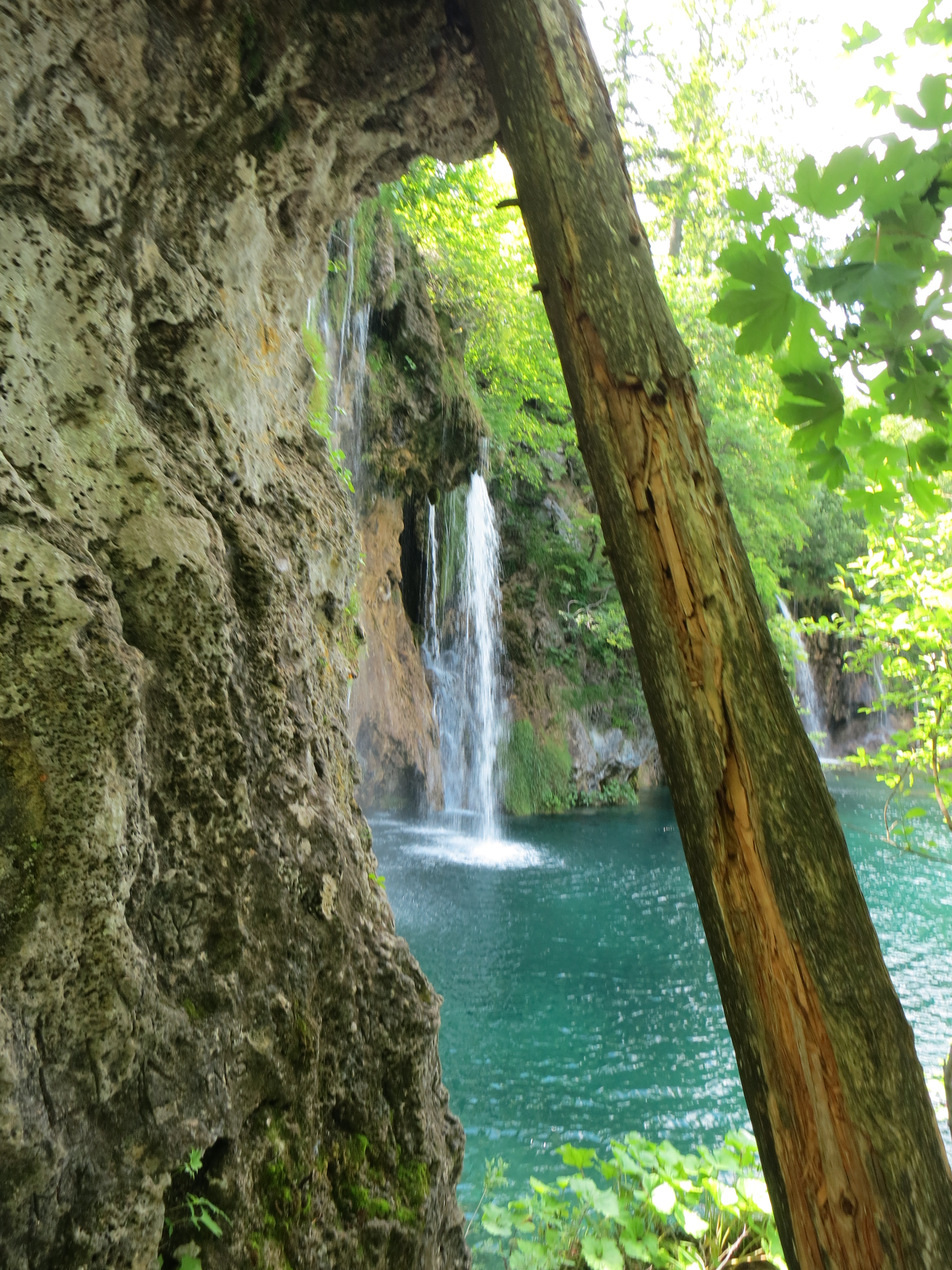
Krka National Park, Croatia; June 11, 2013
