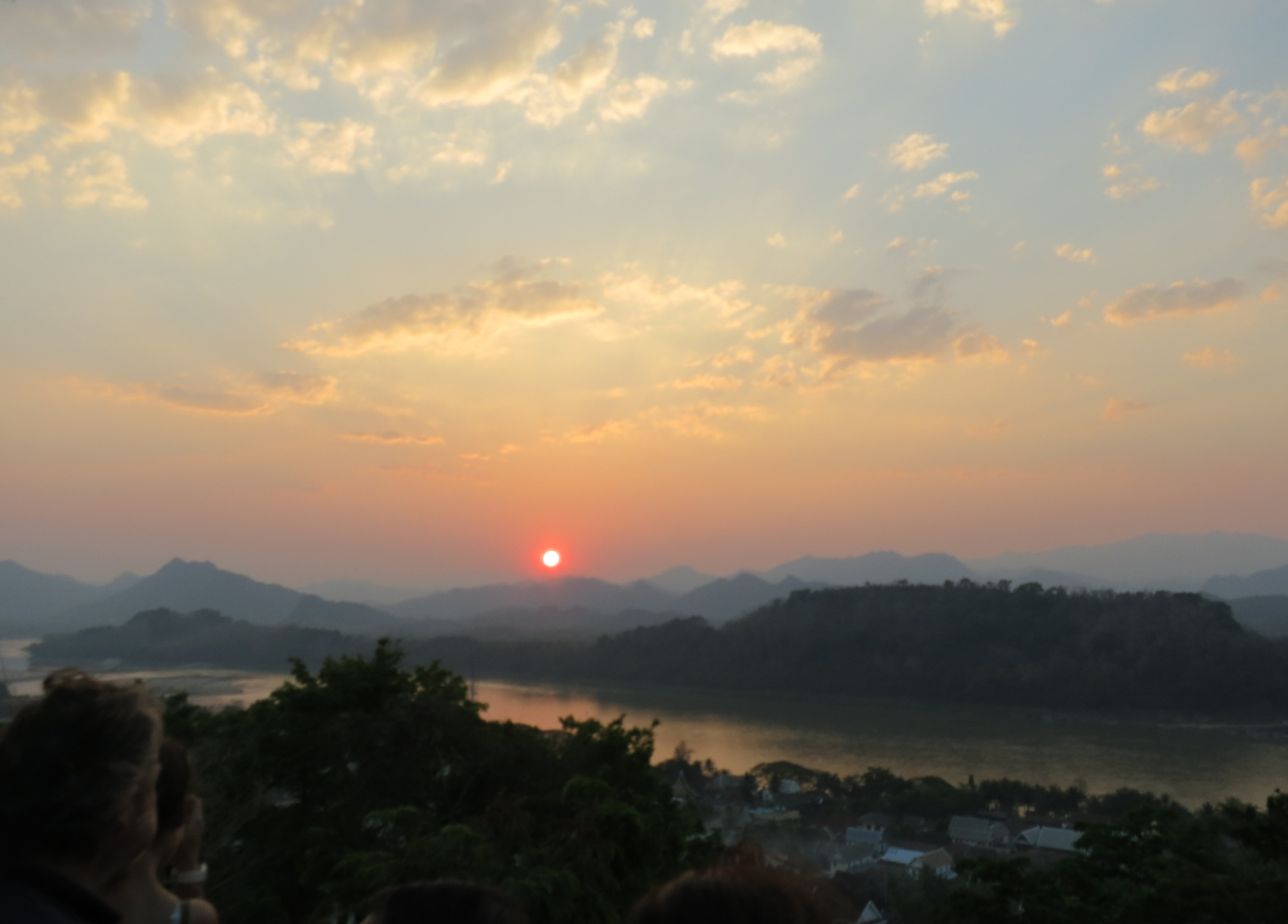
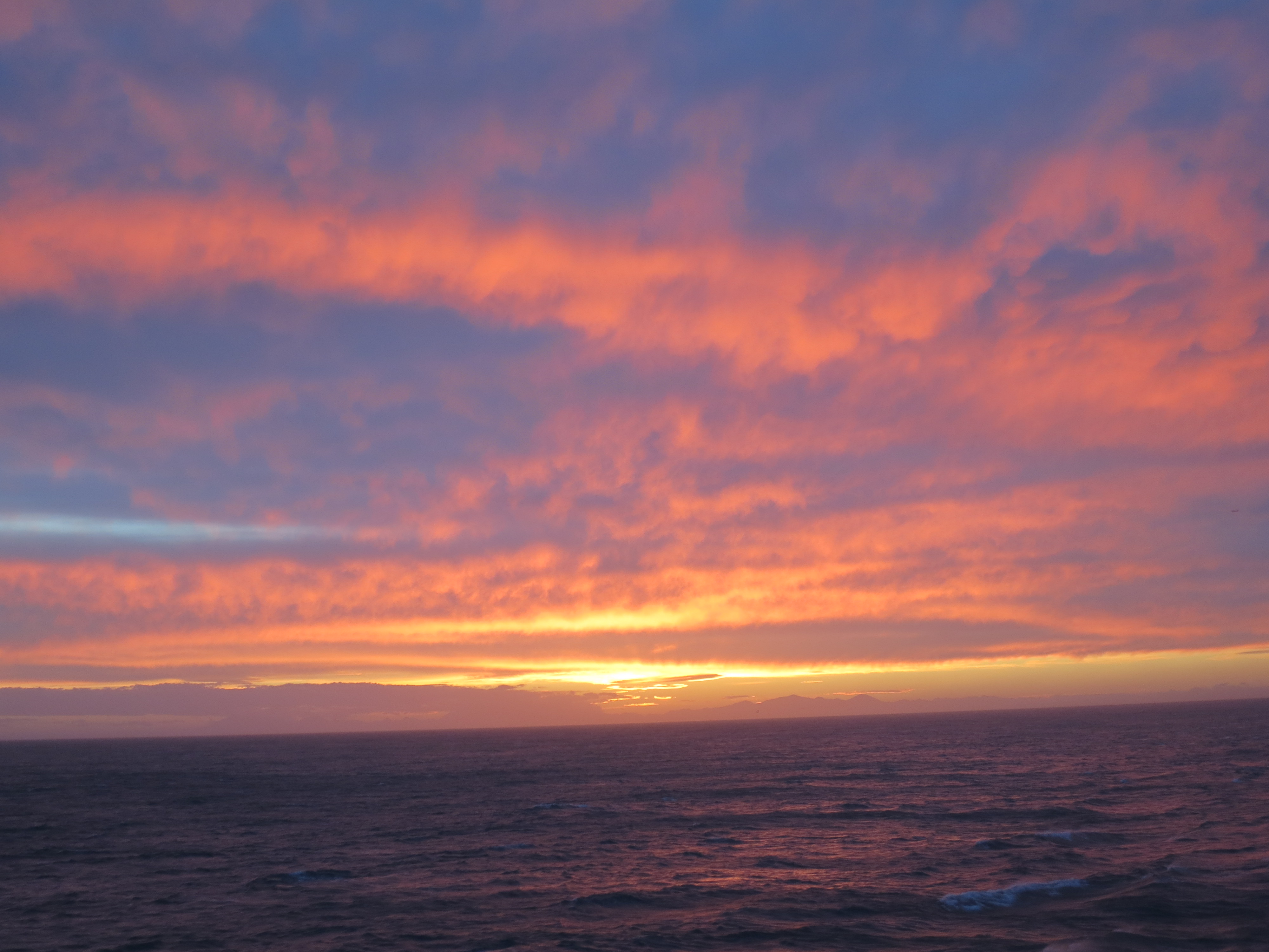
Sunset, Luang Prabang, Laos
Sunset, Luang Prabang, Laos
Because the pizza joints of Siem Reap are really happy:
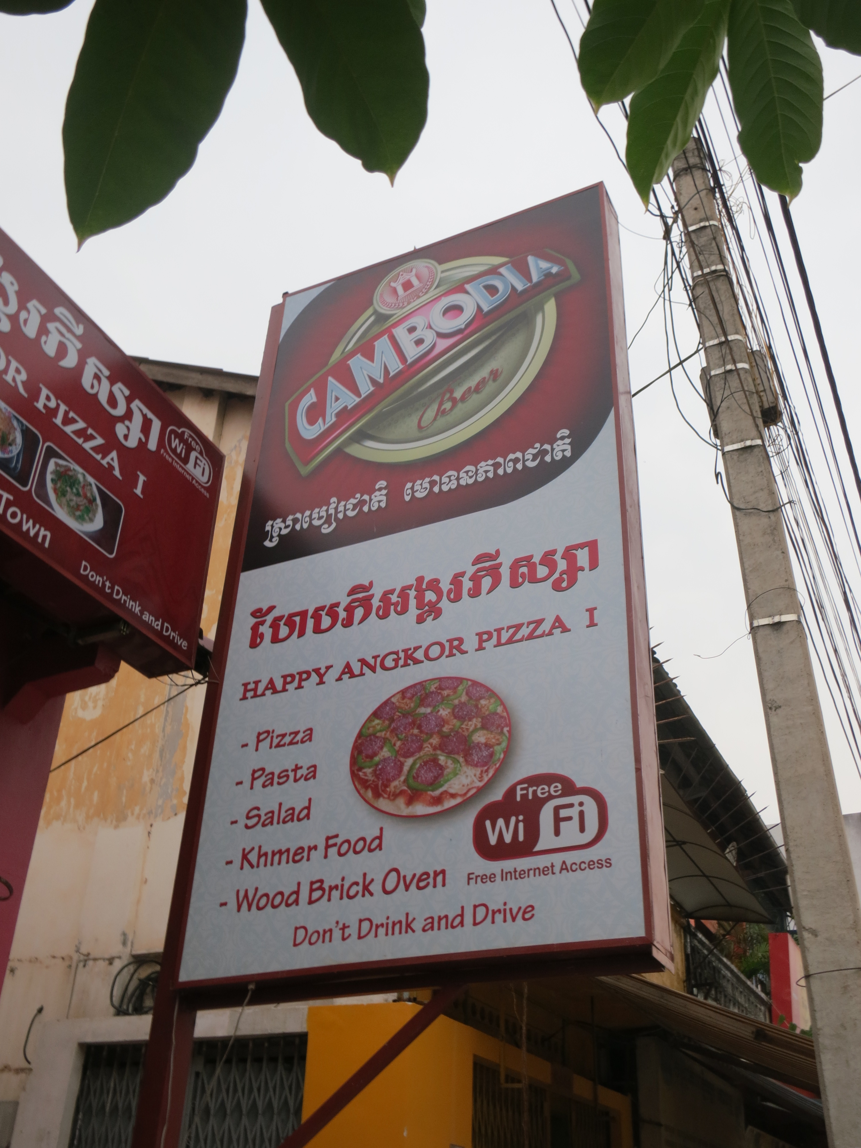
Your basic happy pizza
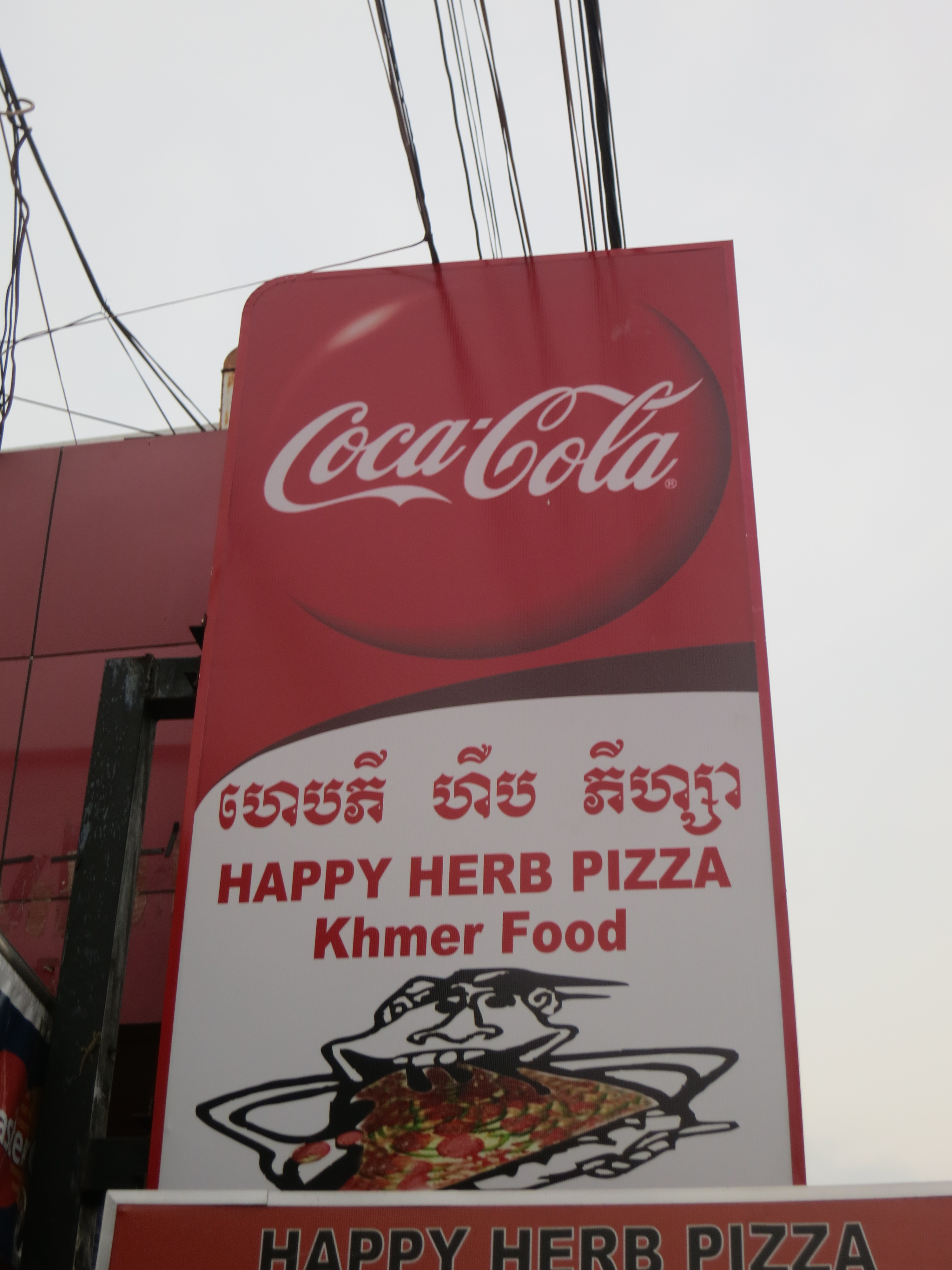
Happy and herbal

Happy and special
And this place takes it to the next level:

They even used a smiley face. Dig it.

Sunset, Mekong River near Luang Prabang, Laos
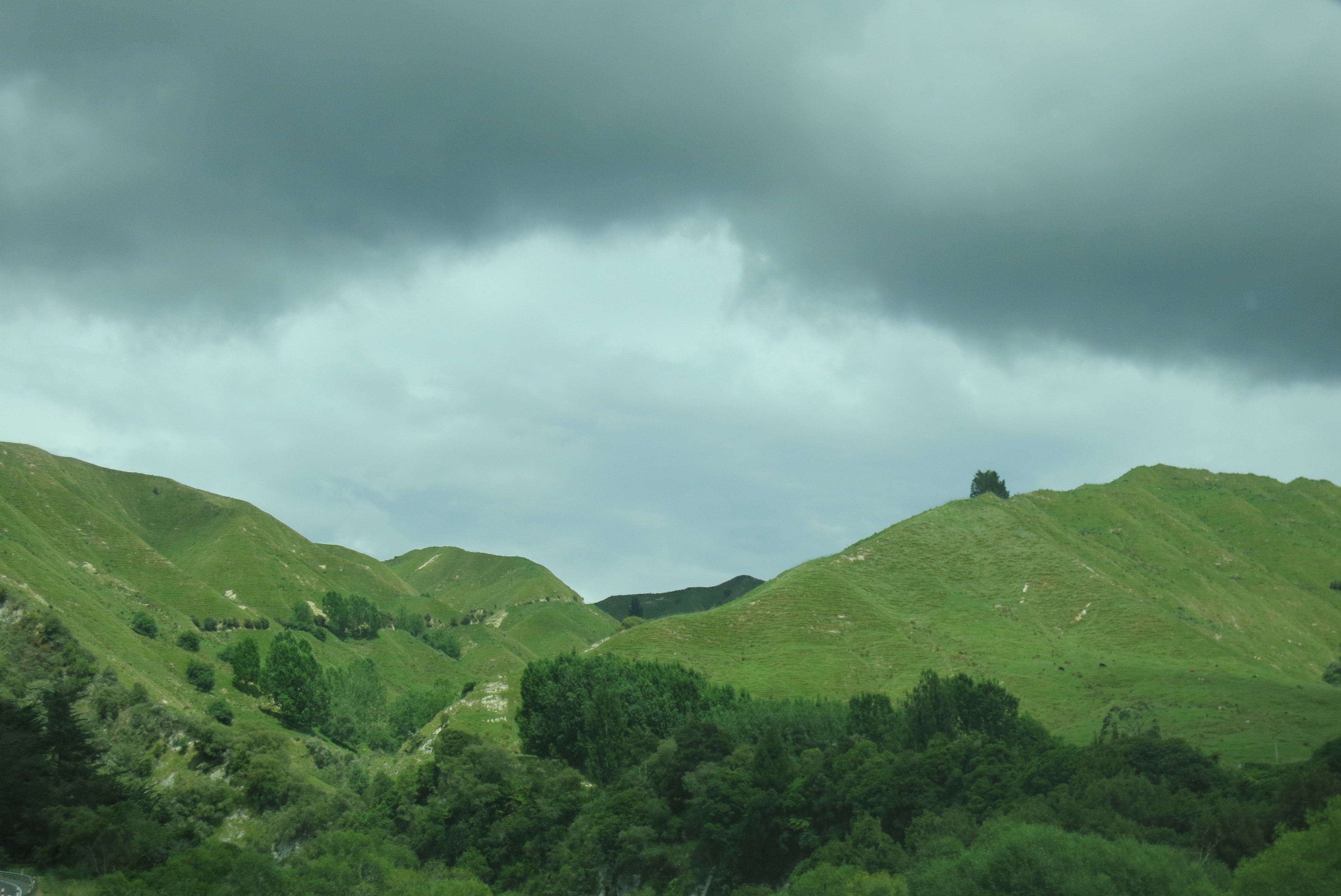
The west coast of New Zealand’s South Island is often called the “wet coast,” and it certainly rained enough while I was there to convince me that this is no casual nickname. The west coast is a narrow piece of land with the Pacific on one side and the mountains on the other, with one highway running the length of the island and just a few mountain passes crossing over to the calmer fields of the east coast. That’s a pretty isolated position when you think about it, as a lot of travelers discovered when the rains around New Year’s took out a section of bridge near Harihari, and they all had to scramble to go north or south in very roundabout ways.
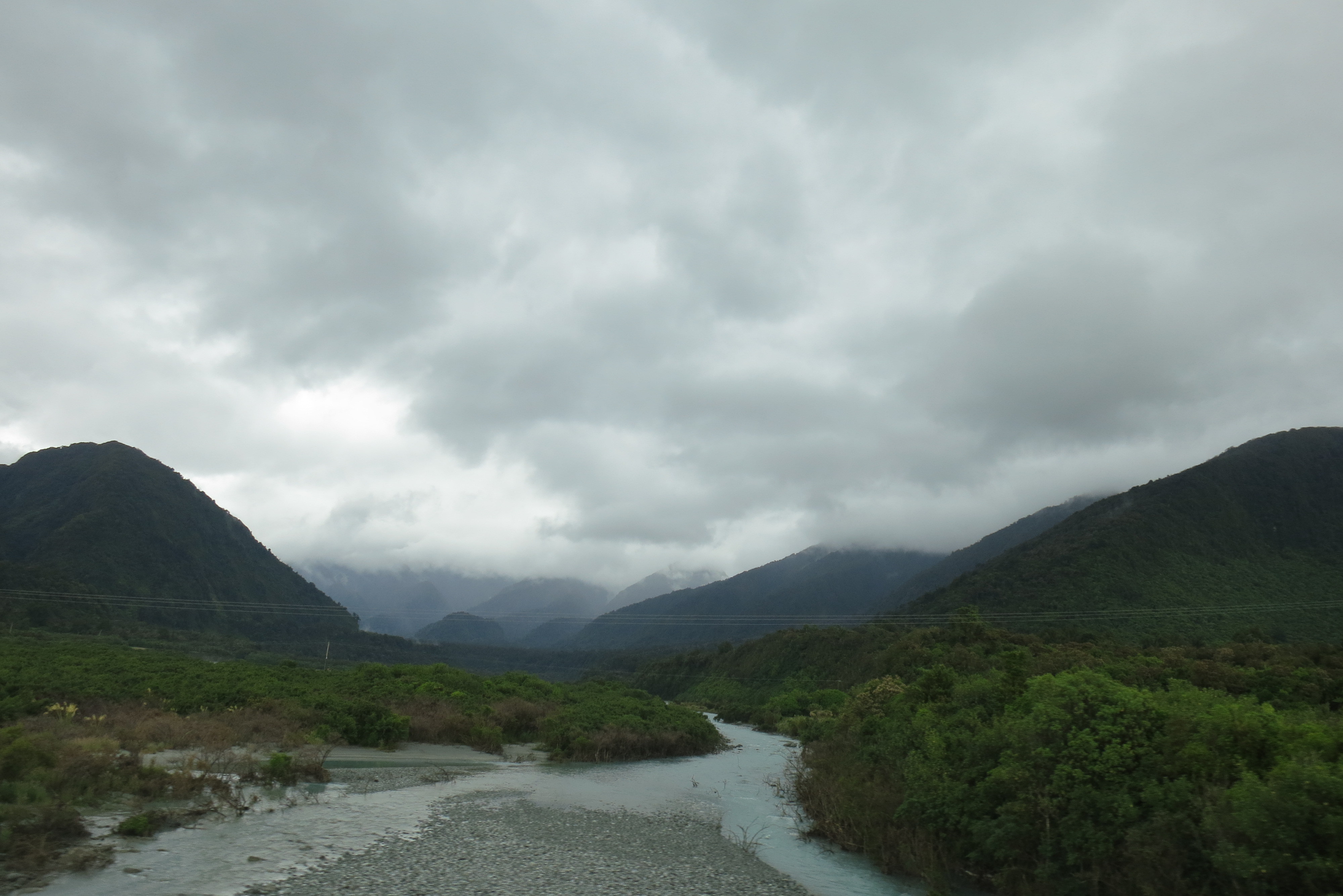
The storm clouds gather on the west coast
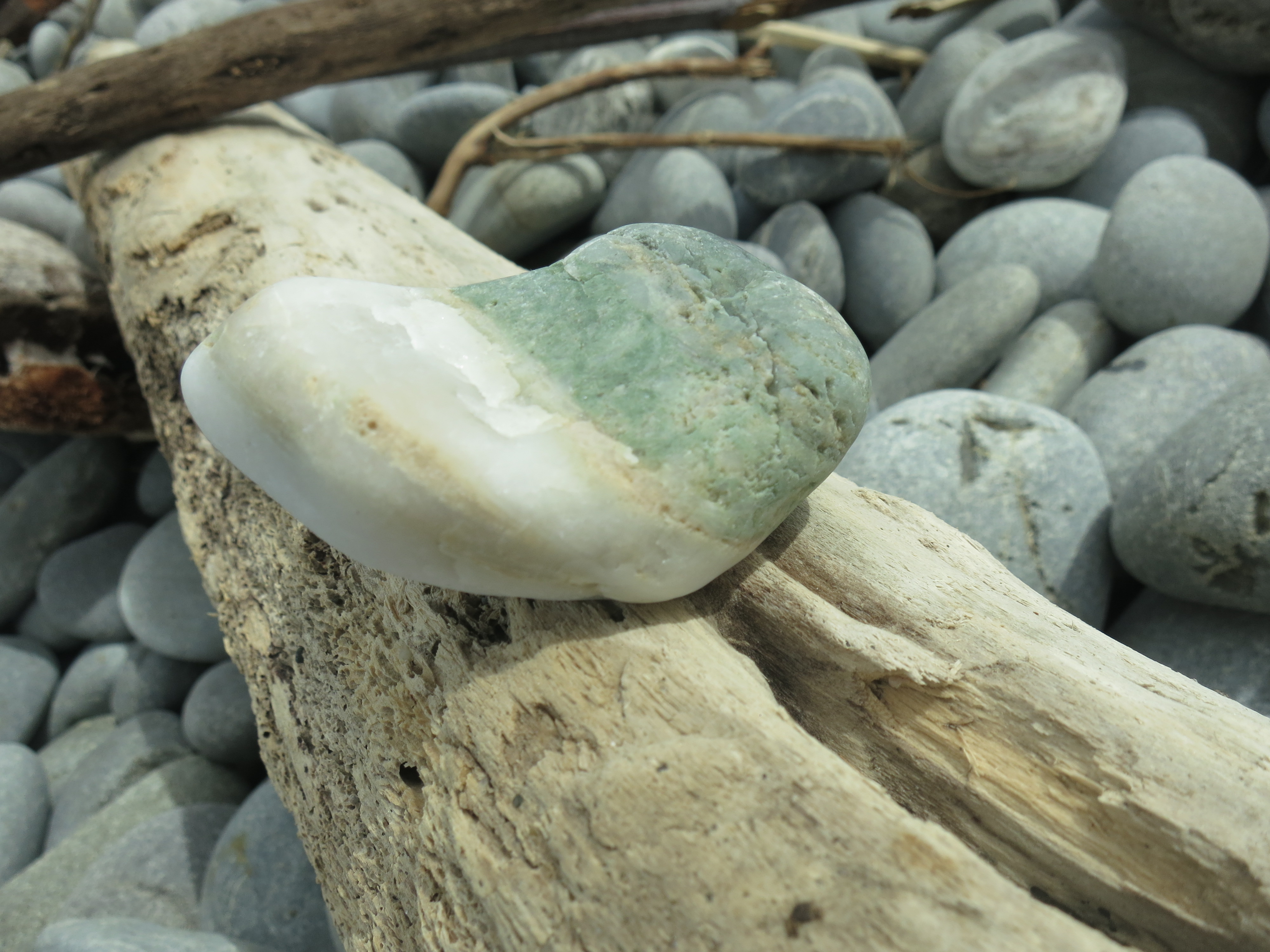
Happily, Liz and I made our way west and south before the heavy rains started, so we were able to see a little of the area. We drove through the mountains for most of the day, then stayed at a brightly decorated hostel in Greymouth. The next morning, we followed the hostel receptionist’s directions to the beach. Well, “beach.” It was a gray strip of land covered in small gray rocks, with a green-gray sea lapping up against it, under a blue-gray sky. You can’t accuse the city of false advertising.

A peaceful morning
But it was actually a peaceful spot to spend an hour. We hunted for jade among the rocks, and found that the more we looked, the more green we found among the gray there. (We never found actual jade, but that is a common stone here, the “greenstone” as the Maori call it, and it’s found in a lot of necklaces and artwork.) Also, every time a wave washed ashore, it made a wonderful rattling, wooshing sound as it retreated back to the sea. It was like turning a rainstick over, to the rhythms of the tides.

 We drove to Hokitika, a charming town with a few tourist spots and a helpful iSite worker who booked our Fox Glacier tickets for the next day. We took a picnic lunch out to Hokitika Gorge, and saw again the startling turquoise blue of Huka Falls (although there was no rushing water this time, so I’m not sure how that squares with the supposed reason for the color being lots of bubbles).

The sky doesn’t even try to match the river’s blue
The walk from the carpark only takes ten minutes, through lush green forest, down to a swingbridge that everyone clung uneasily to as they made their way out to the center. We admired the views and then scrambled back to the car before the storm clouds overhead broke loose.
One-lane bridges: sometimes you can’t even see the other end to make sure no one’s coming your way
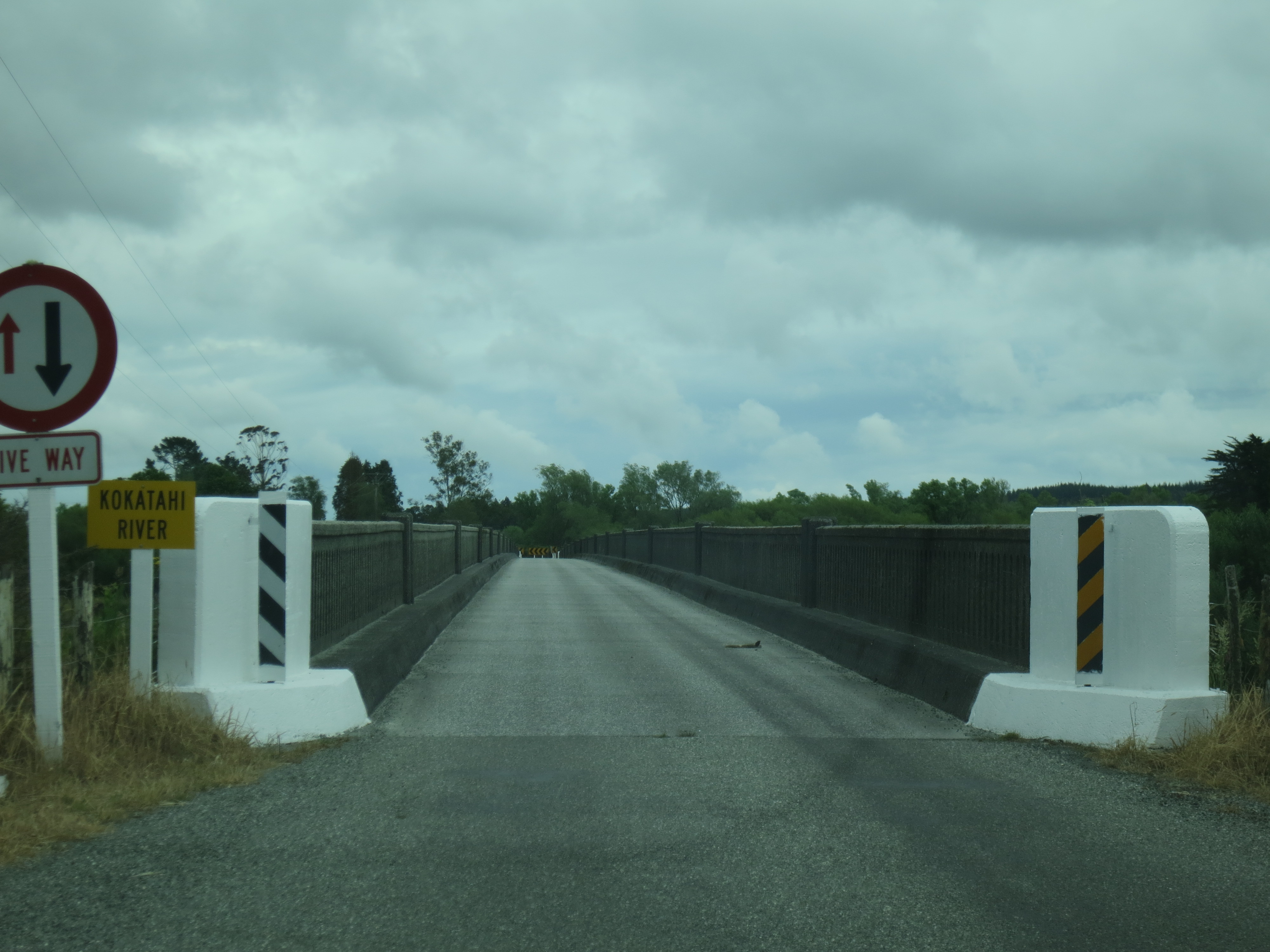
That makes it sound simple, but actually we had to get past a formidable obstacle both on the way in and the way out of the gorge. Guard cows! On our way in, we were held up just before we crossed over our millionth one-lane bridge. (Why does New Zealand have two-lane roads but only one-lane bridges? No one has explained this mystery to me.)

None shall pass
Suddenly, a cow appeared to our right. She had got out of the field somehow, and was walking along, unconcerned, until she noticed our car. Then she became alarmed and walked right in front of the car. Liz gave the car horn a beep, and the cow started trotting, and then we noticed cows in the field to our left started trotting as well, apparently giving the rogue cow encouragement. She eventually moved over to the left enough that we could get by. A cow guarding the entrance to the gorge–what’s the usual entrance fee in that case?

Cow crossing–what can ya do?
On our way back to Highway 6, zipping down the relatively flat lanes of the Westland countryside, we had to stop for a good ten minutes. It was milking time, and the dairy farmers had opened up the gates on both sides of the road, and a stream of cows moved from the field over to the barn. One the farmers stood in work boots and watched, and the other sat in her ATV and kept a lookout for the few cows that strayed down the road. Rush hour on country roads is a lot like rush hour in the city in that way; nothing for it but to sit it out.
Twenty kilometers later, the rain started in earnest, and it wouldn’t let up for days, in what the owner of the hostel I stayed in called one of the worst downpours he’d seen in years. Not that this stopped Liz and me from climbing a glacier in the middle of it. Stay tuned for that story next time!
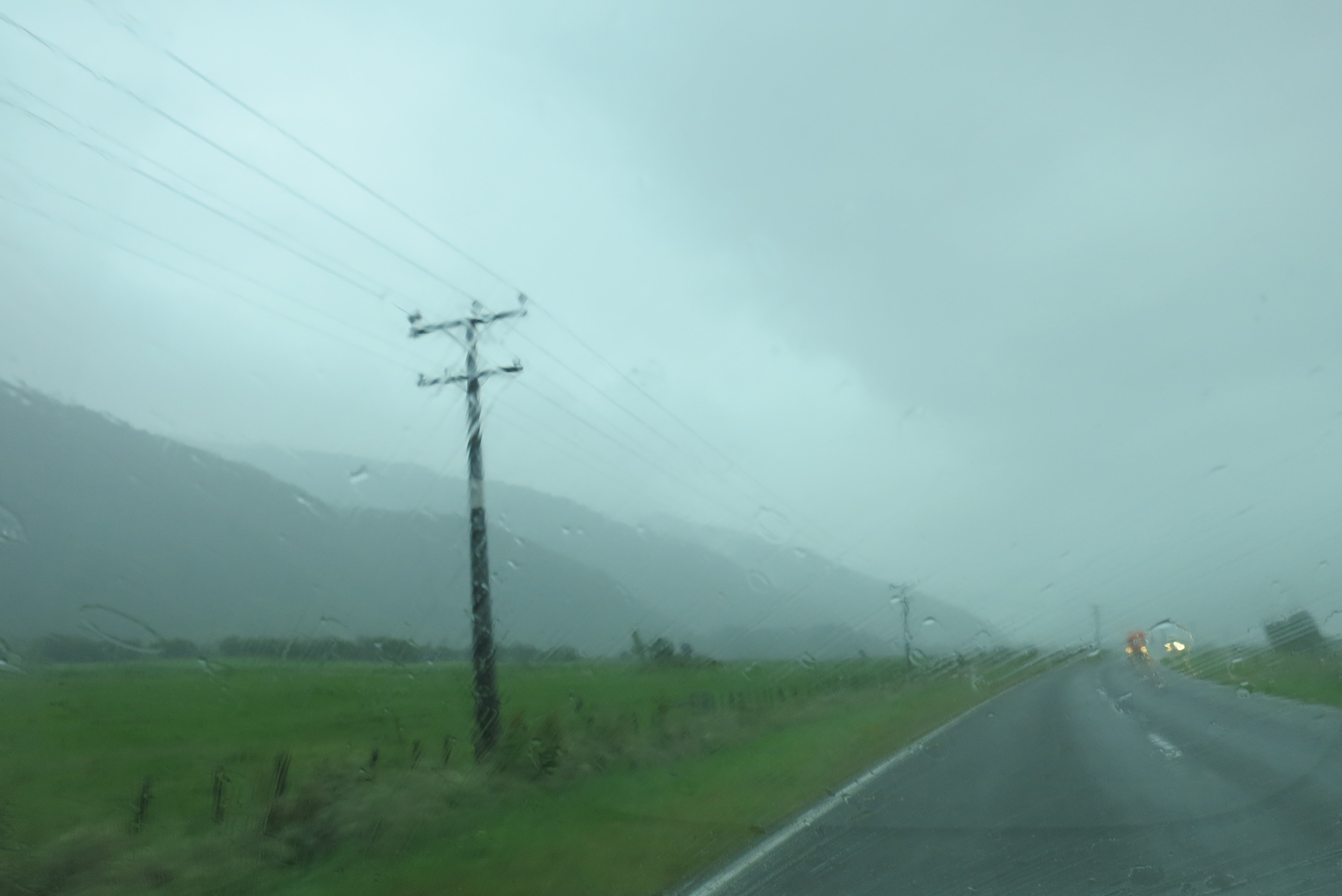
The storm clouds let loose
Sumphet Market, Chiang Mai, Thailand; February 16, 2013
According to Maori legend, the hero Maui went fishing one day and pulled up the North Island, and his canoe became the South Island. Ever since 1962, the Interislander Ferry has acted as the fishing line between canoe and fish, carrying passengers and their cars from Wellington to Picton and back again. After Christmas, I took the ferry over to Picton to meet back up with Liz for a few days (Picton is mostly west and only a little south of Wellington, because of the way the South Island skews to the left).
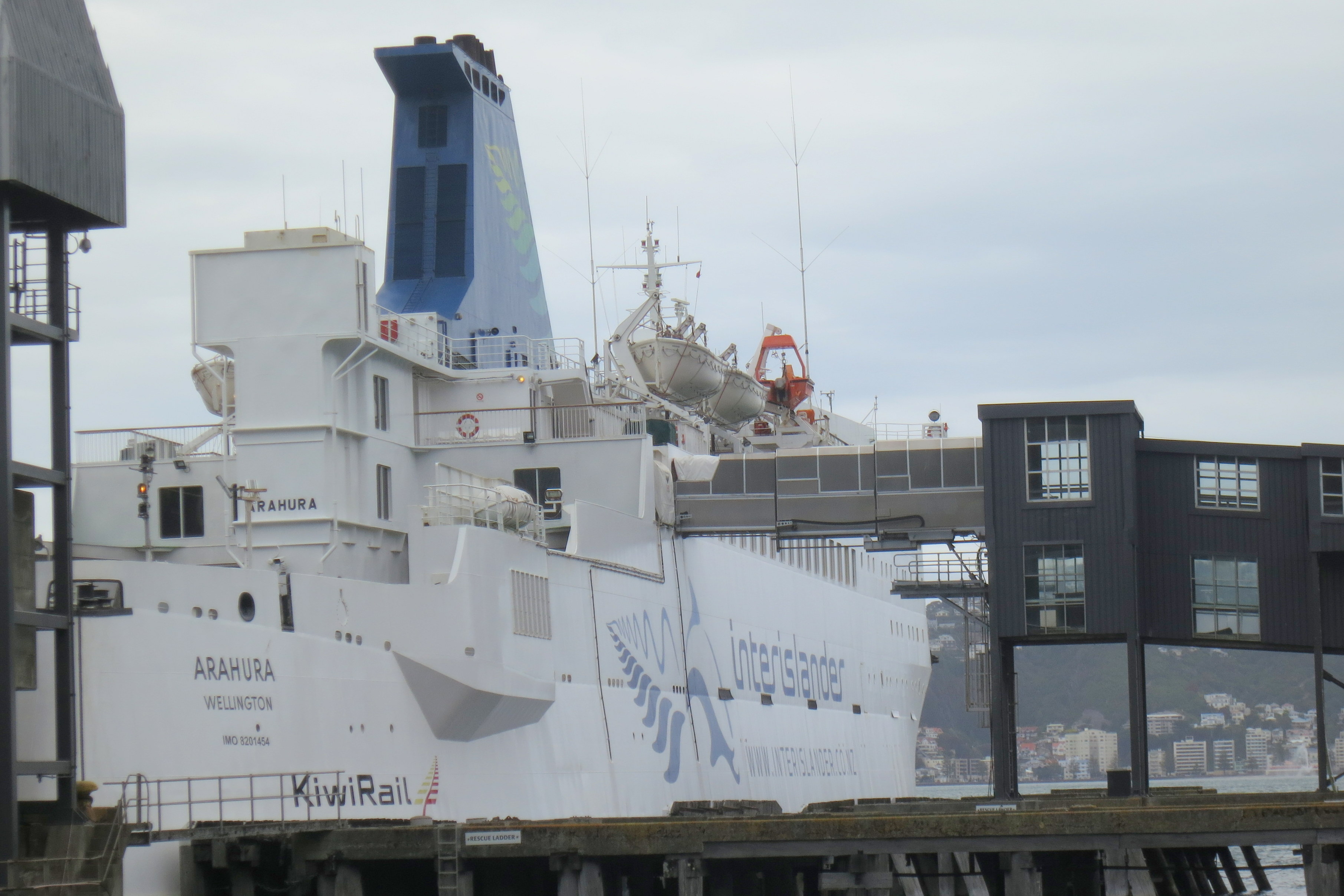
An imposing Interislander Ferry
If you’re taking your car across, you check in quite early and get it loaded on board. If you’re just taking yourself, you can show up 45 minutes ahead of time and check your bag like you do at the airport. There are no assigned seats, and there don’t seem to be seats for everyone (at least on one of the boats I took; different models make up the fleet). I set myself up in one of the airplane-type seats, plugged in my computer, and got some writing done.
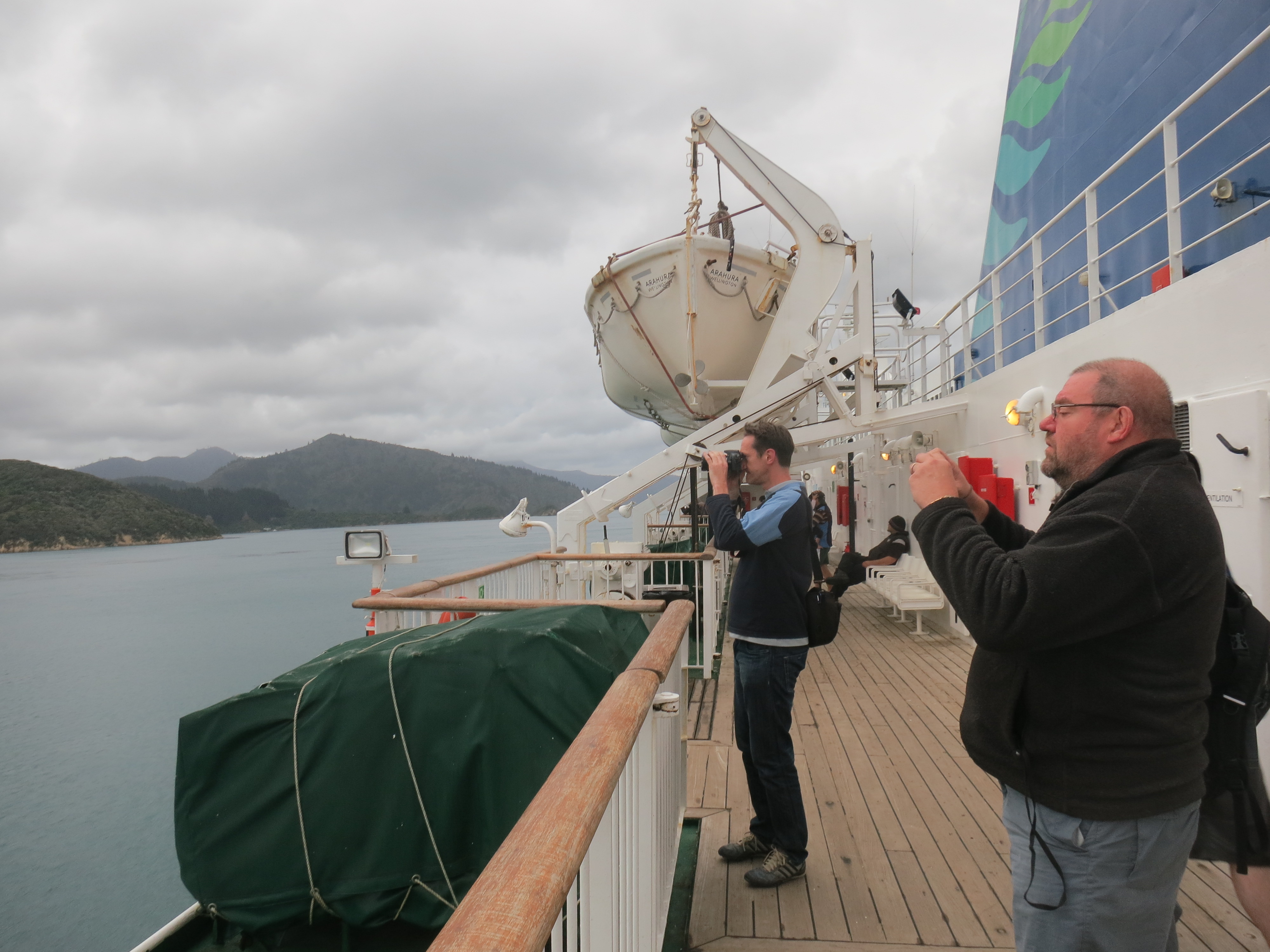 After a bit, I went out on the deck to watch the sunset as we sliced through the open ocean waters, and later I went back out to watch the craggy hills of the South Island rise up on either side of us. The outer decks are very basic; just a few benches line the inner ring, and smokers huddle against the cold by the railings.

Emergency instructions by labelmaker
Inside, there’s more comfort, with a bar, a pricy snack shop, a movie theater, and a children’s play area. On my second ferry trip, I found myself near a TV that played a five-minute ad about the history of the Interislander on a continuous loop for the entire journey. That was too much, but I did like the vintage posters for the ferry lining the halls as you disembark.
 Once you get to Picton, it’s an easy walk down the main road to hostels, a bus pick-up, the rail station, etc. It looked harder to find your way to the city in Wellington, but happily for me, my Couchsurfing host picked me up when I arrived, so I didn’t have to figure it out.
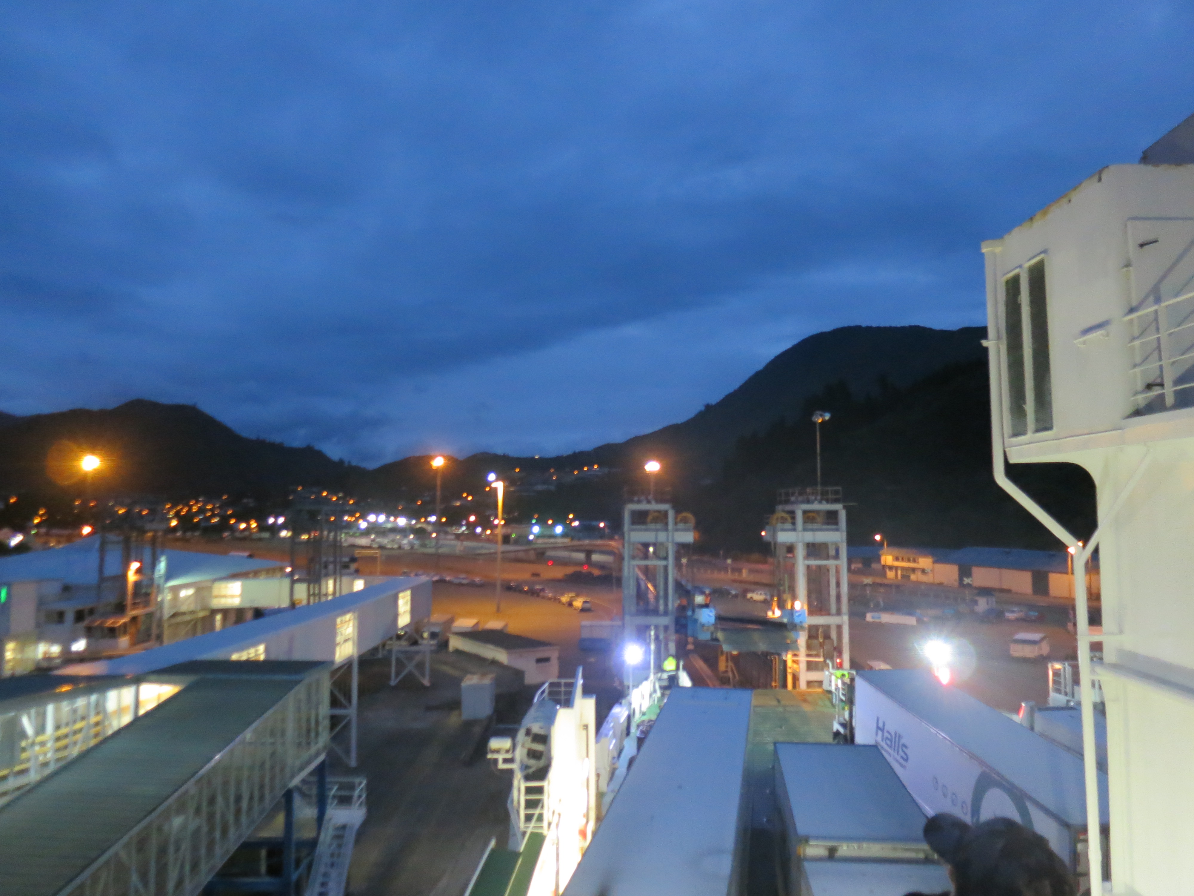
Picton
Taking the Interislander ferry isn’t quite the sunny holiday frolic depicted in the ads, but it is a serene three hours out there on the water.
After Liz and I left the central part of the North Island, we stopped off at National Park (yes, that’s the actual name of the town) so that Liz could hike the Tongariro Crossing and I could bundle up against the cold and damp of the mountains while reading a good book.
I have a lot of photos of the hills and mountains of New Zealand. They are just too dramatically beautiful not to gaze at longingly mile after mile.
A couple days later, we drove south, and once the mountains were in our rearview mirror, the weather improved immediately. We got more than one radio station, we saw other cars on the road, and we started passing through towns. We must be getting closer to Wellington.
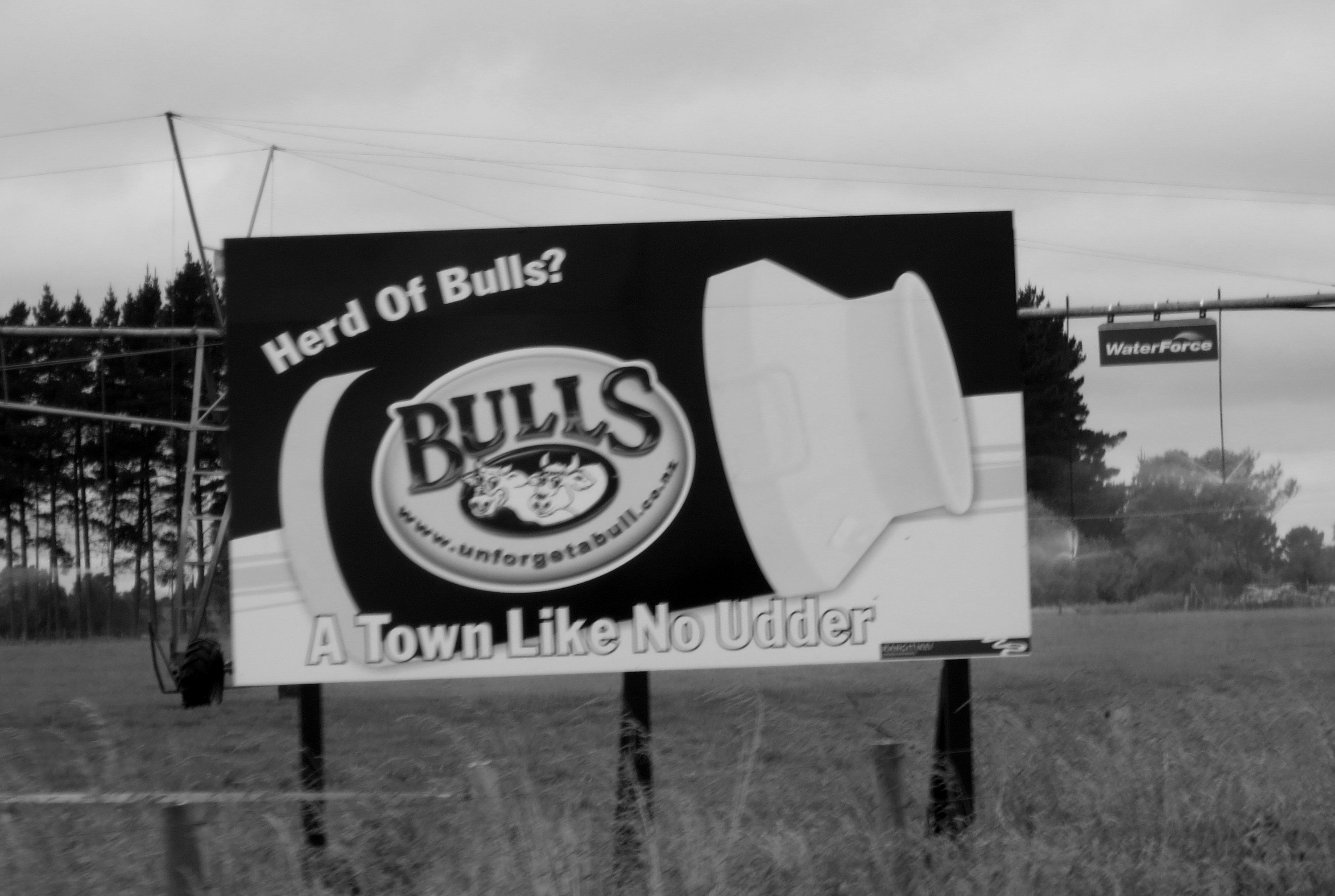
The town of Bulls delivered pun after pun as we drove through it. I also liked the “Afford-a-Bulls” $2 shop.
About 40 minutes outside of the capital city, we pulled off the highway to a town called Waikanae Beach. Liz dropped me off at my friends’ home and she carried on to Wellington for a few days. We’d meet up later in the week on the South Island. In the meantime, I’d see how the Kiwis celebrate Christmas. Spoiler: in the sun. They celebrate the (northern hemisphere’s) midwinter solstice in the sun.
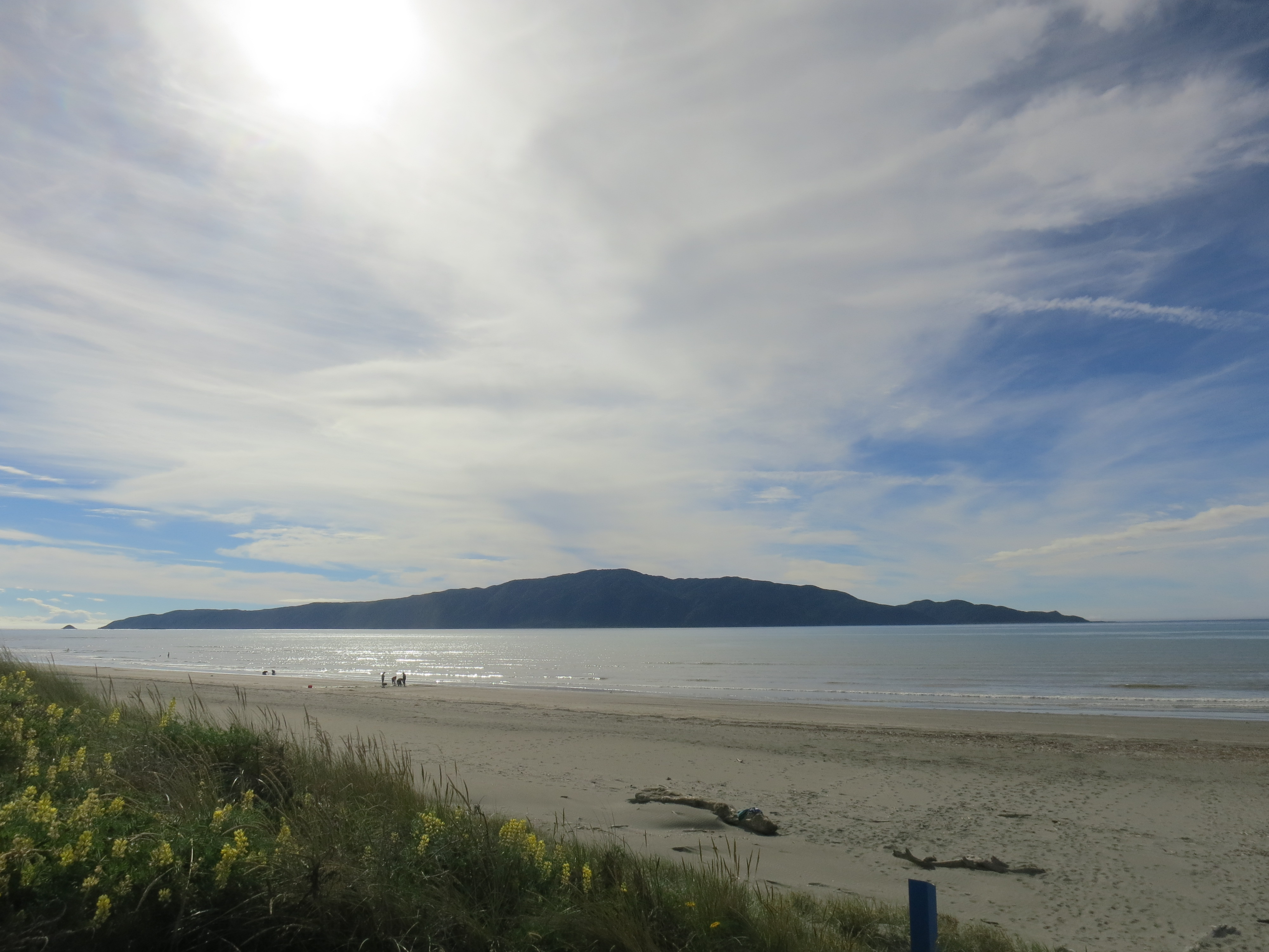
Kapiti Island off the coast
We went to the most laid-back church service I’ve ever been to (the pastor was in shorts and sandals) and sang a few carols. The words were projected on a screen at the front of the sanctuary and a guitarist led us in song. At the end of the service, ushers handed out Christingles, which are apparently common in the Church of England, though I’d not heard of them before. It’s an orange (the world), wrapped in a red ribbon (Christ’s blood), stuck with four toothpicks holding fruit and candy (the four seasons and the fruits of the earth or the sweetness of Christ’s love), and containing a candle in the center (Jesus, the light of the world). It was fun to watch the kids of the congregation mumble “Silent Night” with the rest of us while sneaking the candies off their Christingles with varying levels of surreptitiousness.

Turns out the orange wasn’t that tasty
I had a lot of fun with the 9-year-old of the house, a smart, sweet kid who explained to me all about the various things he’s collecting and which Horrible Histories episodes he likes best. We played in the ocean together, and on Christmas day we put together some of his Legos and smashed down an Angry Birds Star Wars imperial ship. We tried to out-weird each other in our Mad Libs choices, and we both dozed off after a big Christmas dinner. Such fun!
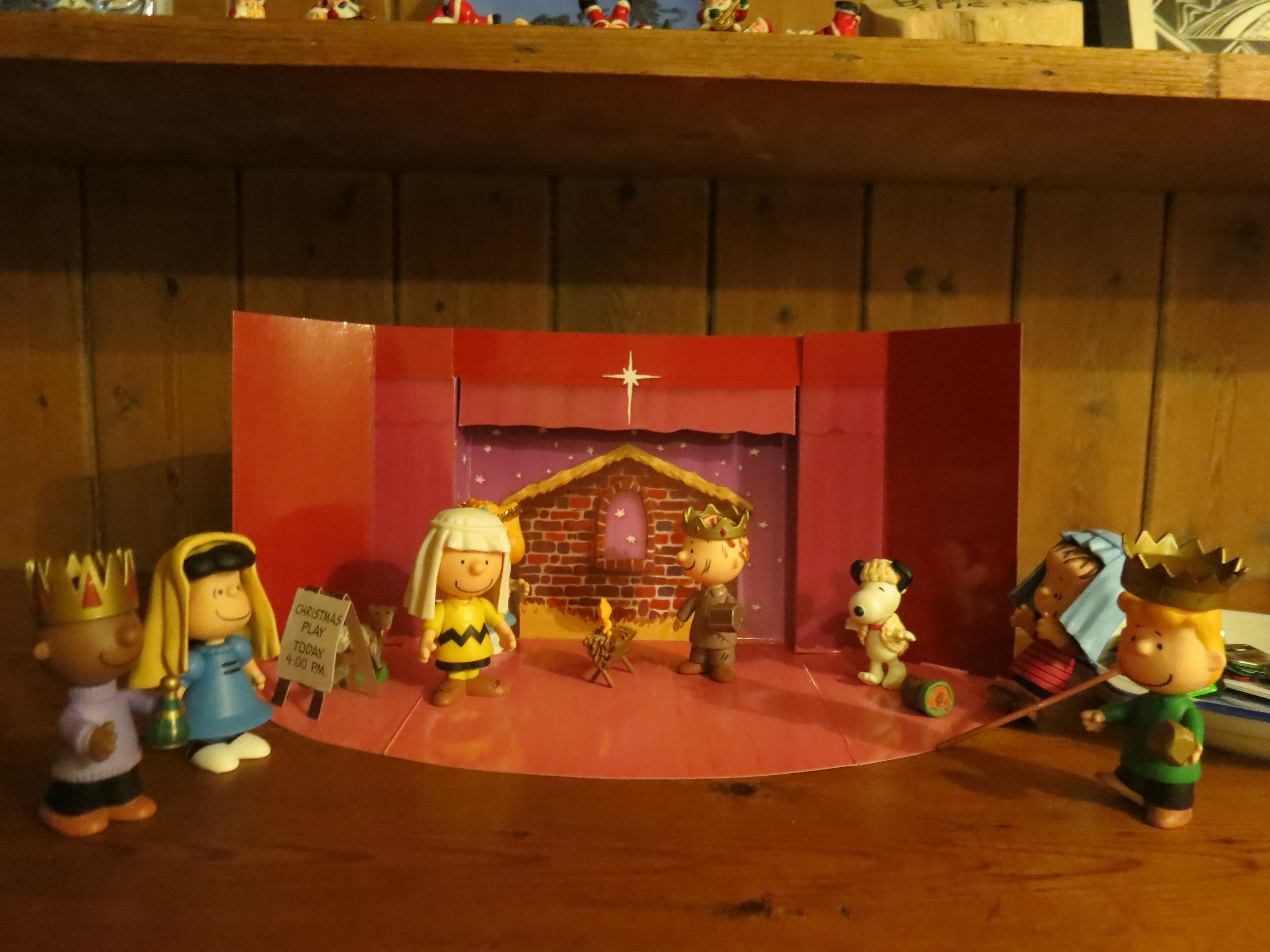
Best nativity scene
Dinner was a massive collection of food, and also delicious. Then came dessert, which also took up a whole dining table, and was also delicious. I had my first taste of pavlova; a light, tasty meringue and fruit dish. New Zealanders and Australians argue about who invented it, but they agree it is their favorite dessert.
The Kapiti coast is a popular place for Kiwis to retire; its positioned east of Kapiti Island and north of the tip of the South Island, so it’s more protected than many other parts of the North Island, and while my hosts said that Christmas was especially hot this year, they also said they always spend at least part of Christmas on the beach. What a great tradition!

In front of a pohutukawa bush, the “New Zealand Christmas tree” because it blooms right around that time of year
Hello dearest fellow travelers! I hope you’ve had a good week and have exciting/relaxing/warm plans for the weekend. This is a bit of a cheat of a post, since it’ll be about two lines long. It’s 7am and I’m headed to the bus station in Chiang Rai right now. I hpoe to be in Laos by 11! And then it’s a matter of luck and timing to see if I get on the slow boat to Luang Prabang today or tomorrow. It’s a two-day trip on the boat, with an overnight break in Pak Beng, and then I’ll be in the World Heritage town of Luang Prabang. New countries, new adventures!
I’ve already mentioned how fortunate I was to have Liz as a road trip buddy in New Zealand, but I’ll say it again: I had so much fun traveling with her. We laughed a lot—both at funny things we said and ridiculous situations we found ourselves in, like leaving a camera on the hood of the car and driving for ten feet before realizing it. We made a good driving/navigating team—she drove, I squinted at a map and made my best guess, which only resulted in turning around about half the time. We even sang Christmas carols together on the drive through the Taupo Volcanic Zone, two sopranos belting out the first verse of just about every hymn we could think of as we hurtled down the first straight road we’d seen in the whole country.
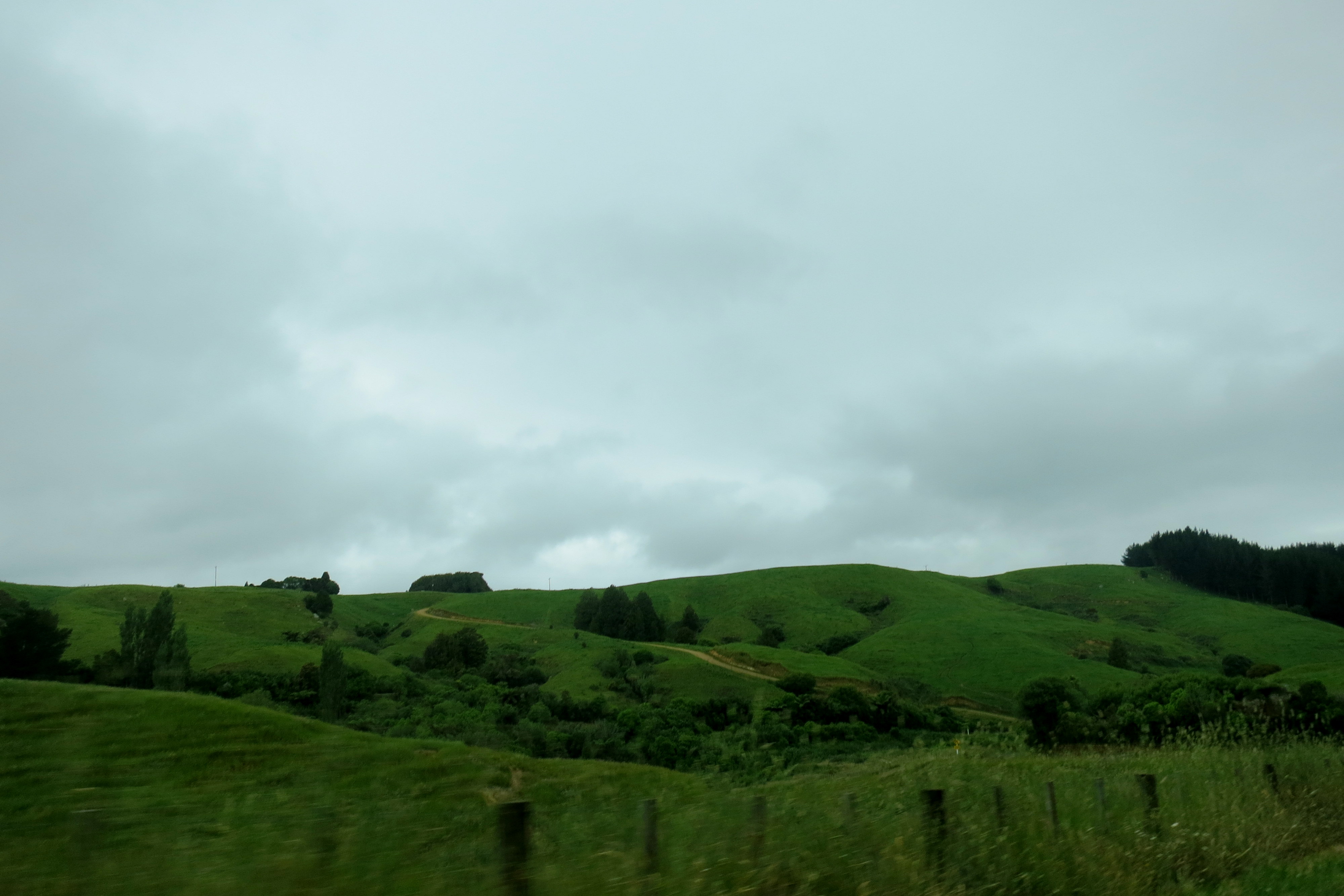
The gray skies and green hills of central North Island
Liz was a little more used to the roads in New Zealand than I, considering she’s from northern Ontario, and many Canadian roads are similarly unsealed (read: teeth-rattling gravel). What neither of us was really prepared for was how small the roads were (major highways were two-lanes just about everywhere except around Auckland and Wellington), how much they twisted and turned (we never quite got used to turning a blind corner and hoping we didn’t meet anyone crossing the center line coming the other way), or how un-signed they’d be.
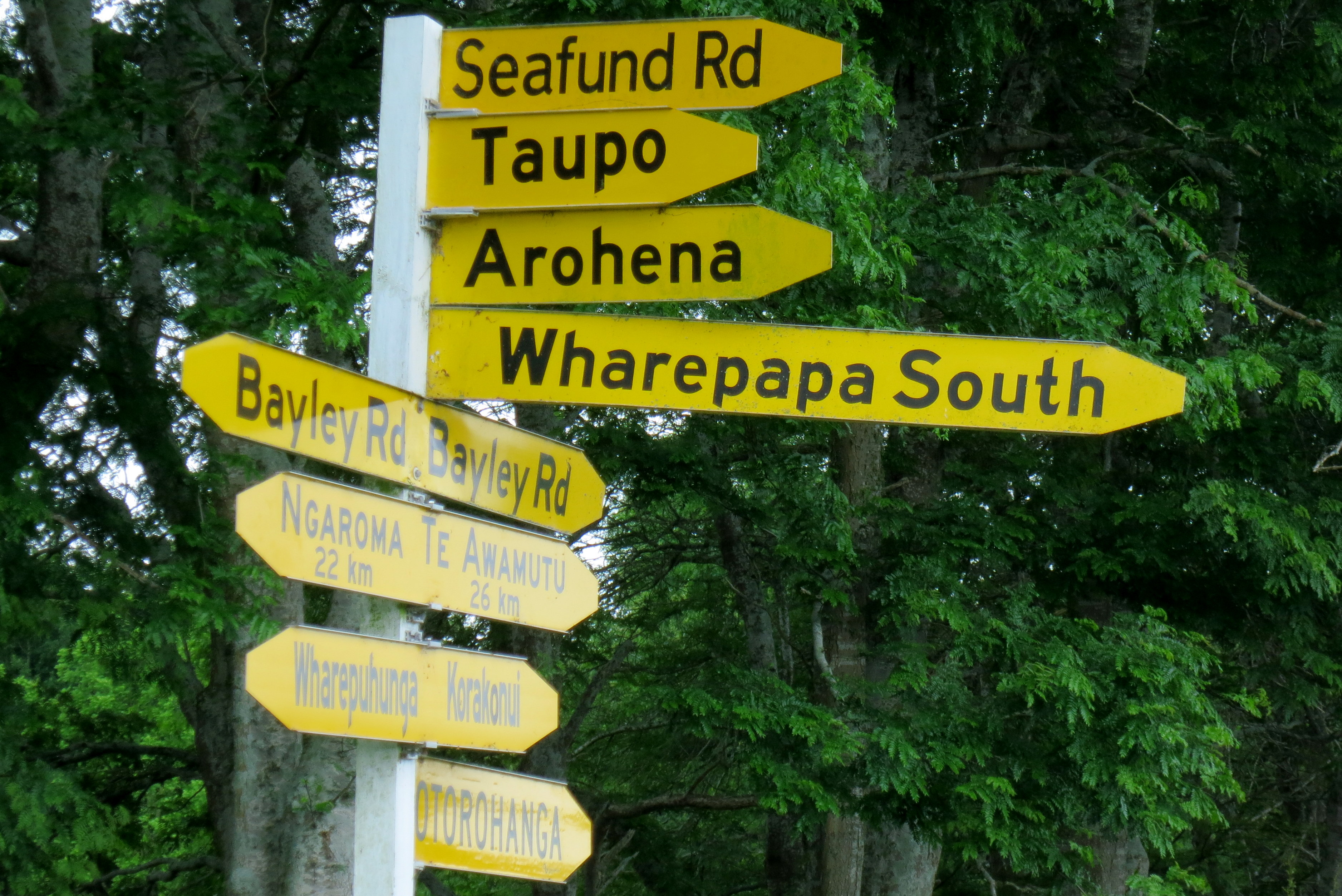
Putting a lot of signs all at once doesn’t make up for the lack of signage in a thirty-kilometer radius, NZ.
I should say, we’d see signs sometimes, but the road might have changed names somewhere along the way, and if our map wasn’t detailed enough, it wouldn’t show the name change, so we couldn’t be sure we were on the right road. Also, road signs would point out what town we were eventually heading toward, but in the same manner as if that were the next town over, so we’d see a town name with an arrow and think “ah we’re here” but then no town would materialize and twenty minutes later we’d finally be there.

Getting around the dairy country where Liz’s friends lived was particularly bewildering. The landscape was all similar—large hills with turf that look like it had been molded into many tiny ridges, the occasional collection of black rocks, and lots and lots of cows. Liz knew the area a little since she’d worked there for a few weeks, but she’d only ever driven one route. As soon as we deviated from that route, we were lost. On the day we drove to Waitomo, we borrowed the GPS from Liz’s friends, but even the GPS got turned around in the labyrinth that was central Waikato roads. The best was when the GPS had us turn right when we should have turned left, and it took us a good 40 minutes to sort out the mistake.

All this backtracking and second-guessing was mostly just fun, until it rained. And it rains a lot in New Zealand. Our worst rainy drive was probably the twenty kilometers between Franz Josef and Fox Glacier. It was 7 in the morning, Liz had been rained out of her tent the night before, and we were climbing a mountain road in the pouring rain to make it to our tour on time. Many kudos to Liz for getting us there alive; all I could do was say over and over, “It’ll be fine, we’ll get there in time.” (Since I alternated this with “I don’t know if I can do this hike” and Liz then had to reassure me, I think I wasn’t actually that helpful.)

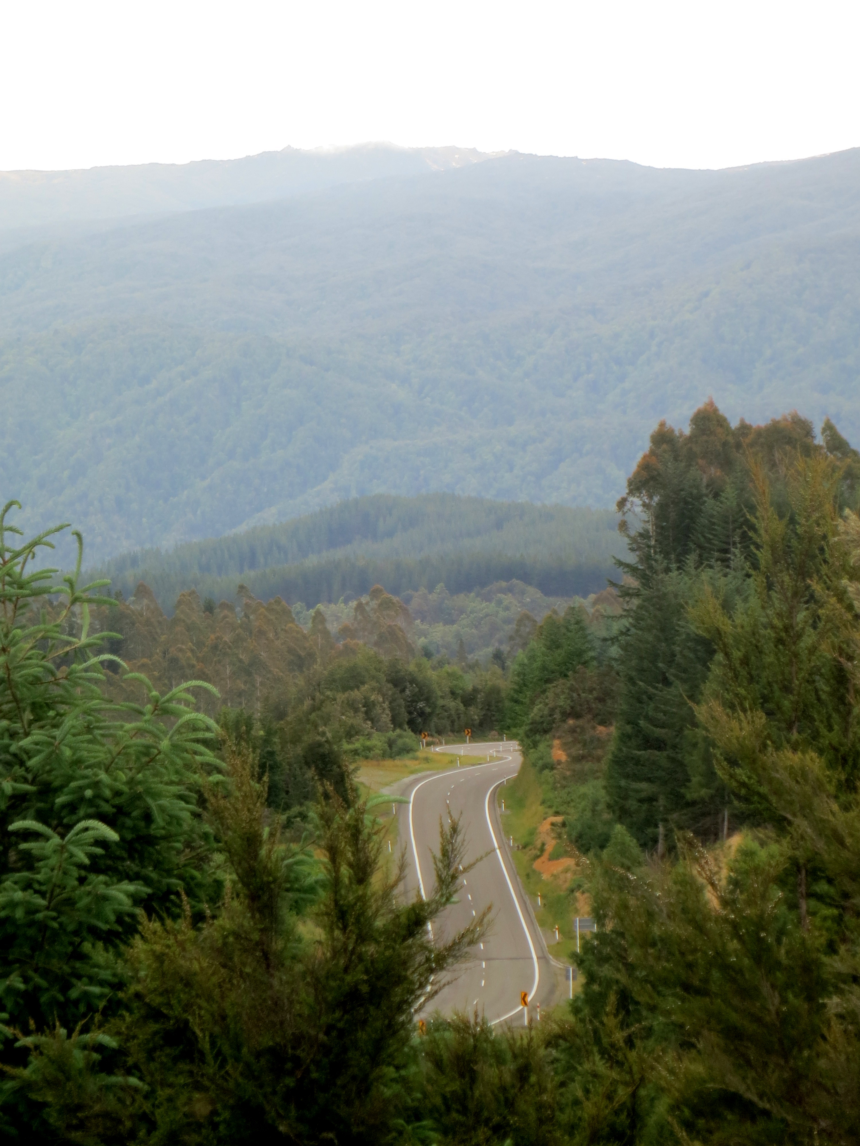
An ominous start to an awesome day
At home, driving in sketchy conditions with poor signage can be helped with a boost from the radio, but our little Nissan Sunny rental only had a range of 78-86FM, and for the most part, we could only get one station, if any. Those mountains really did the job on scrambling any signal we might have got. Our radio was hung up on 84.0—any time we hit scan, the numbers would zoom past, 83.183.283.383.483.583.683.783.883.984.0. Boom. There it would stay, desperately trying to transmit something no doubt awesome—rock n roll, lotta soul, cosmic jive?—but not actually giving us so much as a faint crackle of static. Good thing we had lots to talk about, and the occasional song to belt from memory. When the radio did come to life, it was oh so good. The occasional Maori tune, some current New Zealand pop songs, and then the most amazing array of ‘90s Top 40 hits. Ace of Base, Backstreet Boys, Alanis, Enrique… wonderful for a nostalgic singalong or two, horrible if it’s all you could get for years!
On the way to Greymouth
This doesn’t even get to one-way bridges and cow rush hour, but that’s a post for another day. Basically, everything about road tripping in New Zealand was familiar enough to be comfortable and strange enough to be fun and funny—an ideal combination, especially when you’re sharing it with someone who feels the same way.
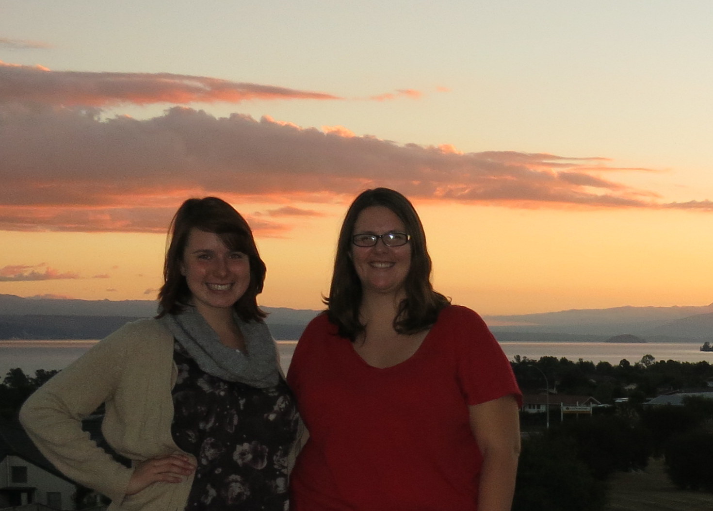
Liz and me in Taupo

Singapore; February 9, 2013
